Latest

Delving deep into mountains for future water security
16/07/2026
A BGS-led project is using new water-tracing investigation methods, geophysics and modelling to understand how water moves from mountains to the lowlands, helping to improve water security for billions of people.

Updated national 3D model will determine the depth to the solid bedrock beneath our feet
13/07/2026
The BGS Superficial Deposit Thickness Model now includes an elevation model of geological rockhead for the first time, providing important data for civil engineers, geoscientists and environmental scientists.


Collecting beach pebbles: fun hobby but is it legal?
14/07/2026
The UK coastline will be inundated with keen holidaymakers this summer, many of whom will take a memento of their trip home in the shape of a pebble or two — but is it legal?
Explore more news
Browse all news and events by category
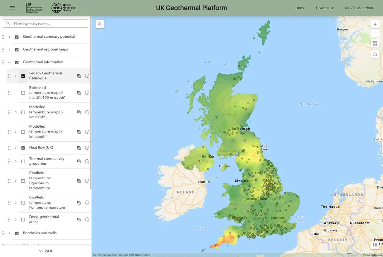
New platform highlights geothermal potential across the UK
11/08/2025
A new government-funded geothermal initiative, which includes an interactive map, has launched to help decision makers assess the geothermal potential across the UK.

Oasis revealed as Scottish capital’s ‘most seismic’ concert
07/08/2025
Twenty years of evidence from earthquake monitoring proves the Britpop legends are the most ‘ground shaking’ musical act to perform at Murrayfield Stadium, with the chance to secure their position at the top of the charts this weekend.

IODP³-NSF Expedition 501: successful offshore operations launches onshore phase
06/08/2025
Scientists have managed to take water and sediment samples from beneath the ocean on the New England Shelf for the first time, with the intention of understanding this offshore aquifer system.

New tool helps identify coal mine gas risk for housing developments in Scotland
05/08/2025
Scientists have co-developed a new tool for North Lanarkshire Council to help screen coal mine gas emissions prior to the development of new houses and buildings.
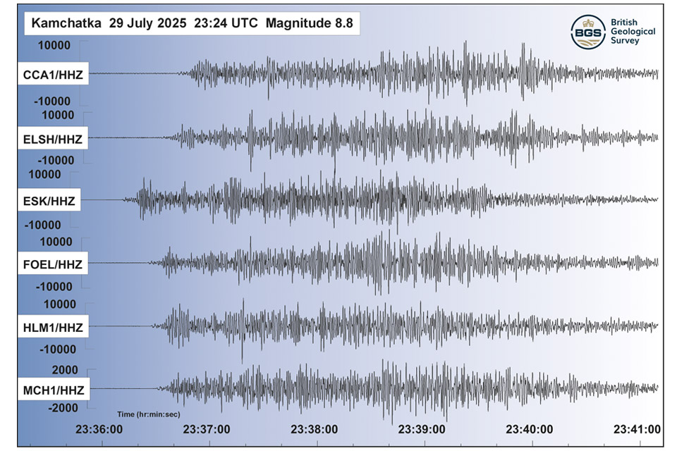
Kamchatka earthquake highlights the advances in tsunami early warning systems
31/07/2025
The response to the 8.8 magnitude earthquake in Russia has emphasised how far scientific understanding of tsunamis has come over the last two decades, and the improved mitigation measures that are now in place.
New journal article reveals snapshot of forever chemicals in shallow English soils
31/07/2025
Data on the presence of per- and polyfluoroalkyl substance concentrations in English soils has been released.
BGS hosts India for ‘deep dive’ on carbon capture and storage
30/07/2025
Some of India’s top scientists visited BGS to explore the UK’s carbon dioxide storage research potential.
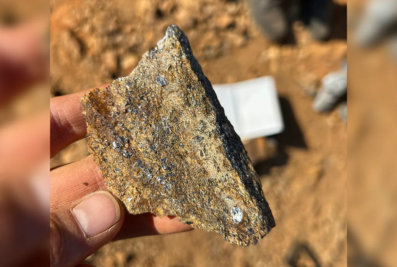
Zambia’s first critical minerals guide supports the country’s potential in global clean energy transition
18/07/2025
A new guide to Zambia’s critical minerals highlights the country’s current and potential critical mineral resources, including cobalt and lithium.