EMODnet data ingestion service
The European Marine Observation and Data Network (EMODnet) consists of more than 160 organisations that together work on assembling, harmonising and making marine data, products and metadata more available.
02/06/2018 By BGS Press
The European Marine Observation and Data Network (EMODnet) consists of more than 160 organisations that together work on assembling, harmonising and making marine data, products and metadata more available. BGS is heavily involved in the EMODnet Geology project and have taken on the role as geology thematic lead for the EMODnet Ingestion project.
Project aims
This project aims to reach out to organisations from public, research and private sectors who are managing marine datasets for bathymetry, geology, physics, chemistry, biology and/or human activities, and who are not yet connected and contributing to existing marine data-management infrastructures. We hope to motivate and support those potential data providers to release their datasets for safekeeping and subsequent free distribution.
Can you help?
We would really like to know if you have any suitable data that are not being routinely archived and could potentially be ingested. There are many advantages of releasing your data and making it available: costs can be saved, duplication of effort can be avoided and it allows your data to have greater impact by ensuring it reaches a much wider audience for future re-use.
We encourage you to use the EMODnet data ingestion portal to submit your datasets. We need to test the EMODnet submission service, provide feedback to portal developers and provide evidence to the EU that this project has relevance by increasing productivity of those working on marine issues, stimulating innovation in the blue economy and reducing uncertainty in our knowledge of the behaviour of the sea.
For further information on the ingestion service, check out this video.
Using your data
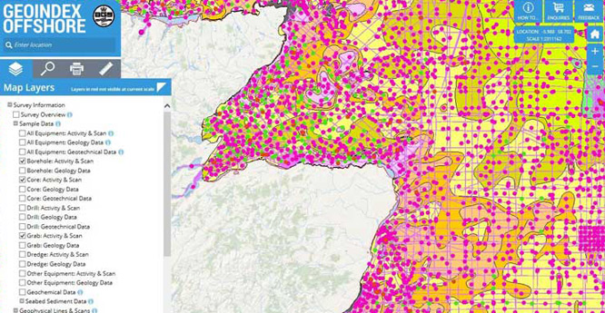
Once data are ingested via the portal, they are passed to the appropriate expert national data centres for open-access publishing and further integration into EMODnet data services and products. The Marine Environmental Data and Information Network (MEDIN) is the hub for UK marine data and operates via a network of data archive centres (DACs). The BGS is the MEDIN DAC for geology and geophysics, and the Offshore GeoIndex is our main data delivery method. Your data can be made available on the GeoIndex if you submit it.
Contact
Contact us via BGS marine data enquiries for more information.


