How can we harness our quantitative geological knowledge to counter the effects of land-use change or help communities adapt to climate change?
Land use and climate change form an inextricably linked feedback loop that can affect livelihoods, communities and ecosystems. Land ecosystems and biodiversity are vulnerable to extreme weather and climate change, and geological conditions determine many land-use options that are critical to developing climate change adaptation strategies and interventions. Land use is also simultaneously a source and sink of greenhouse gases, but human use of land frequently determines whether there is net emission or sequestration.
BGS will be looking at how to harness our geological knowledge to counter the effects of human-led land use and climate change in different environments. We shall consider the human impact on soil quality and food security in sub-Saharan Africa and India, where traditional subsistence agriculture is under pressure from intensification to meet the demands of population growth and urbanisation.
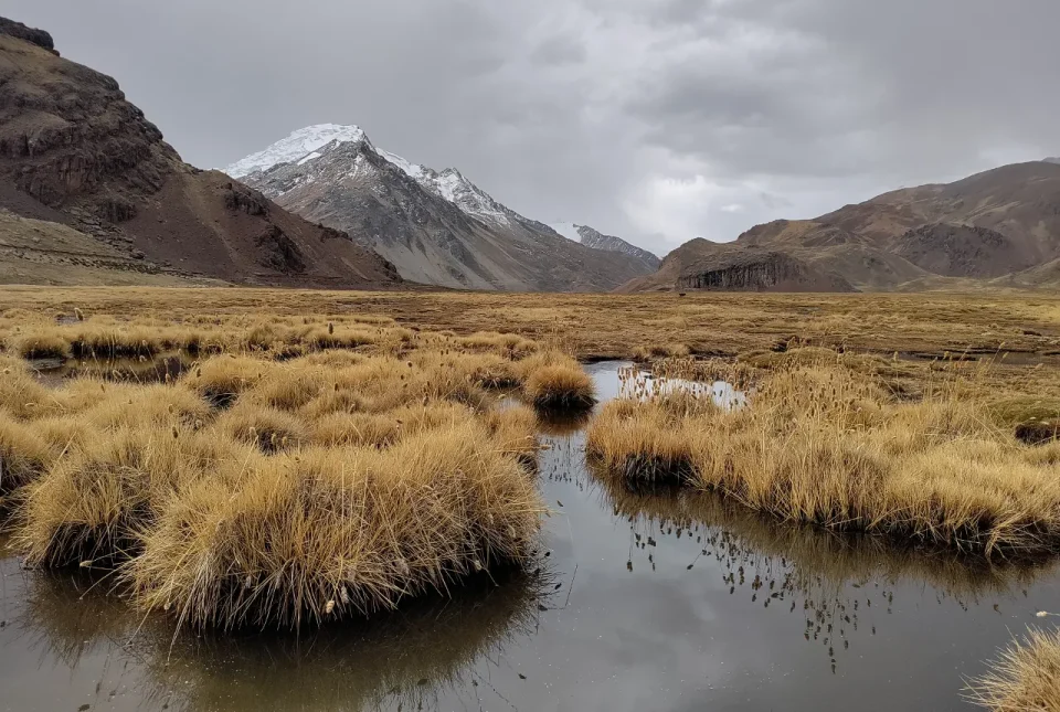

The Suyuparina glacier in Peru.
Tom Gribbin, BGS © UKRI
The main aim of our work was to support our partner countries in developing sustainable extractives sectors. Many developing countries are rich in natural resources and a well-managed extractives sector can make a huge contribution towards economic growth and achieving the UN’s Sustainable Development Goals. Easy access to robust, well-managed geological data provides the fundamental basis for a strong extractives sector and can help partner countries to manage many other major challenges, such as the impact of natural hazards.
Working with partners, we will be studying the effect of soil salinisation and how it can be quantified to inform land management and groundwater resource protection.
Overuse of groundwater for irrigation is an emerging global threat for major food-producing regions. The twin threats of water-quality deterioration and shallow groundwater-resource salinisation often result from over-irrigation, leading to lowering of water tables. Using a unique groundwater-level dataset of 4000 wells developed by BGS and partners, we will collaborate with the Indian National Institute of Hydrology and the Pakistan Council of Research in Water Resources to further develop aquifer salt and water accounting methods. We will apply these to the Indus catchment using newly available groundwater salinity data to reconstruct the evolution of salinity in the catchment and help predict future patterns.
We will also undertake targeted field studies in ‘hot-spot’ areas using environmental tracers in existing monitoring networks to uncover the mechanisms and drivers behind increased salinisation and its relationship to abstraction and canals. This will inform investment by the World Bank and governments on canal improvements, groundwater management and monitoring, and sustainable groundwater abstraction.
Understanding the effectiveness of agricultural interventions often requires costly long-term monitoring and analysis of large geochemical datasets. To mitigate this, BGS will demonstrate the effectiveness of geochemical modelling at a larger scale. This will inform land-management interventions for improving crop nutrient composition, with outcomes for human and animal health, crop yield and mitigation of soil loss resulting from poor land-management practices.
Food security
Understanding the influence of soil geochemistry on food production and nutritional security is an essential component of supporting agriculture and public health. This project will build on our agriculture-nutrition-public health partnerships in sub-Saharan Africa to capitalise on geostatistical and field experimental approaches. This will in turn enhance the understanding of trade-offs between soil and mineral use for nutritious food production compared to other land uses.
Geochemistry and health research will deliver science for the global public good via digital open-access tools (Western Kenya Soil Geochemistry 2022 (arcgis.com)) to visualise spatial data and support user querying functionality (for example, statistical models or tracers). The research will also support the study of geospatial incidence on non-communicable diseases such as cancer or micronutrient deficiency, initially in Kenya and Malawi, as well as providing wider funding and collaborations to inform agricultural and public health policy.
This information will be targeted at government stakeholders who provide direct advice to communities and consider fertiliser formulations. An additional outcome will include a spatial location map of geological resources, produced with the geological surveys in Kenya and Malawi, to underpin advice for agricultural intervention strategies.
Agricultural practices
Building on a recent Royal Society international collaboration project, we will investigate the effect of soil degradation resulting from poor land management and its consequence for food quality using scale studies of the Lake Victoria basin in Kenya. This multidisciplinary work will encompass agriculture, industry and urban changes that influence land-to-lake dynamics and is relevant to settings experiencing rapid deforestation for conversion to agricultural use.
This activity complements work by the UK Centre for Ecology & Hydrology (UKCEH) on aquatic ecology in this catchment and will combine UKCEH’s expertise in earth observation with BGS’s experience in chemistry and applied geochemistry in the region. Research will include determining specific rates of erosion using tracers across differing land-use managements and timescales to inform strategies to improve soil lifespans, and source apportionment analyses for land-to-lake transfers of soil and sediment at catchment scale to better management practices. The resulting model for land-to-lake dynamics will demonstrate a catchment-scale approach to inform sustainable land and aquatic management.
Urban environments accommodate over 55 per cent of the world’s population and produce 80 per cent of economic output. They also consume over 78 per cent of the world’s energy and produce more than 60 per cent of greenhouse gas emissions and 50 per cent of waste. Urbanisation is also exposing larger and increasingly concentrated populations to multiple geohazards. Consequently, the UN considers it vital that cities become the solutions to rather than the cause of today’s global socio-economic and environmental challenges.
We will consider how geoscience can improve urban planning and management, including adopting nature-based solutions for decarbonisation, reducing waste and mitigating natural hazards.
BGS will work with its established research partners in India, Singapore, Malaysia and Vietnam, and with the Coordinating Committee for Geoscience Programmes in East and South-east Asia (CCOP), to develop and apply urban geology ‘typologies’. We will identify critical local environmental and socio-economic factors that influence geoscientific hazards and their management in the urban environment. The typologies developed will be used to demonstrate global applicability of geohazard models.
Specifically, we will identify source apportionment of anthropogenic contamination caused by urban development via pilot studies and employ earth observation data (INSAR and hyperspectral imagery) to identify geohazards in urban areas to inform national, regional and municipal-scale resilience strategies for landslides, sea and river defences and subsidence. A key outcome of this research will be interpreting our findings for non-specialist urban stakeholders. Alongside CCOP, we will co-develop an urban geoscience knowledge hub that integrates research on urbanisation and geohazards, the use of blue-green infrastructure (for example, constructed wetlands) and the wider BGS International Geoscience Research and Development programme, and will also link European and Asian partners.
Blue-green infrastructure
Blue-green infrastructure (BGI) — constructed wetlands, blue roofs and urban forests — could help address flood, drought, landslide and subsidence risk, identified as key issues affecting South-east Asia and Latin America. However, whilst increasingly common in middle- and high-income countries, BGI is less so in fast-developing metropolitan areas where population exposure to risk is highest.
Alongside local communities, government, industry and academia, BGS will undertake two activities, one investigating tools for assessing the effectiveness of BGI and the other improving the effectiveness of BGI solutions. Firstly, pilot studies will evaluate the efficacy of transferring BGI and nature-based solutions from cities where they have been implemented (such as Singapore) to cities where they are deemed likely to be effective (for example, Hanoi and Kuala Lumpur). We will also develop a web tool to assess the impact of BGI for socio-hydrological resilience modelling, with partners in Mexico. This will enable local communities and decision makers to optimise BGI and enhance resilience to flood and drought.