The Farne Islands and the Holy Island of Lindisfarne lie off the coast of Northumberland in north-east England. They are formed from the rocks of the Whin Sill Complex, which also forms the outcrops of rock that Bamburgh and Dunstanburgh castles and parts of Hadrian’s Wall are built on. The Whin Sill Complex continues underground beneath large parts of the region, including the offshore North Sea.
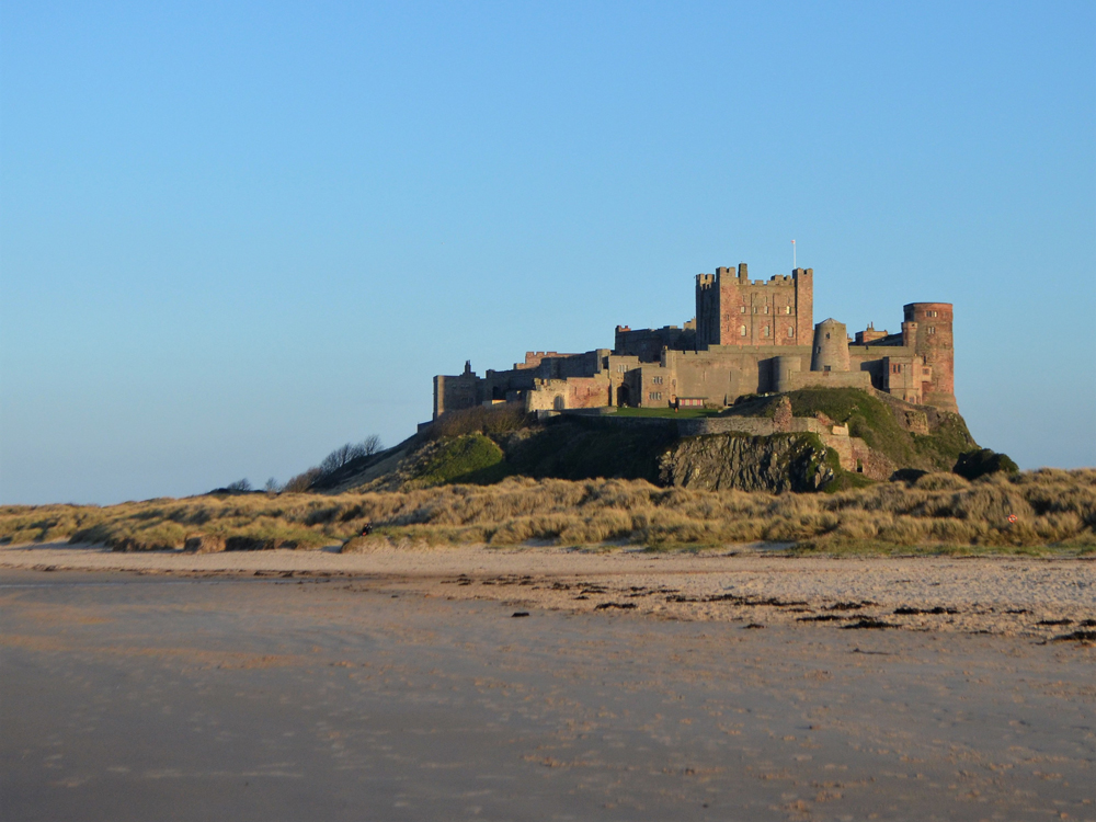

Bamburgh Castle. © Jacqueline Hannaford.
Geology
The Whin Sill Complex is an example of a type of igneous intrusion called a sill. Sills are intrusive rocks that are emplaced concordant with the bedding of the rocks that surround it. Contrast this with a dyke, which cuts across pre-existing bedding.
The complex is made of quartz-dolerites or quartz-microgabbros that have been dated to 301 to 294 million years old. They were intruded into the surrounding rock when magma welled up in cracks in the Earth’s crust as tectonic plates moved over millions of years. The magma slowly cooled and crystallised to form the massive sill.
The Farne Islands
The Farne Islands are an archipelago of between 15 and 20 islands (depending on the height of the tide) lying approximately five miles north-east of the village of Seahouses. The island of Inner Farne is the largest at 16 acres and is the closest to the mainland. They are formed from an outcrop of the Whin Sill Complex and were once connected to the mainland. Sea levels have risen following the end of the last ice age, approximately 10 000 years ago, and the limestone that lies between the Farne Islands and the mainland has been eroded away by the sea.
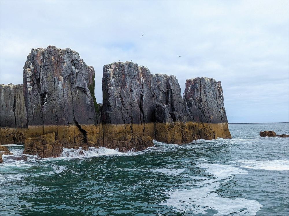
The Pinnacles, Inner Farne, showing vertical jointing in the igneous rock of the Whin Sill Complex. The yellowish-brown band marks high tide. © Jacqueline Hannaford.
Today there is no permanent population on the islands, although rangers from the National Trust are frequently present; the lighthouses all became automated towards the end of the twentieth century. However, the islands have previously been home to various monks and hermits, including the saints Cuthbert and Aidan, and lighthouse-keepers and their families. This includes Grace Darling who, along with her lighthouse-keeper father William, rescued seven survivors from a shipwreck in 1838.
There are thousands of other residents on the islands, however: they are home to many different species of seabirds and a large colony of grey seals. Thousands more birds also come here in the summer to breed or use the islands as a stopping-off point during migration, whilst the seals give birth to their pups here every autumn.
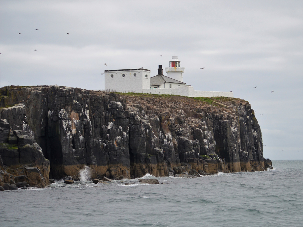
Farne Lighthouse, on the southern tip of Inner Farne. © Jacqueline Hannaford.
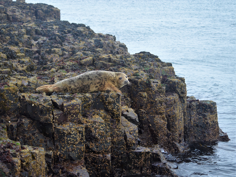
Young female grey seal on Longstone Island. © Jacqueline Hannaford.
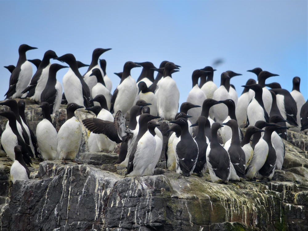
Guillemots nesting on Inner Farne. © Jacqueline Hannaford.
At the time of writing (2023) the Farne Islands were closed to the public due to the risk of bird flu, which badly affected the bird population in 2022. Check the Visit Northumberland website for information about the islands’ re-opening. You can still take a tour of the islands by boat.
The Holy Island of Lindisfarne
To the north of the Farne Islands lies the Holy Island of Lindisfarne. This is not a true island as it is connected to the mainland for about 12 hours a day by a causeway that is covered and uncovered by the tides. You should always check the crossing times to make sure you don’t get trapped in your car by the incoming tide, or on the island itself if you need to be somewhere in a hurry!
You can also make the crossing on foot, following the ancient Pilgrim’s Way that is marked out by wooden poles across the shifting sand and mud. Again you must be mindful of the tides; it is best to set off around two hours before low tide.
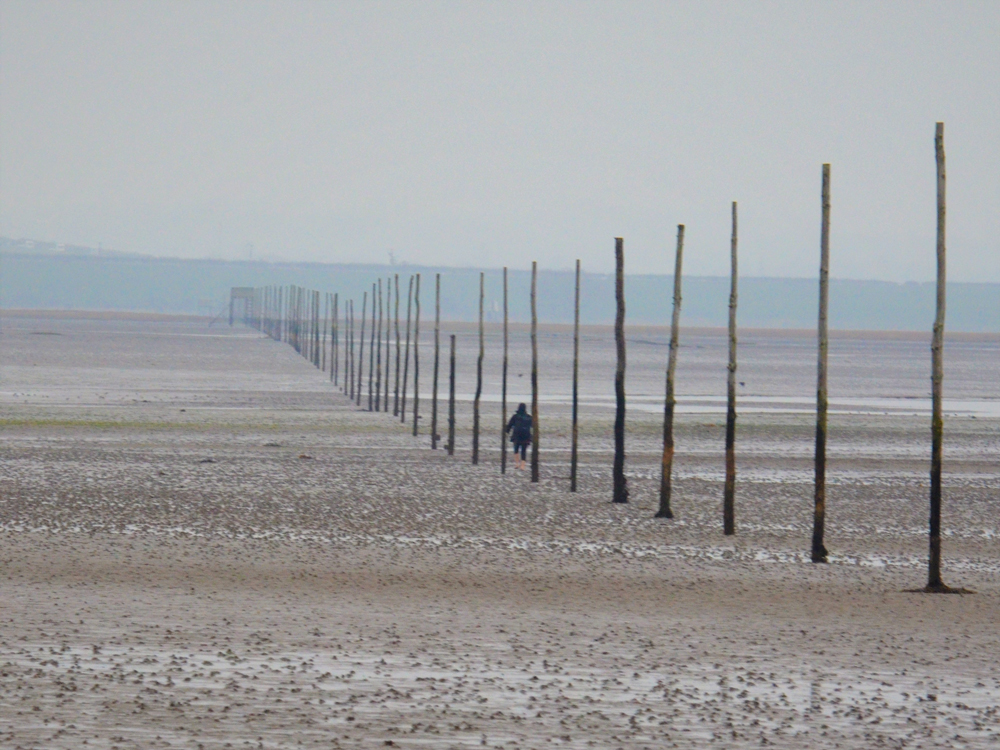
A walker makes her way barefoot from Holy Island across to the mainland on the Pilgrim’s Way. © Jacqueline Hannaford.
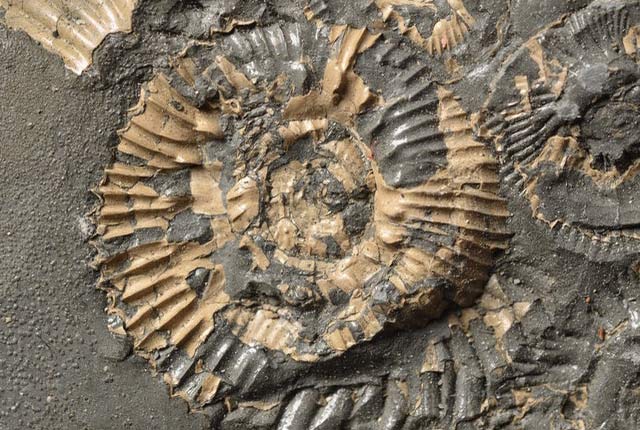
There are two outcrops of the Whin Sill Complex on Holy Island, although they are actually an offshoot of the main Whin Sill itself and are formed by a dyke that runs across the southern part of the main island. The eastern outcrop is known as The Heugh and lies just south of Lindisfarne Priory. On the rocky shore at the bottom of The Heugh you can find the contact between the hard, more uniform-looking, igneous rock of the dyke and the surrounding limestone rocks of the early Carboniferous Alston Formation. The limestone contains numerous fossils of brachiopods and orthocones.
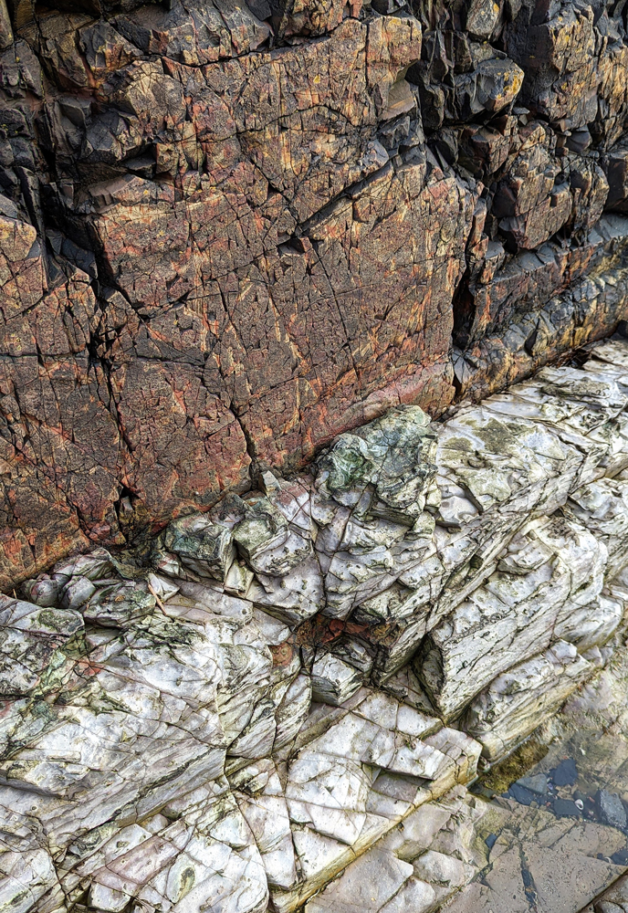
Contact between the Whin Sill Complex (top) and the Alston Formation (bottom). The limestone, which is usually dark grey in colour, has been bleached and metamorphosed by the heat of the igneous rock. © Jacqueline Hannaford.
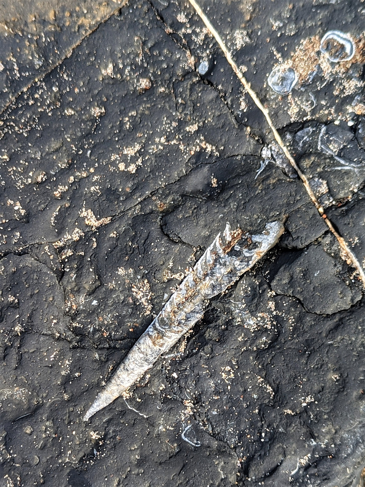
Fossils in the Alston Formation: orthocone showing its chambers and brachiopods (top right). © Jacqueline Hannaford.
The other outcrop of the Whin Sill Complex on Holy Island is topped by Lindisfarne Castle. The castle was originally built in the sixteenth century as an outpost against potential invasions from Scotland. Once Scotland and England were unified under King James I of England/VI of Scotland, it was used to protect the small harbour and eventually became a lookout for coastguards. In the early twentieth century, it was bought by the owner of Country Life magazine and renovated to become a country home. It was subsequently purchased the National Trust in 1944 and is now open to the public.
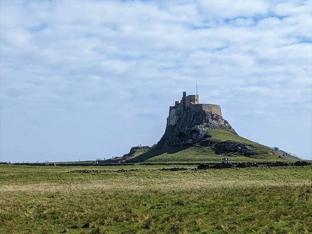
Lindisfarne Castle. © Jacqueline Hannaford.
The northern part of Holy Island is formed from the Alston Formation; the limestone here (the Four Fathom Limestone Member) was known for its purity. In the nineteenth century it was quarried and processed in lime kilns near the castle to produce quicklime, which was then exported to Scotland. The kilns still stand and the remains of the jetties where the quicklime was loaded onto ships can be found on the shore to the south of the castle.
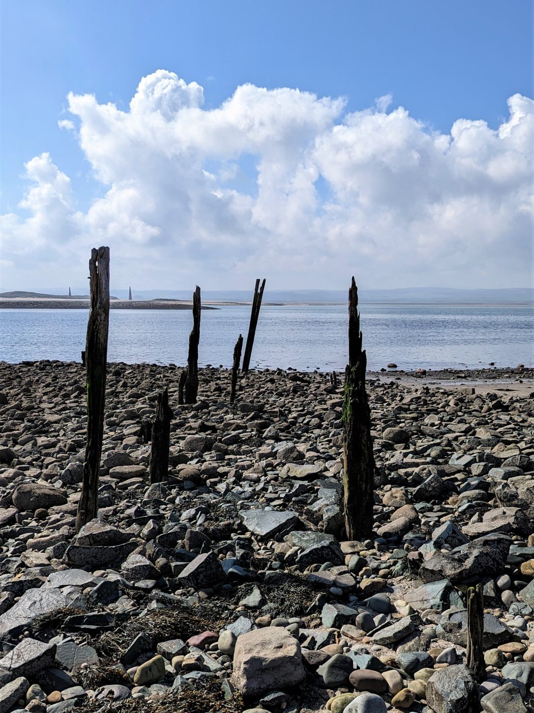
The remains of the nineteenth century jetties used for exporting quicklime from the kilns at Lindisfarne Castle to Scotland. © Jacqueline Hannaford.
Safety
Always check crossing times before visiting or leaving Holy Island. Up-to-date times are posted at both ends of the causeway and around the island.
More information
About the author
Lina Hannaford
You may also be interested in
Discovering Geology
Discovering Geology introduces a range of geoscience topics to school-age students and learners of all ages.
Maps and resources
Download and print free educational resources.
Postcard geology
Find out more about sites of geological interest around the UK, as described by BGS staff.