Are you puzzled by the periods or do you have errors in your eras? Did you know that two or more periods comprise a geological era? Or that two or more eras form an eon?
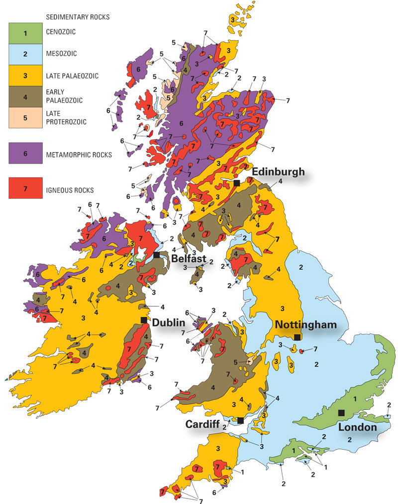

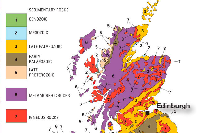
Download and print our colour-in geology map of the UK and Ireland to learn more about the age and composition of the rocks. BGS © UKRI.
Download our free colour-in geology map of the UK and Ireland to help you learn about the eras of the Phanerozoic eon and the late Proterozoic eon.
You can also use this geological map to help you learn when the sedimentary rocks of the UK and Ireland were formed. Turn over the map to show how the eras are made up of periods. Periods are the basic unit of geological time and are separated by a major geological event, such as a mass extinction.
The map colours we suggest are the colours used in the BGS Timechart, but you can use whatever colours you prefer.
You may also be interested in
Discovering Geology
Discovering Geology introduces a range of geoscience topics to school-age students and learners of all ages.
Maps and resources
Download and print free educational resources.