We have been monitoring and modelling landslide activity at Aldbrough on the East Riding of Yorkshire coast since 2001. A range of surveying and monitoring techniques have been used to build our first Coastal Landslide Observatory:
- Terrestrial LiDAR surveying
- UAV Photogrammetry
- Inclinometers
- Piezometers
- Geophysics (PRIME)
- Weather station
- Wave buoy data
We have captured cycles of major deep-seated landslide activity.
Preliminary results confirm the relationships between landslide activity and volume loss with environmental factors such as rainfall and wave action.
Landslide behaviour has also been examined.

Conceptual model of landsliding at Aldbrough.
Publications
- Establishment of a coastal landslide observatory at Aldbrough, East Riding of Yorkshire, UK
- Coastal landslide monitoring at Aldbrough, East Riding of Yorkshire, UK
- Slope dynamics project report: Holderness Coast — Aldbrough, survey and monitoring 2001–2013
- Slope dynamics project report: Holderness Coast — Aldbrough, drilling and instrumentation 2012–2015
- Geotechnical laboratory testing of glacial deposits from Aldbrough, phase 2 boreholes
Coastal Landslide Observatory
The site is 1.5 km north-east of Aldbrough, which is approximately 18 km north-east of Hull. It was selected because it is on one of the fastest eroding coastlines in Europe at 2–m per year overall.
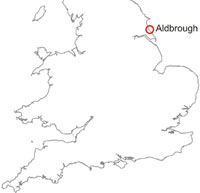
Aldbrough location map
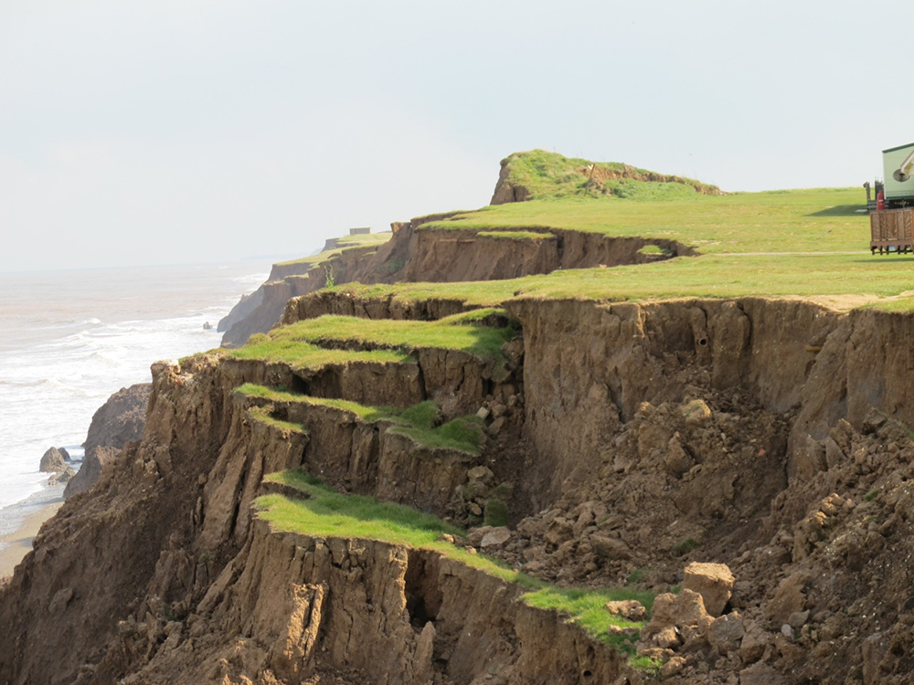
The steep cliffs face north-east and have a regular height of about 20 m. They are actively receding and the cliff profile is stepped due to the contrasting erosion resistances of the tills and the different landslide processes in the upper and lower parts of the cliff. At high tides the lower and, in some cases, middle sections of the cliff are subject to considerable erosion by wave action. Several buildings have been lost to the sea since 1885 including the Spa Inn, the Talbot Hotel and the Royal Hotel.
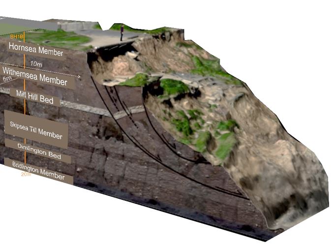
Borehole data
Three pairs of boreholes were sited back from the cliff edge by 10 m, 20 m and 28 m (at time of installation); one of each pair contained an inclinometer casing and the other a piezometer array. The boreholes were drilled to 20 m depth and aligned perpendicular to the cliff.
Geophysical instrumentation, consisting of a new generation of BGS’s automated electrical resistivity tomography (ERT) system, PRIME, was added in 2015 and 2018, in the form of one downhole and two surface arrays arranged orthogonally to the boreholes.
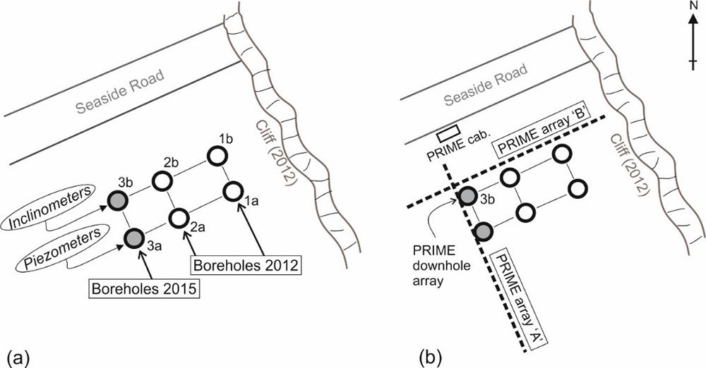
Aldbrough Coastal Landslide Observatory borehole map.
Aldbrough Coastal Landslide Observatory.
GeoBlogy
Hot off the press! Results from our Coastal Landslide Observatory by Catherine Pennington
On a windswept, wave-battered cliff on the coastline of the East Riding of Yorkshire stands an unassuming landslide that has no idea just how important it is. This landslide is being watched. Every move it makes is being recorded and analysed by us here at the BGS.
You may also be interested in

Landslide case studies
The landslides team at the BGS has studied numerous landslides. This work informs our geological maps, memoirs and sheet explanations and provides data for our National Landslide Database, which underpins much of our research.

Understanding landslides
What is a landslide? Why do landslides happen? How to classify a landslide. Landslides in the UK and around the world.

How to classify a landslide
Landslides are classified by their type of movement. The four main types of movement are falls, topples, slides and flows.

Landslides in the UK and around the world
Landslides in the UK, around the world and under the sea.