
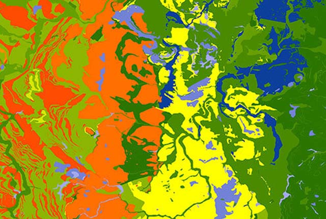
Infiltration SuDs. BGS © UKRI.
Infiltration SuDS map
- 1:50 000
- Great Britain
- Premium
This dataset is suitable for those involved in the planning and design of sustainable drainage systems (SuDS) and for those who approve SuDS planning applications within local authorities.
Supporting documents:
Key information
- Scale:
- 1:50 000
- Coverage:
- Great Britain
- Availability:
- Premium
- Price:
Product 1: BGS infiltration SuDS map: detailed £1.71 per km2
Product 2: BGS infiltration SuDS map: summary £0.58 per km2
All products are subject to number of users, licence fee and data preparation fee.
- Format:
- GIS polygon data. (ESRI, MapInfo, other available by request)
- Uses:
- Local-level to regional-level use
- Themes:
- Built environment, Hydrogeology
This dataset is suitable for those involved in the planning and design of sustainable drainage systems (SuDS) and for those who approve SuDS planning applications within local authorities.
The dataset gives a preliminary indication of the suitability of the ground for infiltration SuDS. These are drainage systems that allow surface water to infiltrate to the ground, such as soakaways, infiltration basins, infiltration trenches and permeable pavements. The selection and design of an appropriate system depends on the properties of the ground, in particular these four factors:
- the presence of severe constraints that must be considered prior to planning infiltration
- the drainage potential of the ground
- the potential for ground instability when water infiltrates
- the protection of groundwater quality
The BGS Infiltration SuDS map is based on 15 nationally derived subsurface property datasets, some of which are a result of direct observations, whilst others rely on modelled data.
The dataset is structured using the four factors and allows consideration of:
- subsurface permeability
- depth to groundwater
- presence of geological floodplain deposits
- presence of artificial ground
- ground stability:
- soluble rocks
- collapsible ground
- compressible ground
- running sand
- shallow mining
- landslides
- shrink–swell clays
- potential for pollutant attenuation
- the Environment Agency’s source protection zones
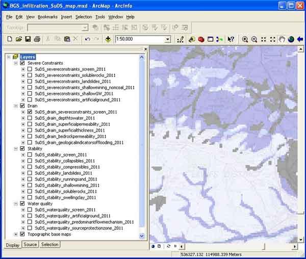
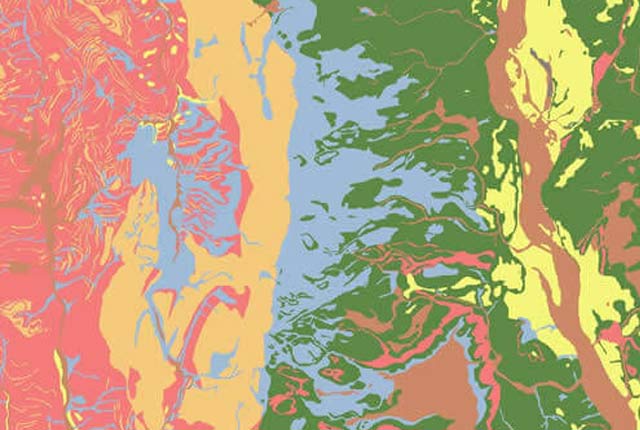
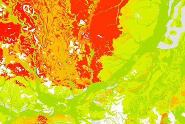
Layout of BGS Infiltration SuDS map data layers in ArcGIS. BGS © UKRI.

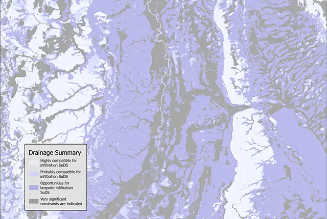
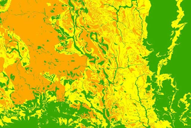
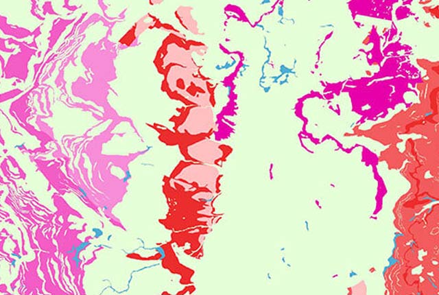
Infiltration SuDS map coverage. BGS © UKRI – Contains OS data © Crown copyright 2020
SuDS map products
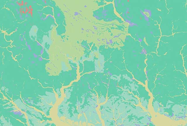
Detailed BGS infiltration SuDS map
The detailed map provides the data layers described along with a further 20 individual, bespoke data layers. These data layers provide information on the properties of the ground, which can be used to guide local SuDS planning and design.
The data can be used to determine the likely limitations present at a site and make preliminary decisions on the type of infiltration SuDS that may be appropriate. We anticipate that this map will be used by planners, developers, consultants and SuDS approval bodies.
The dataset is intended to be used at a preliminary stage and is not a replacement for a site investigation.
Summary BGS infiltration SuDS map
The summary map comprises four summary layers, providing an indication of the suitability of the ground for infiltration SuDS. The layers summarise:
- presence of severe constraints
- drainage potential of the ground
- potential for ground instability as a result of infiltration
- susceptibility of the groundwater to contamination
This map is anticipated to be of use in strategic planning and not for local assessment. It does not provide specific subsurface data or state the limitations of the subsurface with respect to infiltration.
You may also be interested in
BGS Civils: bulking volume
BGS Civils is a suite of national maps of engineering properties based on geological data and the digital 1:50 000 scale geological map – BGS Geology 50k.
BGS Civils: corrosivity (ferrous)
The BGS corrosivity dataset is a GIS layer supporting the management of underground iron assets that has been created in response to the growing awareness of the cost of maintenance of structures such as pipelines and building foundations.
BGS Civils: discontinuities
This theme provides information on the discontinuities in bedrock and superficial deposits as part of a suite of GIS layers for different engineering parameters.
BGS Civils: engineered fill
This theme provides information on the suitability of a geological material to be used as engineered fill.
BGS Civils: excavatability
This theme provides information on the excavatability of geological deposits at surface.
BGS Civils: foundation conditions
This theme provides information on the suitability of a geological material for foundations as part of a suite of GIS layers for different engineering parameters.
BGS Civils: strength
This theme provides information on zones of rock strength and the local factors controlling it, as part of a suite of GIS layers for different engineering parameters.
BGS Civils: sulfate/sulfide potential
The BGS Civils: sulfates and sulfides dataset is a GIS layer that supports the management of underground assets
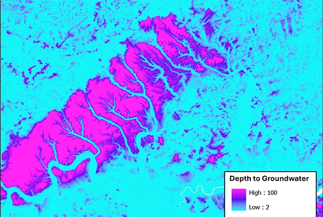
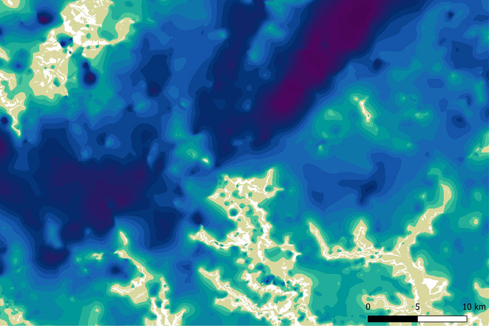
Depth to groundwater
The BGS depth to groundwater product is a national scale dataset of probable maximum depth to the phreatic water table.
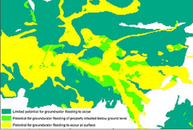
Groundwater flooding
In response to the need for more information on groundwater flooding, BGS has produced the first national dataset on the susceptibility across Britain.

Permeability
Permeability data is often used in studies of groundwater. Our permeability information is based on BGS Geology 50K data.
Superficial deposit thickness model
The superficial deposit thickness model shows the depth of the bedrock surface below unconsolidated deposits