Key information
Scale:
1:50 000Coverage:
Great BritainAvailability:
LicensedFormat:
GIS line and polygon data. (ESRI, MapInfo, others available by request.)Price:
£0.34 per km2 for commercial use. Subject to number of users, licence fee and data preparation fee.
Uses:
Local-level to Region-level useGet data
Free access
Our free data is available under the Open Government Licence. Please acknowledge reproduced BGS materials.
Sample data downloadPaid access
Supporting documents
This theme provides information on the electrical resistivity of a geological material, to be used where the earthing characteristics of the ground are required.
The spatial model covers England, Scotland and Wales at 1:50 000-scale using data from these BGS datasets:
- Soil Parent Material Model
- National Geotechnical Property Database
- Geophysical Laboratories Database
The resistivity of geological units is an important factor in engineering activities where the electrical characteristics of the ground are required, e.g. in earthing of electrical systems. The resistivity of the ground is dependent on a number of factors, including pore water resistivity, saturation and the clay content of the underlying geology.
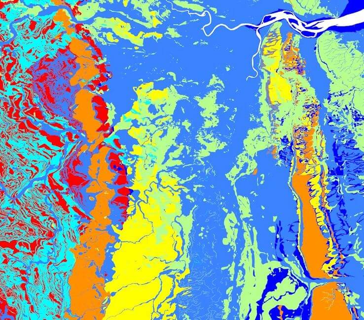

BGS Resistivity map example. BGS © UKRI.
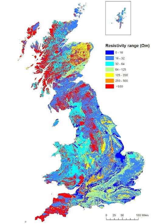
BGS Resistivity map of the UK. BGS © UKRI – Contains OS data © Crown copyright 2020.
What is resistivity?
Electrical resistivity is an intrinsic property of a material and is measured as its resistance to current per unit length for a uniform cross-section. The national attribution of resistivity is based on the calculation of resistivity using the methodology published in An effective medium algorithm for calculating water saturations at any salinity or frequency (Berg (2007).
We hold several thousand field resistivity soundings but they cover a limited number of geological units and are unlikely to cover the lithological variation and saturation conditions that may be encountered. The Berg method uses a number of parameters that are known for the lithologies of many geological units (or can be reasonably estimated using knowledge of similar materials (from the datasets listed) and the field soundings results as a guide.
Who uses resistivity data?
Resistivity is of interest to a wide range of organisations concerned with development including:
- infrastructure
- utility companies
- local authorities
- green energy companies
- developers
- engineering consultants and contractors
Resistivity is particularly relevant to the major power distribution networks.
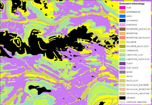
Classification
The Soil Parent Material Model of Great Britain, which describes the geology of the near surface, has been classified with modelled values of electrical resistivity. The description of the classification can be found in the free downloadable user guide.
Download BGS Resistivity sample data
You may also be interested in

Soil Parent Material Model
The Soil Parent Material Model details the distribution of properties of the weathered and unweathered soil parent materials of Great Britain.
National Geotechnical Properties Database
This is a relational database enabling interrogation of AGS 4.0 formatted geoenvironmental and geotechnical data critical to UK engineering.