The River Severn flows through the Ironbridge Gorge, which is located to the south of Telford in Shropshire and is a World Heritage Site. It is named after the famous Iron Bridge designed by Thomas Farnolls Pritchard and built by Abraham Darby III, the first arch bridge in the world to be made from cast iron.
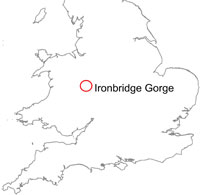

Ironbridge Gorge location map.
The gorge is thought to have originated some 10 000 years ago and is deeply incised in rocks of late Carboniferous and Silurian age, which are prone to landsliding and have suffered a number of failures through its history. The valley sides rise steeply from 40 m at river level to over 140 m on the plateau above.
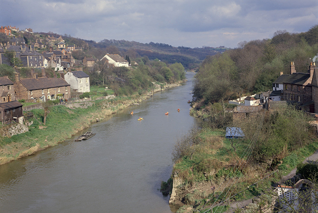
Ironbridge Gorge. Photo taken in 1974. BGS © UKRI.
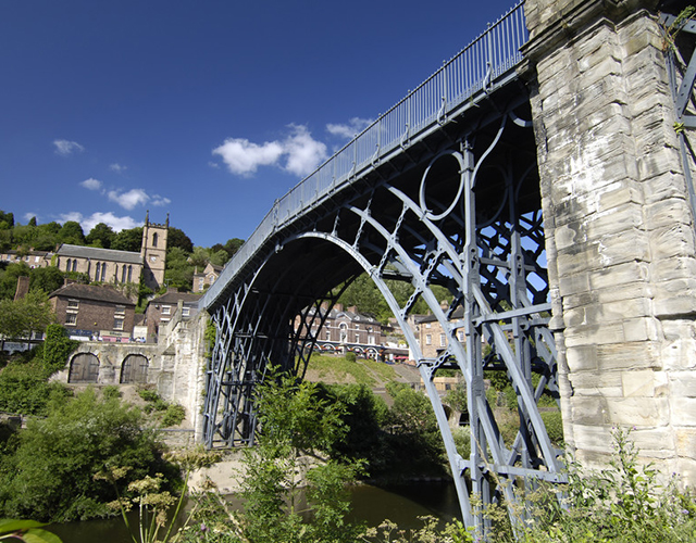
The Iron Bridge, Shropshire. Photo taken in 2003. BGS © UKRI.
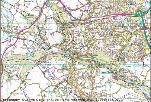
Ironbridge Gorge map. Contains Ordnance Survey data © Crown Copyright and database rights 2021.
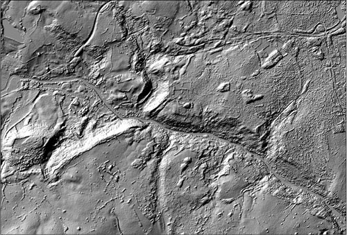
Hillshade relief map. Taken from NEXTMap Britain elevation data from Intermap Technologies.
Landslides
There are over 20 landslides documented in the National Landslide Database in the area. Examples of two of the larger landslides in the gorge are described here.
The Jackfield landslide
In 1952, a landslide (National Landslide Database ID 4335/1) occurred at the village of Jackfield, Shropshire, on the River Severn just over 2 km downstream of the Iron Bridge, destroying several houses and causing major dislocations in a railway and road (Skempton, 1964).
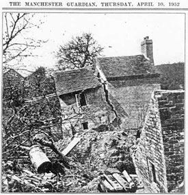
Pear Tree Cottage, damaged by the 1952 Jackfield landslide and demolished the following year. Manchester Guardian, 10 April 1952.
This landslide event was included in the Fourth Rankine Lecture (Skempton, 1964). The following quotation is taken from this paper.

It is possible that previous landslides may have taken place along at least a part of the present slip surface, but the slope must have been more or less stable for a long time before 1950, when warnings of instability were observed in the form of a broken water main serving cottages near the river bank. Towards the end of 1951 further movement was noted, and by February 1952 the road was becoming dangerous. During the next month or two the landslide developed alarmingly. Six houses were completely broken up, gas mains had to be relaid above ground, the railway could be maintained only by daily adjustments to the track and a minor road along the river had to be closed to traffic. By this time the maximum downhill displacement totalled 60 ft. The strata, consisting of very stiff clays and mudstone, alternating with marl-breccia and occasional coal seams, dip gently in a south-easterly direction with the strike running roughly parallel to the section of the landslide. The slide, however, was confined wholly within the zone of weathered, fissured clay extending to a depth of 20 ft to 25 ft below the surface. The slip surface ran parallel to the slope (which is inclined at 10º), at an average depth of 18 ft. The length of the sliding mass, measured up the slope, amounted to about 550 ft and in the winter 1952–53 ground-water level reached the surface at a number of points, although on average it was located at a depth of 2 ft.
In 1984, further ground movement occurred to the west of the 1952 area of landslide. Salthouse Road was carried into the river and was replaced by a temporary wooden roadway constructed along the line of the former railway (High-Point Rendel, 2005a). Other movement events for the Jackfield landslide are documented in 1925 and 1931 (Giles, 2008).
The Lloyd’s Coppice landslide
This landslide (National Landslide ID 4338/1) is currently actively moving as a series of rotational and translational slides. Crags of sandstone have moved down from their outcrop near the top of the hill, bringing with them the overlying thick till. Geological faults, ground water, surface water, the nature of the geology, construction and mining are all associated with the instability of this slope.
The backscarp of this landslide was photographed in 1924.
This landslide is within the Halesowen Formation, which is particularly susceptible to movement in this area as it includes more silty strata and less sandstone than elsewhere. Buildings and roads have been affected by the landslide.
Considerable investigative work has been undertaken by Telford and Wrekin Council on this landslide to develop appropriate management plans to anticipate and mitigate the effect on the land usage.
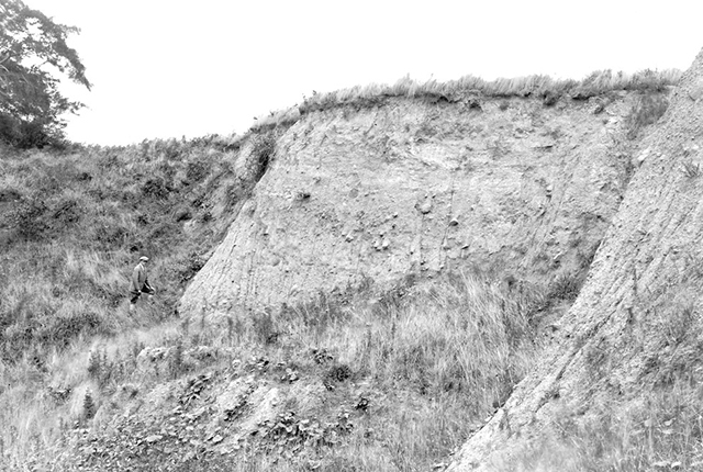
The backscarp of Lloyd’s Coppice landslide from 1924. BGS © UKRI.
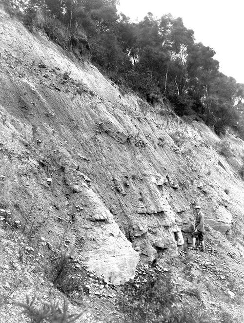
The backscarp of Lloyd’s Coppice landslide from 1924. BGS © UKRI.
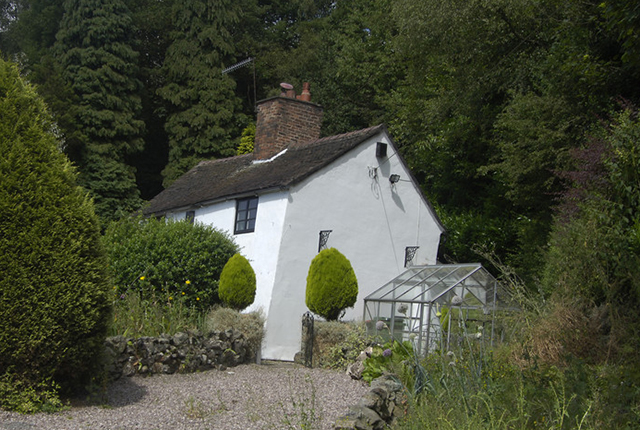
Movement of a house within the Lloyd’s Coppice landslide. The greenhouse is vertical. BGS © UKRI.
Further reading
Bridge, D M, and Hough, E. 2002. Geology of the Wolverhampton and Telford district — a brief explanation of the geological map. Sheet Explanation of the British Geological Survey 1:50 000. Sheet 153 (England and Wales). Available at https://nora.nerc.ac.uk/id/eprint/19548/
Carson, A M, and Fisher, J. 1991. Management of landslides within Shropshire. 95–99 in Slope Stability Engineering Developments and Applications. Chandler, R J (editor). (London, UK: Thomas Publishing.) DOI: https://doi.org/10.1680/ssedaa.16606.0016
Cruden, D M, and Varnes, D. 1996. Landslide types and processes. 36–75 in Special Report 247: Landslides: Investigation and Mitigation. (Washington D.C., USA: Transportation Research Board.)
Culshaw, M. 1972. A preliminary report on the stability of Jockey Bank, Ironbridge. Institute of Geological Sciences Technical Report WN/EG/72/5. (London, UK: Institute of Geological Sciences.) Available at https://webapps.bgs.ac.uk/data/Publications/publication.html?id=19566215
Culshaw, M. 1973. A stability assessment of the north slope of the Ironbridge Gorge, Telford, Shropshire. Institute of Geological Sciences Technical Report WN/EG/73/1. (London, UK: Institute of Geological Sciences.) Available at https://webapps.bgs.ac.uk/data/Publications/publication.html?id=19566217
Culshaw, M. 1973. A stability assessment of the slopes around Lee Dingle, Telford, Shropshire. Institute of Geological Sciences Technical Report WN/EG/73/5. (London, UK: Institute of Geological Sciences.) Available at https://webapps.bgs.ac.uk/data/Publications/publication.html?id=19574383
Denness, B. 1977. The Ironbridge landslide — a case history of instabilities in Carboniferous sediments. Proceedings of the Conference on Rock Engineering (CORE-UK), University of Newcastle-upon-Tyne, British Geotechnical Society, London, 407–422.
Gostelow, T P, Hamblin, R J O, Harris, D I, and Hight, D W. 1991. The influence of late and post glacial slope development on the engineering geology of Wenlock Shale near Ironbridge, Salop. Geological Society Engineering Geology Special Publications, Vol. 7(1), 349–359. DOI: https://doi.org/10.1144/GSL.ENG.1991.007.01.30
Hamblin, R J O. 1986. The Pleistocene sequence of the Telford district. Géotechnique, Vol. 97, 365–377. DOI: https://doi.org/10.1016/S0016-7878(86)80028-1
Hamblin, R J O, and Coppack, B C. 1995. Geology of the Telford and the Coalbrookdale Coalfield. Memoir of the British Geological Survey, Parts of 1:50 000 geological sheets 152 and 153 (England and Wales); 1:25 000 sheet SJ 60 with parts of 61, 70, 71.
Harmer, F W. 1907. On the origin of certain canyon-like valleys associated with lake-like areas of depression. Quarterly Journal of the Geological Society, Vol. 63(1–4), 470–514.
Henkel, D J, and Skempton, A W. 1954. A landslide at Jackfield, Shropshire, in a heavily over-consolidated clay. Géotechnique, Vol. 5(2), 131–137. DOI: https://doi.org/10.1680/geot.1955.5.2.131
High-Point Rendel. 2005a. Ironbridge Gorge Instability: The Interpretation of Ground Investigations at Jackfield and the Lloyds. Borough of Telford & Wrekin Council R/2088/01.
High-Point Rendel. 2005b. Ironbridge Gorge Landslides: Ironbridge and Coalbrookdale Ground Behaviour Study. R/2320/01.
Maw, G. 1864. Notes on the drift-deposits of the valley of the Severn, in the neighbourhood of Coalbrook Dale and Bridgnorth. Quarterly Journal of the Geological Society, Vol. 20(1–2), 130–144. DOI: https://doi.org/10.1144/GSL.JGS.1864.020.01-02.24
Rayner, C, Rayner, M, and Rosenbaum, M. 2007, A geological trail through the landslides of Ironbridge Gorge. Proceedings of the Shropshire Geological Society, Vol. 12, 39–52.
Shropshire Star. 2008a. Iron Bridge twisting under landslides. 18 September 2008.
Shropshire Star. 2008b. More floods misery on way. 29 June 2007.
Skempton, A W. 1964. Fourth Rankine Lecture: long term stability of clay slopes. Géotechnique, Vol. 14(2), 77–101. DOI: https://doi.org/10.1680/geot.1964.14.2.77
Varnes, D. 1978. Slope movement types and processes. Special Report 176: Landslides: Analysis and Control. (Washington D.C., USA: Transportation Research Board.)
Wills, L J. 1924. The development of the Severn valley in the neighbourhood of Iron-Bridge and Bridgnorth. Quarterly Journal of the Geological Society, Vol. 80(1–4), 274–308. DOI: https://doi.org/10.1144/GSL.JGS.1924.080.01-04.15
You may also be interested in

Landslide case studies
The landslides team at the BGS has studied numerous landslides. This work informs our geological maps, memoirs and sheet explanations and provides data for our National Landslide Database, which underpins much of our research.

Understanding landslides
What is a landslide? Why do landslides happen? How to classify a landslide. Landslides in the UK and around the world.

How to classify a landslide
Landslides are classified by their type of movement. The four main types of movement are falls, topples, slides and flows.

Landslides in the UK and around the world
Landslides in the UK, around the world and under the sea.