The Nigerian Geochemical Mapping Project was funded by the World Bank through the Nigerian Sustainable Management of Mineral Resources Project (SMMRP) to give technical assistance to the Nigerian Geological Survey Agency (NGSA) to carry out a national programme of geochemical mapping.
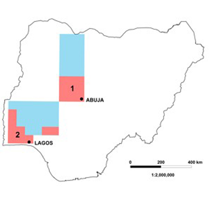

Map showing the location of the Nigerian geochemical mapping areas supervised by BGS (pink: 1 — Minna cell and 2 — SW Cell). Areas in blue have been sampled by the NGSA.
The Project commenced in October 2008 and was completed in September 2010.
Diversifying exploration
In Nigeria there is a drive to diversify away from the dependence on an oil-based economy and an aim of this work was to stimulate the metalliferous minerals exploration sector.
It is a national requirement to have geochemical maps for resource exploration as well as addressing issues relating to the environment and health.
The Global Geochemical Baselines Project Global Reference Network (GRN) of cells used for regional geochemical mapping has 44 cells in Nigeria. The Project completed the equivalent of two of these cells to demonstrate to the NGSA how regional geochemical mapping should be conducted and the results are presented as a series of geochemical maps.
The two cells were the Minna Cell and a collection of 1:100 000 map sheets, equivalent to a cell area, in south-west Nigeria (known as the SW Cell). Towards the end of the Project BGS field geochemists also gave assistance to NGSA staff as they continued their work on completing the remaining 42 cells.
Workshops and training
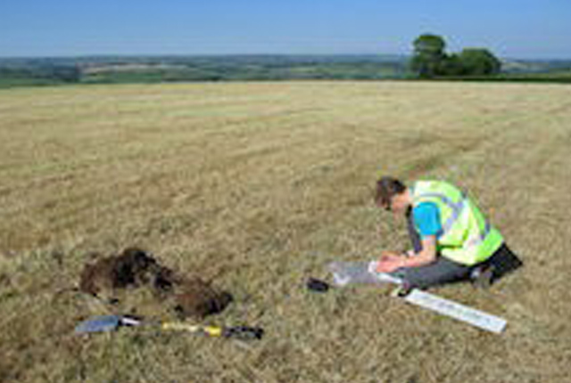
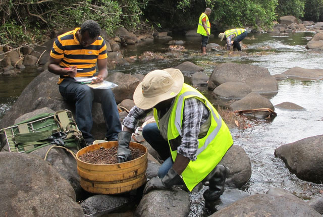
Collecting a stream sediment sample using a 150 µm nylon sieve.
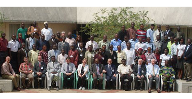
Specialists from BGS and GTK (Finland) ran a workshop on geochemical mapping techniques in Kaduna, Nigeria, from 19-23 January 2009. Over 50 people attended, including staff from the Nigerian Geological Survey Agency (NGSA) and Nigerian universities. The workshop was opened by representatives of the Kaduna State Governor and Nigeria’s Minister of Mines and Steel Development, and was covered in the national media.
During the week-long workshop, participants were trained in practical sampling techniques, digital mapping, and analysis of geochemical data. The workshop was widely agreed to be a success by both trainers and trainees, and in the words of one trainee, the training was “very enlightening, I cannot wait to do it hands-on in the field and see the outcome – which I believe will change the mining sector in this country”.
Nigerian Geochemical Mapping Technical Assistance Project
The workshop was part of a larger World Bank-funded project, in which BGS and GTK provided technical assistance to the NGSA as they develop a national geochemical mapping programme. The geochemical maps are being used for mineral exploration in Nigeria, as well as for environmental investigations.
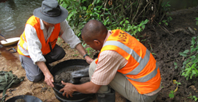
The geochemical mapping was based on the collection of stream sediment from small streams.
The geochemical mapping of the two (Minna and SW) master cells was completed between August and November 2009 . A total of 1307 and 284 stream sediment samples were collected from the Minna and SW cells respectively with sample densities of one sampling site per 21 and 90 km2 respectively. Each cell is approximately 160 km x 160 km.
Over 100 Nigerian geoscientists were given practical training in all aspects of geochemical mapping. The samples were sent to Nigerian National Geoscience Research Laboratory for initial sample preparation and storage.
Multi-element ICP-MS analysis on all the samples was undertaken at the BGS laboratories in Keyworth (UK) for Ag, Al, As, Au, B, Ba, Be, Bi, Ca, Cd, Ce, Co, Cr, Cs, Cu, Dy, Er, Eu, Fe, Ga, Gd, Hf, Ho, K, La, Li, Lu, Mg, Mn, Mo, Nb, Nd, Ni, P, Pb, Pr, Rb, S, Sb, Se, Si, Sm, Sn, Sr, Ta, Tb, Th, Ti, Tl, Tm, U, V, W, Y, Yb, Zn and Zr.
The samples were also sent to Canada for Fire Assay fusion and ICP-MS analysis for Au, Pt and Pd. Two Nigerian secondary reference samples were collected and analysed as part of the quality control on the laboratories.
The results for 57 of the elements are presented as classified symbol plots on geochemical maps produced as ArcGIS map project files.
Progress of the project was delivered as a series of 26 reports available from the Nigeria Geological Survey Agency, Abuja, Nigeria.
Further reading
Key, R M, Johnson, C C, Horstwood, M S A, Lapworth, D J, Knights, K V, Kemp, S J, Watts, M J, Gillespie, M, Adekanmi, M A, and Arisekola, T M. 2012. Investigating high zircon concentrations in the fine fraction of the stream sediments draining the Pan-African Dahomeyan Terrane in Nigeria. Applied Geochemistry, Vol. 27(8), 1525–1539. DOI: https://doi.org/10.1016/j.apgeochem.2012.04.009
Lapworth, D J, Knights, K V, Key, R M, Johnson, C C, Ayoade, E, Adekanmi, M A, Arisekola, T M, Okunlola, O A, Backman, B, Eklund, M, Everett, P A, Lister, T R, Ridgway, J, Watts, M J, Kemp, S J, and Pitfield, P E J. 2012. Geochemical mapping using stream sediments in west-central Nigeria: Implications for environmental studies and mineral exploration in West Africa. Applied Geochemistry, Vol. 27(6), 1035–1052. DOI: https://doi.org/10.1016/j.apgeochem.2012.02.023
Contact
Contact BGS Enquiries for further information.
You may also be interested in:
International geochemistry
BGS has a long history of collaborative international geochemical projects involving regional baseline mapping and health and environment studies.
International geochemistry CD-ROM series
Regional geochemical data from a range of overseas countries are available on a series of CD-ROMS.