GeoClimate UKCP09 Open
BGS Datasets
Key information
Scale:
2 km gridded datasetCoverage:
Great BritainAvailability:
FreeFormat:
2 km gridded GIS data (ESRI, MapInfo, others available by request)Uses:
National-level useGet data
Free access
Our free data is available under the Open Government Licence. Please acknowledge reproduced BGS materials.
GeoClimate open dataGeoIndex
Paid access
Supporting documents
The BGS GeoClimate: shrink–swell national datasets show potential change in subsidence due to changes in climate. They have been developed by combining long-term UK Climate Projection (UKCP) scenarios for rainfall and temperature changes with the geotechnical properties of the ground, to identify areas projected to experience the largest increases in susceptibility to subsidence over the next century.
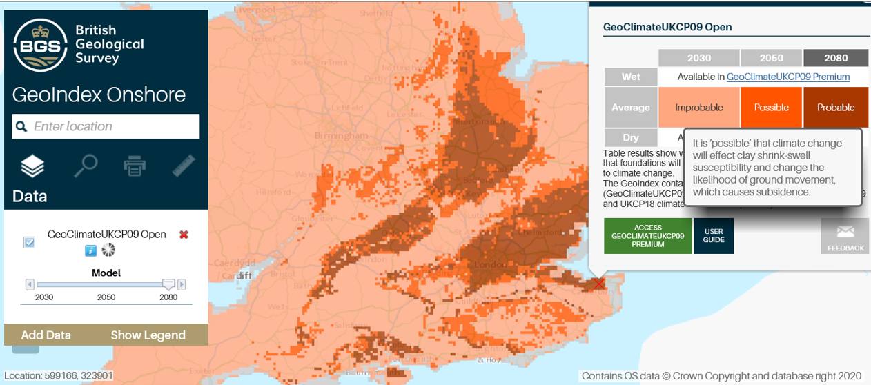

UKCP09 Open available through the BGS GeoIndex. BGS © UKRI.
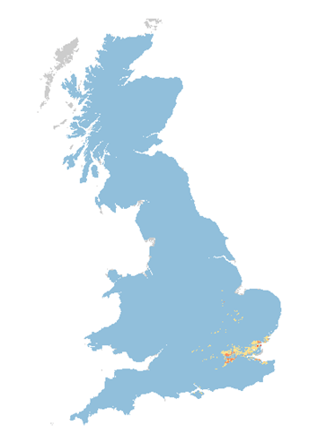
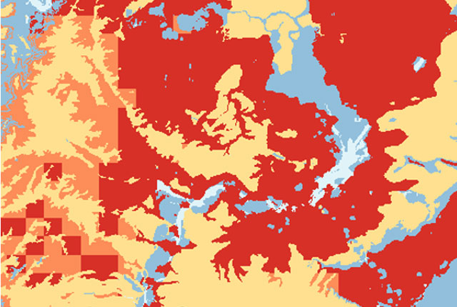
GeoClimate UKCP09 coverage map. BGS © UKRI
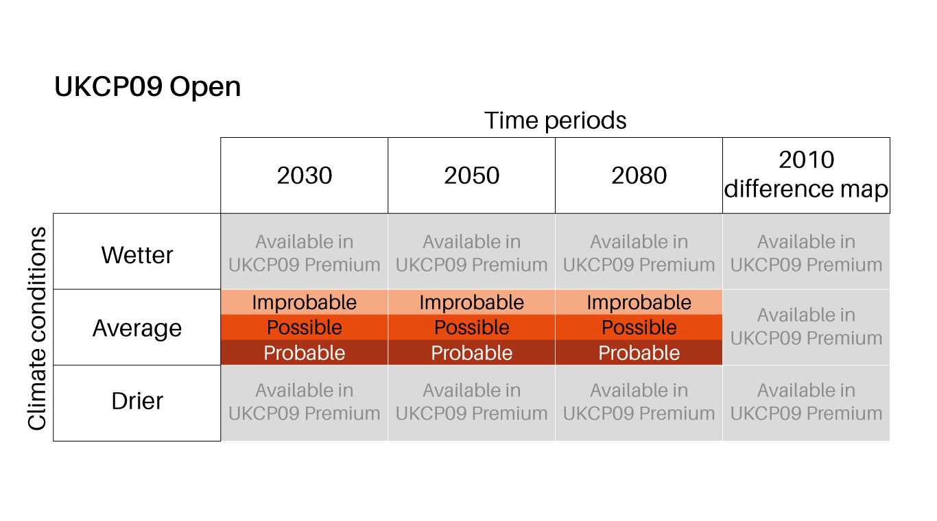
Summary of GeoClimate UKCP09 Open dataset content. BGS © UKRI.
GeoClimate UKCP09 Open is provided for three time periods: 2030s, 2050s and 2080s, with one projection provided for each time period based on the average outcome for the medium emissions scenario and the most susceptible GeoSure value (worst case) within the grid cell.
- More about the full suite of GeoClimate shrink–swell products
Additional dataset information
| Features | GeoClimate UKCP09 Open |
|---|---|
| UKCP09 emissions scenario | Medium emissions |
| Temporal projections (11-year windows) | 2030s (2025–2035), 2050s (2045–2055), 2080s (2075–2085) |
| Projections provided | Median average |
You may also be interested in
GeoClimate UKCP09 Premium
Based on medium emissions scenario, provides five levels of susceptibility for average, wetter and drier climate conditions for the time-period envelopes of 2020, 2030, 2040, 2050 and 2080 at the 1:50 000 area polygons scale.
GeoClimate UKCP09 and UKCP18
BGS has developed a suite of products, including maps and data, which show potential change in subsidence due to UKCP climate change scenarios