Garry Baker appointed BGS Director of Informatics
Garry Baker has been appointed by the British Geological Survey (BGS) to be its new Director of Informatics.
07/09/2022 By BGS Press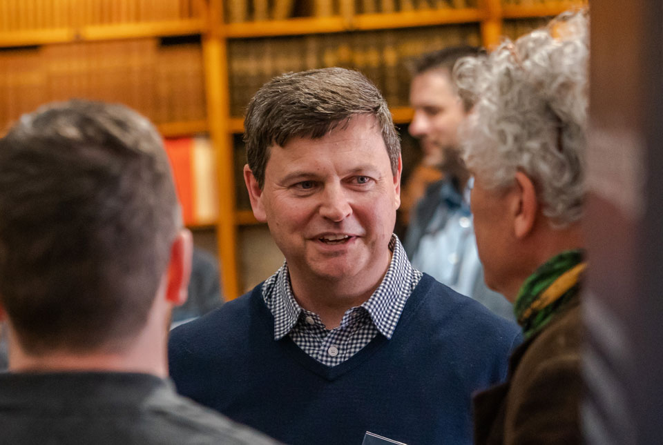

Garry Baker has been appointed by BGS as its new Director of Informatics.
As a member of the BGS Science Strategy group and part of the BGS Senior Management Board, this important post will help to deliver the new science strategy from 2023 .
Garry will be responsible for the strategic leadership of the BGS informatics programmes, including the National Geoscience Data Centre, ensuring efficient stewardship of analogue and digital assets to enable research and help create value and impact.
Based at the BGS headquarters in Keyworth, Nottingham, and working across all BGS sites, the role takes leadership of around 130 informatics staff.

I am excited to be taking on this new and exciting role of BGS Director of Informatics. I am looking forward to ensuring that we, as an organisation, manage our unique national data assets and leverage the latest capabilities to achieve our overall business and science strategies, as well as building strong connections with external communities.
Garry Baker, BGS Director of Informatics.
Garry has over 26 years’ experience in data and information management, working on survey, collaborative and commercial projects both nationally and internationally. This has included IT development and management roles, project and programme management and ultimately managing the BGS Data Centre, which is a significant component of the UKRI/NERC Environment Data Service. Garry plans on using his experience to revitalise informatics’ capabilities and solutions for both BGS and external communities.
On behalf of BGS and the BGS Board I am delighted to welcome Garry into this role. I am really looking forward to working with him to develop a new and coherent informatics strategy, which will underpin our new BGS Science Strategy. Garry has an outstanding track record as a data and informatics leader and I know that he will use this experience to ensure that BGS is at the forefront of digital innovation and research.
Dr Karen Hanghøj, BGS Director.
Garry started his new appointment as Director of Informatics on 1 September 2022.
Related news

Call for new members and Chair to join the NERC facilities steering committees
25/02/2026
New members are needed to join the committees over the next four years.

Your views wanted – developing a ‘Geothermal energy subsurface data portfolio’
24/02/2026
BGS is aiming to support the growth of the sector by providing the best-available, location-specific geothermal and ground source heat information as an accessible product or service.

Map of BGS BritPits showing the distribution of worked mineral commodities across the country
18/02/2026
BGS’s data scientists have generated a summary map of the most commonly extracted mineral commodities by local authority area, demonstrating the diverse nature of British mineral resources.

Funding awarded to map the stocks and flows of technology metals in everyday electronic devices
12/02/2026
A new BGS project has been awarded Circular Electricals funding from Material Focus to investigate the use of technology metals in everyday electrical items.

New UK/Chile partnership prioritises sustainable practices around critical raw materials
09/02/2026
BGS and Chile’s Servicio Nacional de Geología y Minería have signed a bilateral scientific partnership to support research into critical raw materials and sustainable practices.

Extensive freshened water confirmed beneath the ocean floor off the coast of New England for the first time
09/02/2026
BGS is part of the international team that has discovered the first detailed evidence of long-suspected, hidden, freshwater aquifers.

Funding secured to help mitigate ground risk in UK construction sector
05/02/2026
The BGS Common Ground project has been awarded new funding to help unlock the value of ground investigation data.

Can sandstones under the North Sea unlock the UK’s carbon storage potential?
02/02/2026
For the UK to reach its ambitious target of storing 170 million tonnes of carbon dioxide per year by 2050, it will need to look beyond the current well-studied geographical areas.

Quaternary UK offshore data digitised for the first time
21/01/2026
The offshore wind industry will be boosted by the digitisation of a dataset showing the Quaternary geology at the seabed and the UK’s shallow subsurface.

Suite of ten new soil reference materials released
02/01/2026
BGS has a longstanding track record of producing high-quality reference materials and has released ten new soil reference materials.
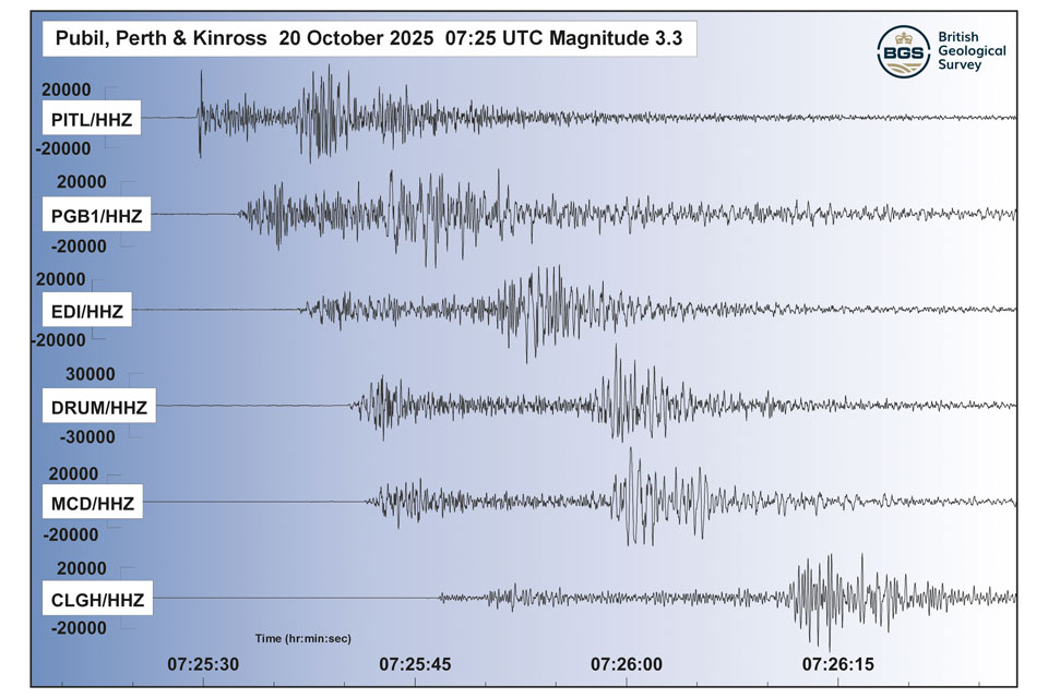
Perth and Kinross tops the UK’s earthquake activity charts for 2025
29/12/2025
Seismologists at BGS have published data on the number of seismic events over the past 12 months with over 300 earthquakes recorded.

BGS awarded funding to support Malaysia’s climate resilience plan
17/12/2025
The project, funded by the Foreign, Commonwealth & Development Office, will focus on minimising economic and social impacts from rainfall-induced landslides.