Antarctic mountain named in honour of BGS scientist
BGS’s Ian Millar has been honoured for his geological research in Antarctica by having a mountain on the continent named after him.
06/11/2023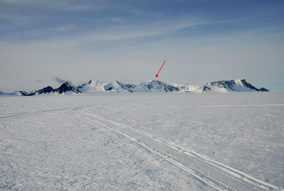

Each year, the Antarctic Place-names Committee recommends new names for geographical features, to honour scientists and support staff who have worked in the region. This year, they have announced that a 2000 m mountain on the southern Antarctic Peninsula will be named Mount Millar after Dr Ian Millar of the British Geological Survey (BGS).
Ian, who works at BGS’s headquarters in Keyworth, Nottinghamshire, worked for the British Antarctic Survey (BAS) for more than 21 years before he became an isotope geochemist at BGS in 2005. During his time at BAS, he took part in several field seasons and cruises in and around the Antarctic Peninsula and Transantarctic Mountains, spending more than a year in total working on the southern continent.
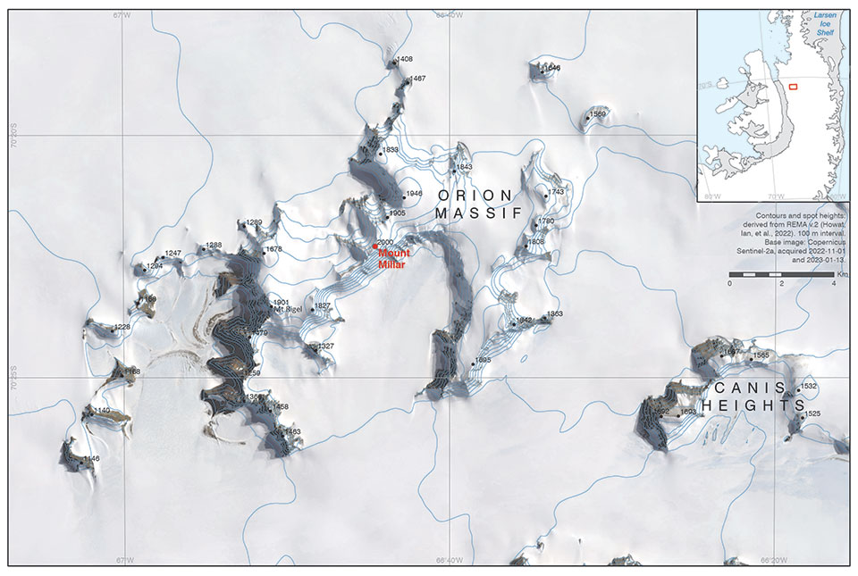
Mount Millar on the map. © UK Antarctic Place-names Committee and British Antarctic Survey.
In 1991, Ian spent ten weeks camping and travelling by skidoo with a field guide in a remote area of the southern part of the Antarctic Peninsula, collecting rock samples in order to determine the ages of the rocks, working close to the location of Mount Millar. His work there contributed to determining the geological history of the peninsula through detailed geochronology.

I have been incredibly lucky to undertake some amazing fieldwork during my career, both in Antarctica with BAS and, more recently, in much warmer regions like North Africa and south-east Asia since joining BGS.
Dr Ian Millar, BGS Isotope Geochemist.
Mount Millar can be found on the Antarctic Place-names Committee’s website.
About BAS
The British Antarctic Survey (BAS) is the United Kingdom’s national polar research institute. It has a dual purpose: to conduct polar science, enabling better understanding of global issues, and to provide an active presence in the Antarctic on behalf of the UK. BAS is a component of the Natural Environment Research Council (NERC), which is part of UK Research and Innovation (UKRI).
About the author
Relative topics
Related news

Updated geological assessment of the Southern North Sea set to underpin future offshore infrastructure development
25/03/2026
The first regional assessment for 30 years will support offshore marine and subsurface planning for the UK’s low-carbon energy infrastructure, including the 2030 target of 45 to 50 GW generated through offshore wind.

New research could help provide a more reliable water supply for millions in rural Africa
24/03/2026
A new BGS-led study has revealed crucial insights into the longstanding challenges affecting the reliability and performance of rural water supply infrastructure in sub-Saharan Africa.

UK Critical Minerals Intelligence Centre 2026 showcase
Event on 31/03/2026
Join us for a special live webinar with the team from the Critical Minerals Intelligence Centre showcasing the latest research from 2026 on copper, the future of digital, and what’s next for the criticality assessment.

PhD adventures in Copenhagen, Denmark: revealing past recovery processes of tropical forest systems through ancient environmental DNA
12/03/2026
PhD student Chris Bengt visited the University of Copenhagen to carry out very delicate extraction of aeDNA from lake-sediment cores, in the hopes of unlocking the secrets of past volcanic eruptions.

Call for new members and Chair to join the NERC facilities steering committees
25/02/2026
New members are needed to join the committees over the next four years.

Your views wanted: developing a geothermal energy subsurface data portfolio
24/02/2026
BGS is aiming to support the growth of the sector by providing the best-available, location-specific geothermal and ground source heat information as an accessible product or service.

Map of BGS BritPits showing the distribution of worked mineral commodities across the country
18/02/2026
BGS’s data scientists have generated a summary map of the most commonly extracted mineral commodities by local authority area, demonstrating the diverse nature of British mineral resources.

MARC Conference 2025: highlighting the importance of conferences to PhD students
16/02/2026
BGS and University of Nottingham PhD student Paulina Baranowska shares her experience presenting her research on nuclear forensics at her first international conference.

Funding awarded to map the stocks and flows of technology metals in everyday electronic devices
12/02/2026
A new BGS project has been awarded Circular Electricals funding from Material Focus to investigate the use of technology metals in everyday electrical items.

New UK/Chile partnership prioritises sustainable practices around critical raw materials
09/02/2026
BGS and Chile’s Servicio Nacional de Geología y Minería have signed a bilateral scientific partnership to support research into critical raw materials and sustainable practices.

Extensive freshened water confirmed beneath the ocean floor off the coast of New England for the first time
09/02/2026
BGS is part of the international team that has discovered the first detailed evidence of long-suspected, hidden, freshwater aquifers.

Funding secured to help mitigate ground risk in UK construction sector
05/02/2026
The BGS Common Ground project has been awarded new funding to help unlock the value of ground investigation data.