Water security
Science briefing paper
Our mission
BGS research measures, monitors and maps groundwater. We examine its response to varying pressures and how it can be sustainably developed and managed, both in the UK and globally. Better understanding increases UK water supply security and contributes to increased global water security, especially in low-income countries. It also reduces the risk of emerging technologies and improves catchment management.
Who we work with
- UK Government departments
- Regulators
- UK water industry
- Non-governmental organisations
and UN agencies - World Bank
- Universities and research organisations
- Engineering consultancies
Groundwater — the climate-resilient UK water resource
Groundwater provides nearly a third of public water supply in the UK, mostly in the south-east of England. Originating as rainfall and naturally stored in aquifers such as chalk or sandstone, groundwater responds more slowly to changes in the climate and can often provide a useful buffer during periods of drought. Increasing population and more erratic rainfall makes groundwater an ever-important, climate-resilient, strategic resource.
Threats to groundwater
The two global threats to groundwater are depletion and contamination. Depletion can occur when more groundwater is being abstracted than can be easily replaced with rainfall or by reducing outflows to rivers and the sea. Globally, the largest depletion issues are in major irrigation areas such as northern India, China, the USA and Iran.
The most widespread contamination issues in the UK are due to agricultural pollution, mainly nitrate, and pollution from mines, which can increase metals, salinity and sulfate concentrations. Other contaminants are increasing and present a threat to groundwater, like the forever chemicals (PFAS) and other organic contaminants such as pesticides, pharmaceuticals and microplastics.
Groundwater flooding can occur where the water table rises. It is estimated to cost the UK over £156 million a year.
Environment Agency, 2016
In 2022 it was estimated that more than half the world’s population relied on groundwater for their drinking water.
World Water Development, 2022
In the UK the two most important aquifers are the highly productive Chalk Group found in southern and eastern England, and the Permo-Triassic sandstones.
BGS, 2019
Over much of the UK, groundwater is estimated to contribute more than 50 per cent of the flow to rivers, with the highest proportion in the south-east of England therefore groundwater keeps rivers flowing in time of drought.
Leeming et al. 2025
Groundwater abstraction in England from all sources is estimated to be approximately 2 km3 a year, roughly 20 per cent of all water abstraction.
Defra, 2023
Solutions
Although groundwater is a hidden resource, it can be characterised, monitored and managed. BGS provides information on the 3D nature of aquifers, and how they will respond to pumping or changes in climate or land use. We provide monthly summaries of the status of UK groundwaters and forecast behaviours over the next three months. We also carry out detailed surveys of groundwater chemistry and age, and are experts in developing monitoring networks for existing and emerging groundwater issues.
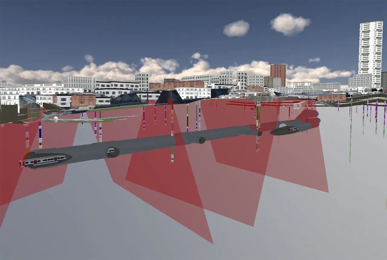
British Groundwater Model
All these data can be tested in numerical groundwater models, which have grown in sophistication to enable links to rivers and the land surface to be included. BGS has developed the first numerical groundwater model for the whole of mainland Great Britain, which enables future forecasts of water security to be explored. To date, the model has supported a wide range of applied research and policy. Relevant work includes estimating the water availability for emerging industries such as hydrogen generation, and the impact and efficiency of carbon capture.
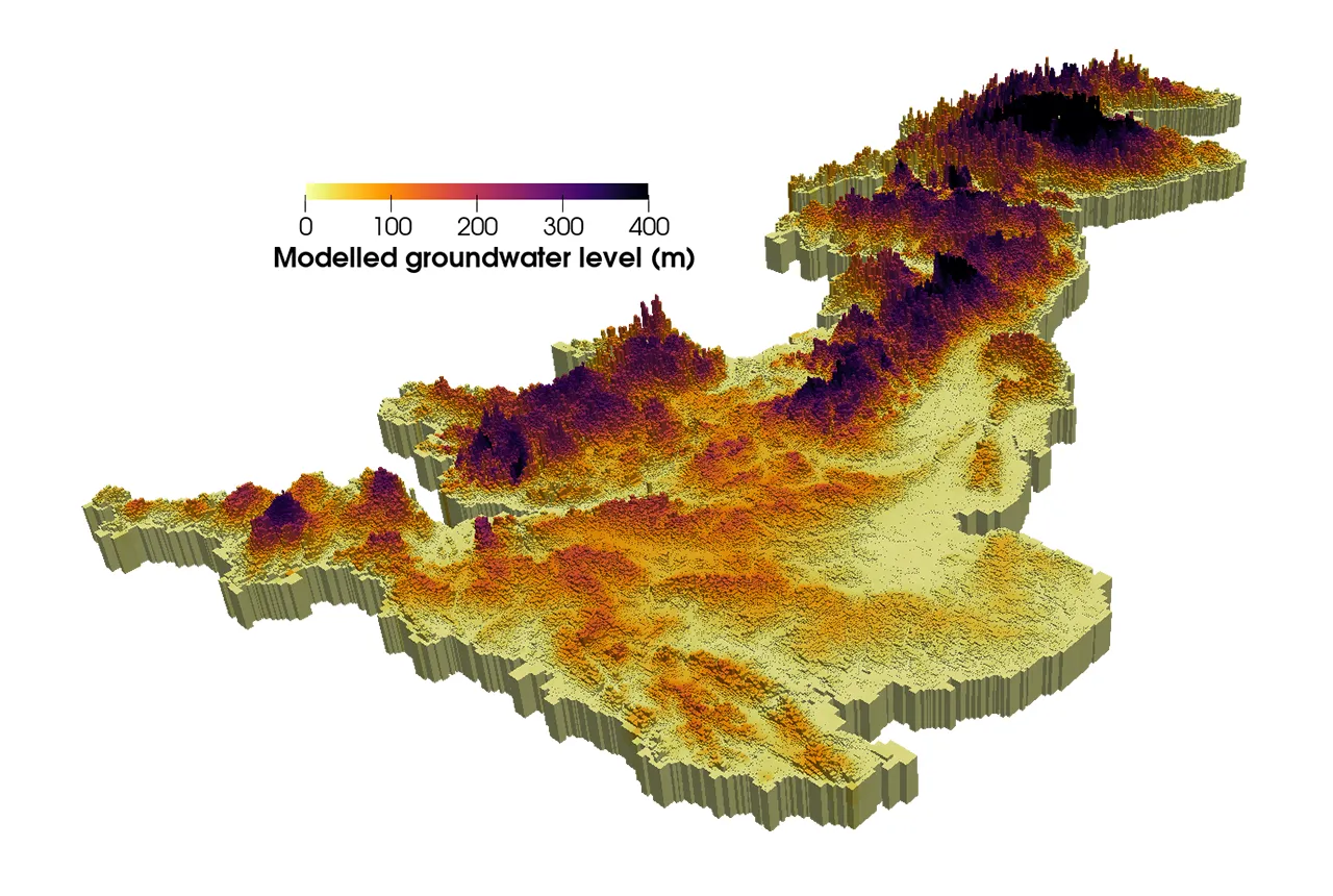

Groundwater levels across Britain simulated with the British Groundwater Model. BGS © UKRI
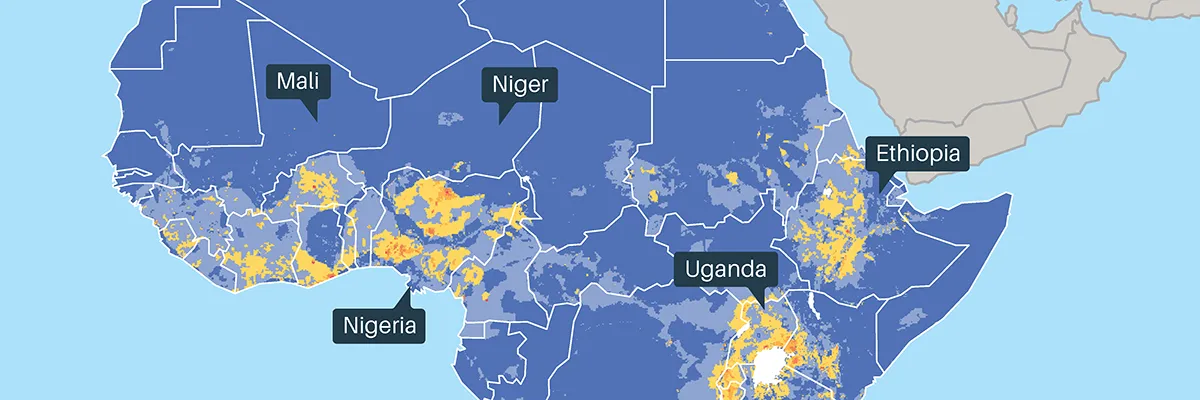
Africa Groundwater Atlas
Access to reliable information is fundamental to developing groundwater sustainably. The BGS Africa Groundwater Atlas provides a summary of the hydrogeology of 51 African countries. Freely available online and with more than 10 000 downloads globally, the maps are used by policymakers, non-governmental organisations, industry and academia. The African Ministers’ Council on Water recently highlighted the atlas as strategically important for unlocking the potential of groundwater to support economic transformation in Africa.
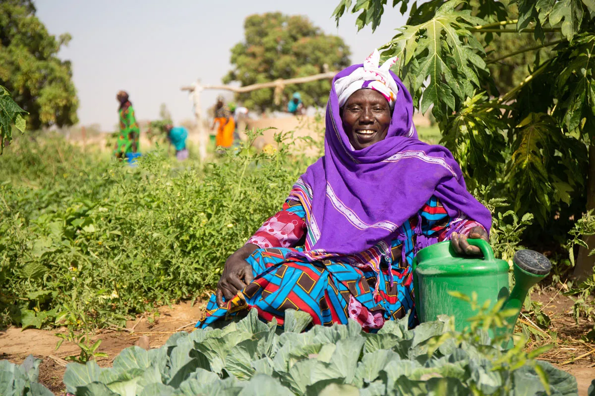
© Basile Ouedraogo, WaterAid.