

Construction and infrastructure
Science briefing papers

Our mission
BGS is the primary custodian of national-scale baseline geological data for the construction and infrastructure sector, to increase early-stage awareness of ground risks and reduce project delays and overspend. BGS provides specialist geological services for government and industry in support of nationally significant infrastructure projects.
We work with
- National Infrastructure Commission
- Infrastructure and Projects Authority
- Geospatial Commission
- Government Office for Technology Transfer
- Infrastructure asset owners
- Geotechnical engineers
Investing in infrastructure
Investment in infrastructure is central to the UK Government’s mission to ‘Fix the Foundations’, which includes a 10-year infrastructure strategy to guide investment plans and provide the private sector with certainty about project pipelines.
Over the last decade, public investment in infrastructure has averaged around £20 billion in Great Britain, or approximately 1 per cent of GDP (NIC report).
An estimated investment of £230 million per year is spent on ground investigations to acquire the geological data and information needed for the development of new infrastructure (BGS report).
33% of UK construction projects are significantly delayed. 50% of those delays are caused by unforeseen ground conditions that could have been mitigated by upfront site investigations.
Chapman and Marcetteau, 2004
80 to 85% of all building failures and damages are related to unforeseen ground conditions.
Brandl, 2004
Cost overruns for 258 megaprojects (worth over $1 billion) averaged 45%, 34% and 20% for rail, bridges and tunnels, and road projects, respectively.
Flyvjberg, 2003
In 2025, the UK experienced the warmest spring on record and the driest in more than 50 years. As a result, subsidence-related insurance claims in the UK totalled £153 million in the first six months of 2025
36 new houses in Cambridge had to be demolished as foundation construction failed to adequately account for soil conditions.
64 houses in Midlothian were demolished due to ground gases from mine workings and failure to install protective measures.
The challenge
Despite investment in ground investigation, failure to properly assess geological conditions and ground constraints is one of the leading causes of project delay and overspend. Improved early-stage awareness of ground risks enables more appropriate design and construction methods, reducing the need for additional surveys and late-stage, often costly, alterations.
The solutions
Better data in — It is estimated that less than 30 per cent of ground investigation records are submitted to the BGS data centres, which equates to a loss of data and knowledge worth an estimated £184 million a year from the UK economy. To help solve this, we have worked with the Infrastructure and Projects Authority to include a new subsurface data sharing model clause in HM Government’s Construction Playbook.
Making data accessible — BGS’s National Geoscience Data Centre holds key datasets for the construction sector, including more than 1.4 million borehole records. These are provided to users via our open-access GeoIndex web app; over 100 000 borehole records are downloaded each month.
Making the economic case — We are working with the Geospatial Commission and industry specialists to provide new data services to unlock further value from ground investigation data. A conservative estimate of the potential value of geological data and information for the construction sector is £2.3 billion a year.
Learn more about the Common Ground project.

The Construction Playbook. © Crown copyright 2022.
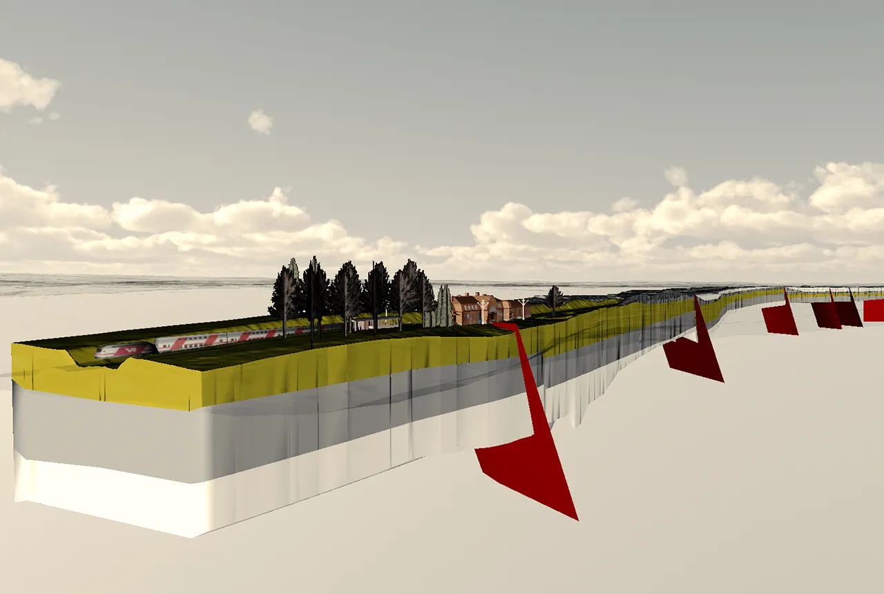
Leeds to York 3D geological model with linear infrastructure. Image from Geovisionary. BGS © UKRI 2021.
The complete picture
BGS delivers bespoke data products, geological services and 3D ground models to provide early-stage awareness of ground conditions and de-risk new infrastructure projects. The information is used to inform infrastructure design and construction, such as:
- route lineaments
- geotechnical baseline reports
- design optioneering
- drilling methods for tunnelling
projects - management of excavated
materials
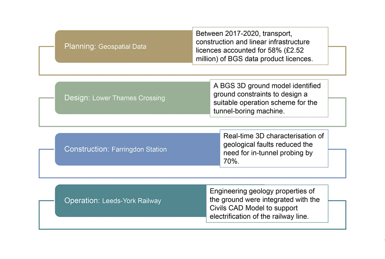
Examples of where BGS geological expertise has been used to support
transport infrastructure projects across the infrastructure life cycle. BGS © UKRI.
Evidence suggests that use of 3D geological data and information leads to an estimated 10 per cent efficiency saving at the ground investigation stage.
View our other policy briefing notes

The subsurface: our hidden asset
The British Geological Survey (BGS), part of UK Research and Innovation (UKRI), is the UK’s primary provider of authoritative geological and geoscience data and information.

Energy transition
Our research on geothermal energy, carbon capture and storage, energy storage and geological disposal supports the energy transition.
Water security
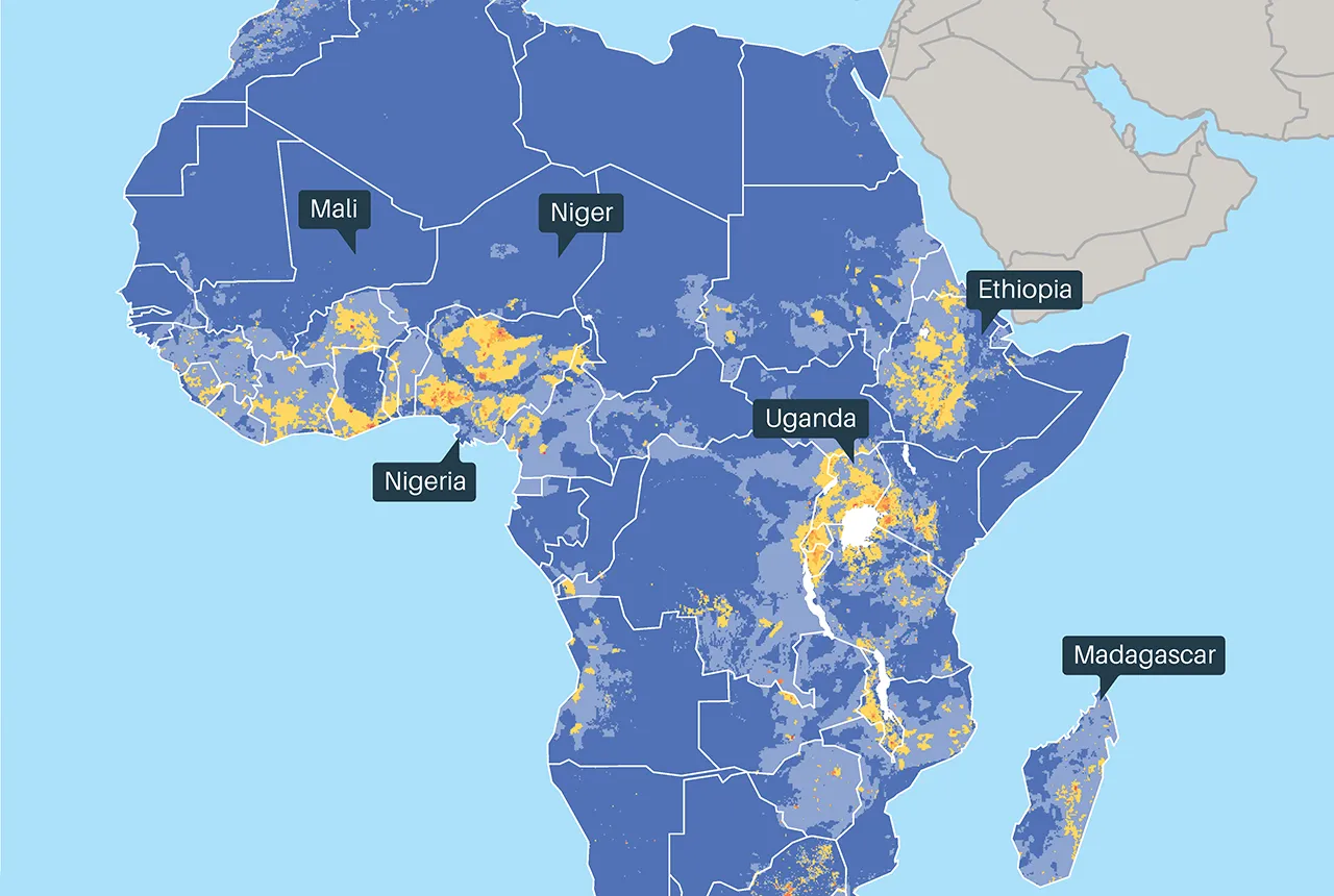
BGS research measures, monitors and maps groundwater. We examine its response to varying pressures and how it can be sustainably developed and managed, both in the UK and globally. Better understanding increases UK water supply security and contributes to increased global water security.

Resilience to geological hazards
Through long-term monitoring, we analyse risk by determining the potential impacts of multiple hazards on communities, critical infrastructure, the environment, and the economy. Our work strengthens societal resilience to Earth hazards in a changing climate.

Land-use planning and housing
BGS provides independent and authoritative geoscience to a range of end users involved in land-use planning and housing development through collaborative research, open data, licensed data, web viewers and decision support tools.