
Groundwater vulnerability data. Contains Ordnance Survey data © Crown Copyright and database rights 2020.
Groundwater vulnerability
- 1:50 000
- England and Wales
- Premium
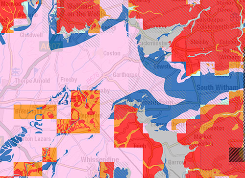
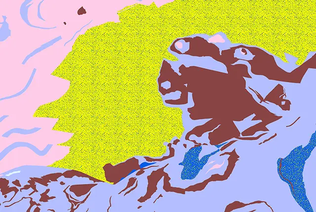
The groundwater vulnerability maps have been created by the Environment Agency and Natural Resource Wales using data from the BGS, the UK Centre for Ecology & Hydrology and the National Soil Resources Institute. The maps provide an assessment of the vulnerability of groundwater to a pollutant discharged at ground level based on the hydrological, geological, hydrogeological and soil properties within a one kilometre square grid.
Key information
- Scale:
- 1:50 000
- Coverage:
- England and Wales
- Availability:
- Premium
- Price:
£0.45 per km2 for commercial use; available from BGS (subject to number of users, licence fee and data preparation fee).
Free for non-commercial research and academic use; available from Environment Agency (England) and Natural Resources Wales (Wales).
- Format:
- GIS polygon data (ESRI, MapInfo, others available by request)
- Uses:
- Local-level to regional-level use
- Themes:
- Environmental change, Hydrogeology
The groundwater vulnerability maps have been created by the Environment Agency and Natural Resource Wales using data from the BGS, the UK Centre for Ecology & Hydrology and the National Soil Resources Institute. The maps provide an assessment of the vulnerability of groundwater to a pollutant discharged at ground level based on the hydrological, geological, hydrogeological and soil properties within a one kilometre square grid.
The maps provide a separate assessment of the vulnerability of groundwater in overlying superficial rocks and those that comprise the underlying bedrock. They also reflect improvements in data mapping and understanding of the factors affecting vulnerability and replace the old groundwater protection purposes map.
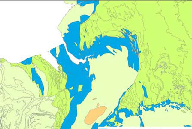
The groundwater vulnerability for each aquifer type is expressed from high to unproductive.
- High: areas that can easily transmit pollution to groundwater. They are characterised by high-leaching soils and the absence of low-permeability superficial deposits.
- Medium: areas that offer some groundwater protection. Intermediate between high and low vulnerability.
- Low: areas that provide the greatest protection to groundwater from pollution. They are likely to be characterised by low-leaching soils and/or the presence of low-permeability superficial deposits.
- Unproductive: areas comprised of rocks that have negligible significance for water supply or baseflow to rivers, lakes and wetlands. They consist of bedrock or superficial deposits with a low permeability that naturally offer protection to any aquifers that may be present beneath.
The importance of the groundwater resource is reflected in the aquifer designation status derived from our aquifer designation maps. Please note that this groundwater vulnerability data supersedes the previous groundwater vulnerability 100k data.
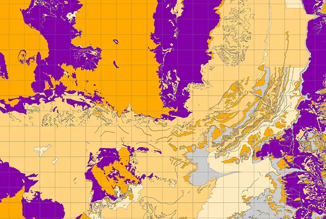
Groundwater vulnerability data coverage. BGS © UKRI – Contains OS data © Crown copyright 2020.
Available map products
Two map products are available: the combined groundwater vulnerability map and the simplified groundwater vulnerability map.
Combined groundwater vulnerability map
This product is intended for use by groundwater technical specialists due to the complex nature of the legend, which displays groundwater vulnerability (high; medium; low), the type of aquifer (bedrock; superficial; unproductive) and aquifer designation (principal; secondary; unproductive). These maps require that users are able to understand the vulnerability assessment method and interpret the individual components of the legend.
Simplified groundwater vulnerability map
This is designed for non-specialists who need to know the overall risk to groundwater from a particular activity, development or pollution incident, but do not have extensive hydrogeological knowledge. The map has five risk categories (high, medium-high, medium, medium-low and low) based on the likelihood of a pollutant reaching the groundwater (i.e. vulnerability), the type of aquifers present and the potential impact (i.e. the aquifer designation).
Additional information
Two additional pieces of information are displayed on both maps:
- Soluble rock risk: areas where solution features that enable rapid movement of a pollutant may be present (identified as stippled).
- Local information: areas where additional information that contributes to the understanding of groundwater vulnerability is held locally by the Environment Agency (identified as dashed areas).
Download Groundwater Vulnerability sample data
You may also be interested in
Aquifer designation data
The aquifer designation dataset reflects the importance of aquifers in England and Wales as a resource and their role in supporting surface water flows and wetland ecosystems.
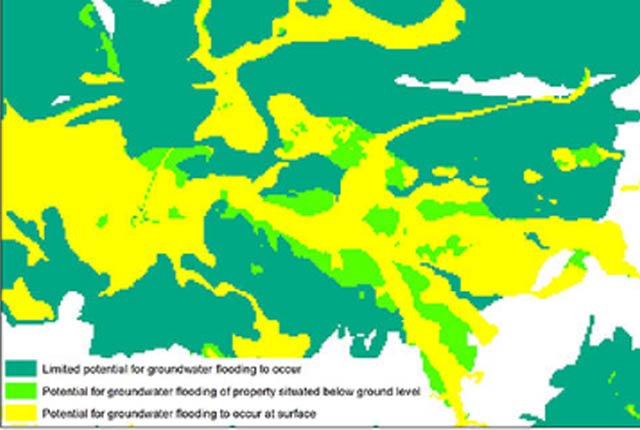
Groundwater flooding
In response to the need for more information on groundwater flooding, BGS has produced the first national dataset on the susceptibility across Britain.
Hydrogeological maps of Scotland
The BGS has produced a suite of hydrogeological maps of Scotland. The suite includes layers with groundwater vulnerability and aquifer productivity data.
Hydrogeology 625K digital hydrogeological map of the UK
The hydrogeological map indicates aquifer potential in generalised term.
Infiltration SuDS map
The BGS Infiltration SuDS map dataset is suitable for those involved in the design of sustainable drainage systems and approving SuDS planning applications.

Permeability
Permeability data is often used in studies of groundwater. Our permeability information is based on BGS Geology 50K data.