
BGS mining hazard (not including coal) 1 km hex grid. BGS © UKRI.
Mining hazard (not including coal) 1 km hex grid
- 1 km hex grid (approx. 1:1 000 000)
- Great Britain
- Open
The BGS mining hazard (not including coal) 1 km hex grid dataset provides a generalised overview of the likelihood for mining to have occurred. It provides a national-scale summary of the presence of mining and an indication of the level of hazard associated with old workings.
Key information
- Scale:
- 1 km hex grid (approx. 1:1 000 000)
- Coverage:
- Great Britain
- Availability:
- Open
- Price:
Free for commercial, research and public use under the Open Government Licence. Please acknowledge the material
- Format:
- GIS polygon data (ESRI)
- Uses:
- Regional-level to national-level use
- Themes:
- Hazards, Mining and minerals
- Sector:
- Construction and planning, Ground stability
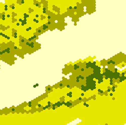
The data has been generalised into a vector map of interlocking hexagon cells, side length 1 km, area approximately 2.6 km2.
There are four classes included within the data:
- low: localised, small-scale mining may have occurred in the area
- moderate: small-scale, underground mining may have occurred in the area
- significant: underground mining is known or considered likely to have occurred in the area
- NA: no record of activity
The data has been generalised from the BGS mining hazard (not including coal) dataset. This additional, detailed dataset is also available to licence and provides further detail as well as information on the type of commodity extracted, mine names and any additional details where available, at a scale of 1:50 000.
Mining hazard hex sample. BGS © UKRI.
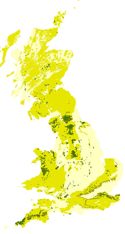
Mining hazard hex coverage. BGS © UKRI – Contains OS data © Crown copyright 2020.
Download mining hazard hex grid data
You may also be interested in

Mining hazard (not including coal) coverage
The mining hazard dataset provides essential information for planners and developers building in areas of former shallow underground mine workings.