Real-time monitoring of environmental phenomena is a large and growing area of interest at the BGS and wider research communities. We provide scalable, robust ways of managing high volume, highly varied data generated by a range of scientific projects, including:
- UK Geoenergy Observatories: UK future energy monitoring and testing
- Hollin Hill: landslide monitoring project
- Seismic monitoring: a network of 100+ seismograph stations
What and where?
We are collecting data from sensors located throughout the UK and beyond (Figure 1) capturing information on properties such as groundwater temperature and levels, barometric air pressure and motion sensors. We have recently started collecting information related to the energy efficiency of buildings and have developed techniques for incorporating data from sensors operated by other institutions.
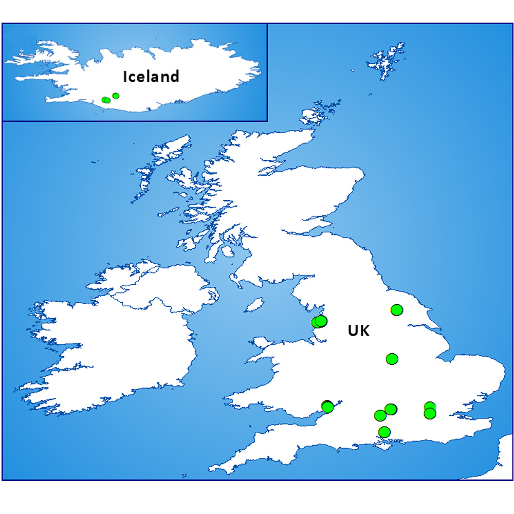

Figure 1: current BGS environmental sensor site locations (not including seismograph stations). BGS © UKRI.
Data management and systems architecture
We want to manage the sensor data we use in our research in a consistent, scalable manner, regardless of the type of sensor, where it is located or who set it up.
We have developed an architecture for streaming sensor telemetry data into a central data store where it can be standardised, cleaned up and generally prepared for the many potential users that want to access that data.
A key element of this approach is that to hold all of the key data and metadata relating to a sensor in a single location. How that data and metadata are optimised for various clients can vary from user to user.
The high-level architecture diagram in Figure 2 shows the key stages in the sensor data flow. We will be releasing more details over time and we are happy to answer specific questions from interested parties.
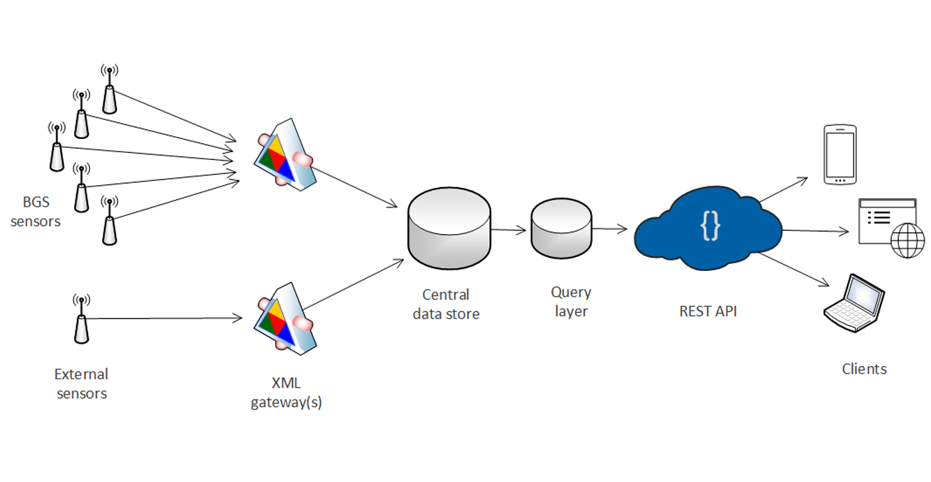
Figure 2: high-level illustration of the BGS sensor data flow. BGS © UKRI.
Data access
Our philosophy is to tailor data clients to meet the needs of the users without compromising the design of the central data store. This means that we may create web portals or mobile applications for a geographical area, a particular scientific discipline or a topic of public concern.
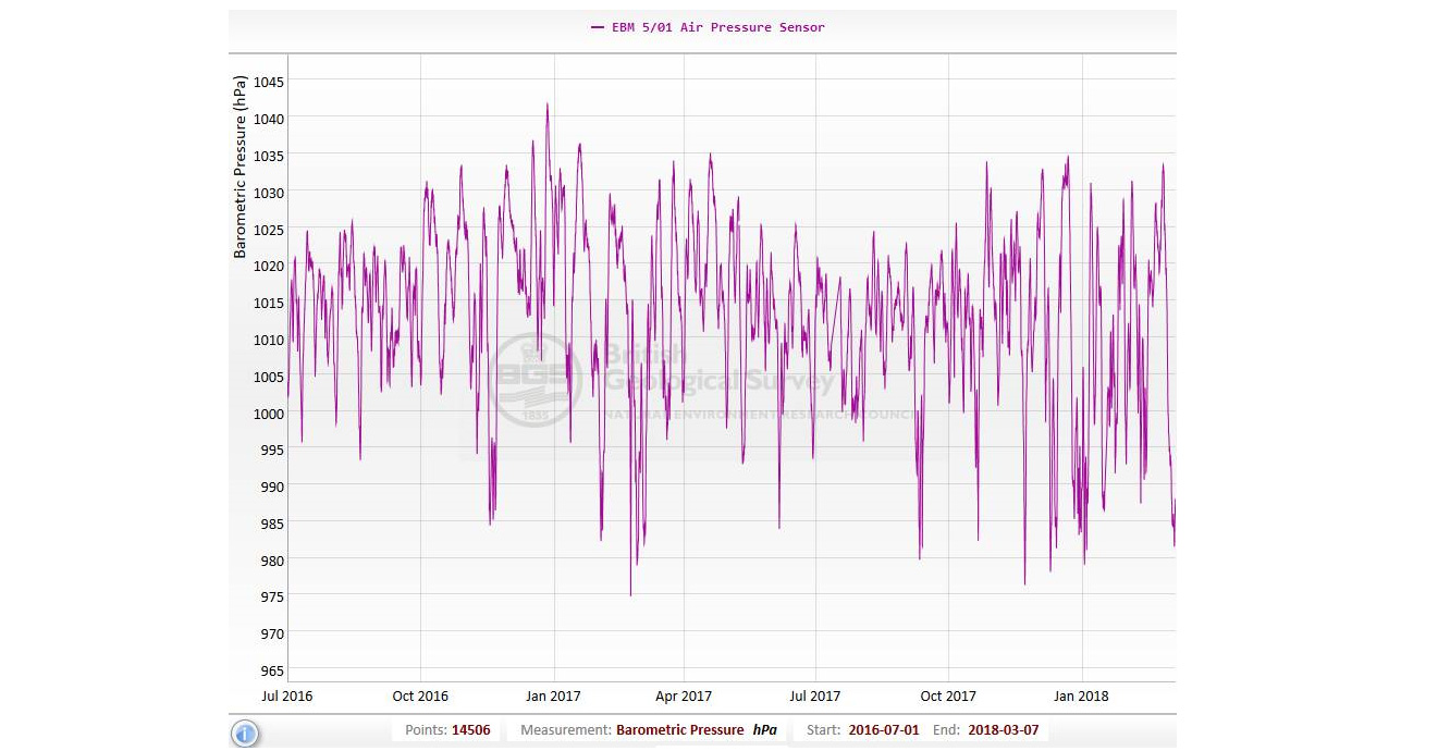
Figure 3: JavaScript graph client consuming JSON data. BGS © UKRI.
The range of outputs we are working on include:
- publicly accessible web APIs
- use of third-party libraries for graphing temporal data such as dygraphs.com
- ingestion of non-telemetry data into the sensor data database
Sensor data
You may also be interested in

Technologies
Applications, software and online services created by the BGS and our collaborators.