Fieldwork on Volcán de Fuego
Understanding how one of the world’s most active volcanoes builds up material, and how they collapse to feed hot flows
13/10/2025

Volcán de Fuego in Guatemala is one of the most active volcanoes in the world. Its frequent eruptions are spectacular to watch, but they also gradually build steep deposits of ash and lava fragments on its flanks. From time to time, this material becomes unstable and collapses, sending hot flows known as pyroclastic density currents (PDCs) often 5 to 10 km, sometimes more than 10 km, down the slopes of the volcano.
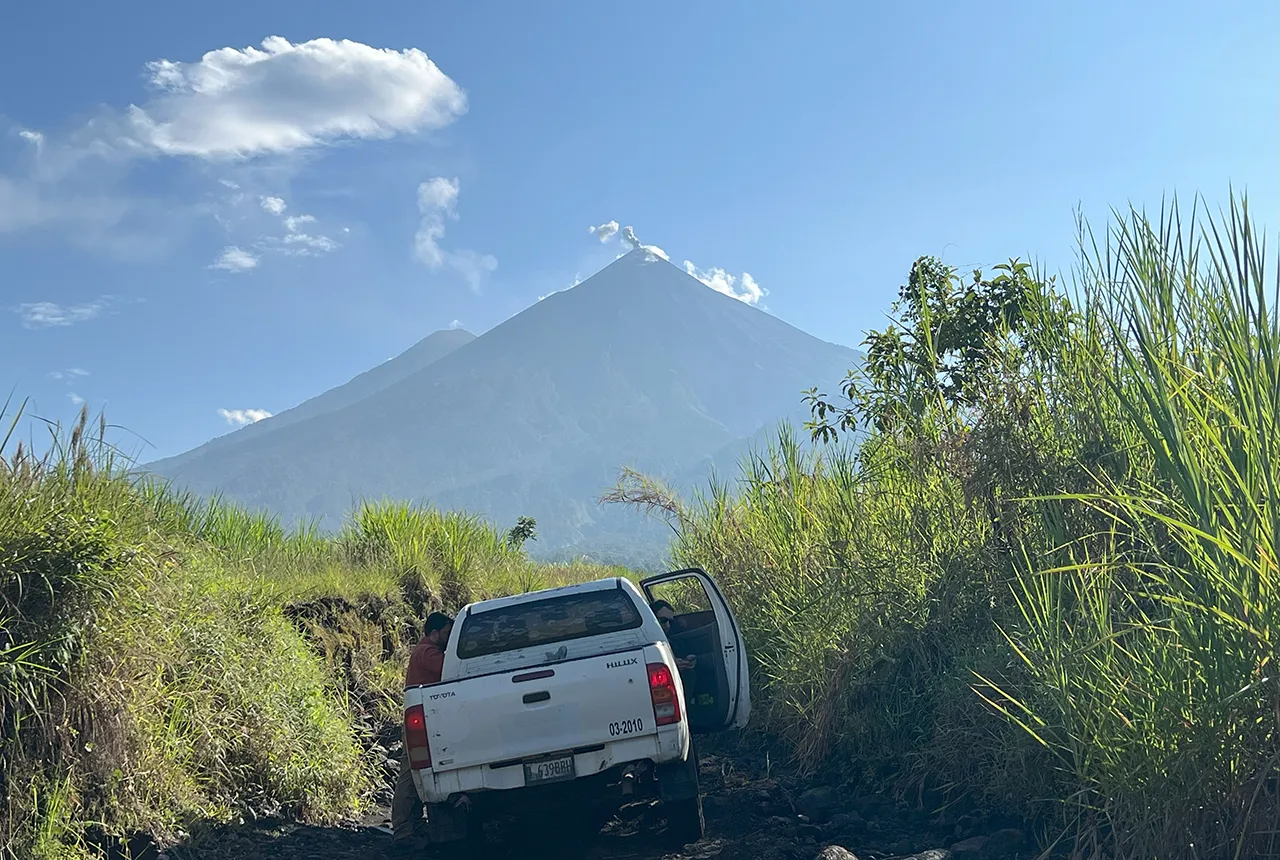
Approaching the volcano study area was a bumpy ride. BGS © UKRI.
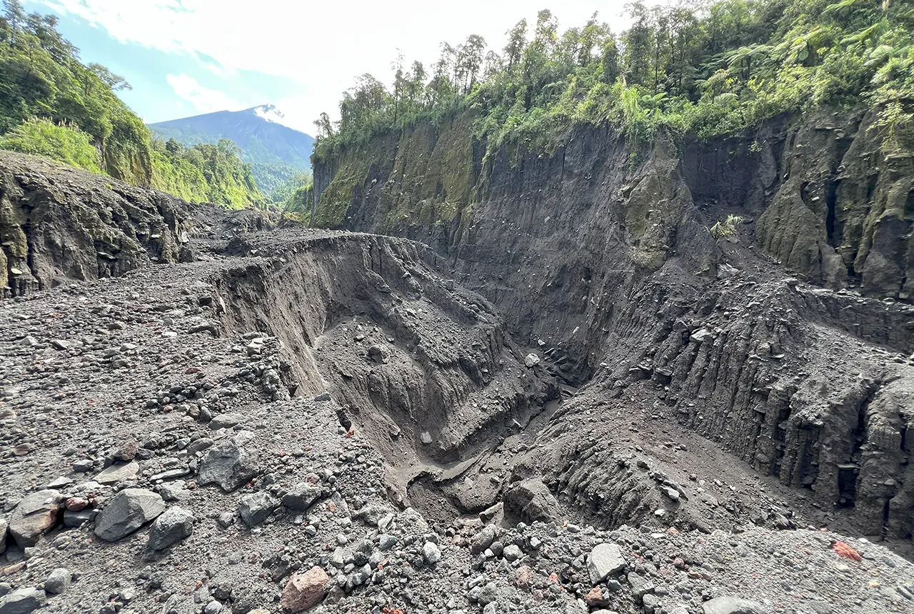
Ceniza ravine, our main study site, is a steep-walled channel with terraces constructed from multiple pyroclastic density currents. BGS © UKRI.
While eruptions at Fuego are closely monitored, these collapse-generated flows remain less understood. Our project, funded through a NERC Urgency Grant, is a collaboration between Guatemalan scientists, local institutions and international partners to investigate the timing and monitoring of these collapses.
Fieldwork in the rainy season
This project focuses on the 9 to10 March 2025 eruption, which generated PDCs with runouts exceeding 6 km. In August 2025, we travelled to Fuego to study the deposits left behind. Our work combined field mapping and sampling with drone surveys and satellite imagery, but this was a race against time: Guatemala’s rainy season quickly erodes the evidence.
Our main study site was the Ceniza ravine, a valley that channels many of Fuego’s flows. Using satellite images, we identified deposits from the March 2025 eruption. On the ground, we confirmed a few intact outcrops, which were unconsolidated and, months after the eruption, still hot.
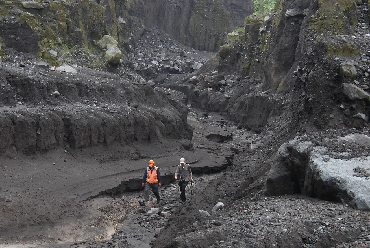
Research team members from INSIVUMEH and CONRED in the Ceniza Ravine, which was the study area for the August 2025 fieldwork. BGS © UKRI
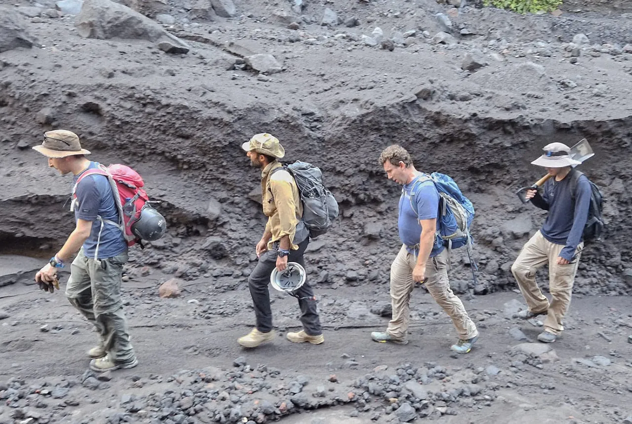
Some members of the research team. Left to right: Geoffrey Lerner (Institute for Scientific and Technological Research of San Luis Potosí, Mexico), Symeon Makris (BGS), Sylvain Charbonnier (University of South Florida, USA), and Fabrizio Ponce (National Institute for Seismology, Vulcanology, Meteorology and Hydrology, Guatemala). © Eric Breard, University of Edinburgh.
Reading magnetic fingerprints
To understand these deposits better, we collected samples for particle-size analysis and geomagnetic thermal proxy analysis. This technique uses tiny magnetic minerals that are naturally present in rocks. When heated, their magnetic orientation resets to align with the Earth’s magnetic field and, once cooled, the orientation becomes locked in, like a tiny compass needle frozen in place. By measuring the magnetism of our samples, we can tell whether particles were hot when they came to rest. If they all point the same way, the deposits came directly from the eruption column. If the directions are random, the material had cooled long before and was likely part of older piles that later collapsed.
Geomagnetism therefore lets us trace the provenance of the material — whether it was born in the eruption or destabilised from older accumulations. This is crucial for hazard assessment, since collapses of stored flank material can generate larger flows than those expected from eruption size alone.
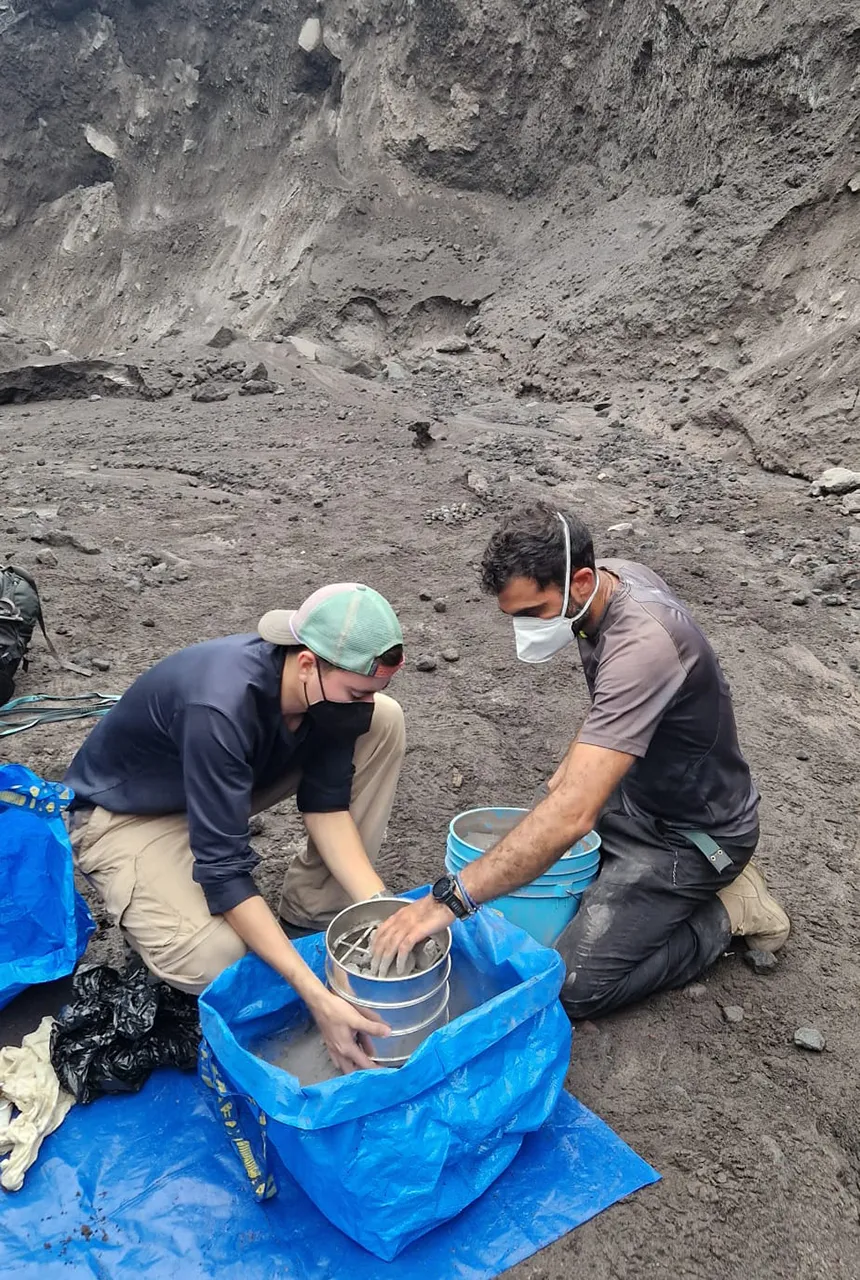
Members of the team studying the deposits from the March 2025 pyroclastic density currents. © Geoffrey Lerner, Institute for Scientific and Technological Research of San Luis Potosí, Mexico.
Drones and 3D models
Another key part of our work involved flying high-resolution drones along the flanks of the volcano to produce detailed 3D models of the ravines. Together with satellite imagery, these allow us to measure how much material is stored on the volcano and how this material changes over time. By repeating the surveys, we will be able to build a timeline of how volcanic material accumulates and when it becomes unstable.
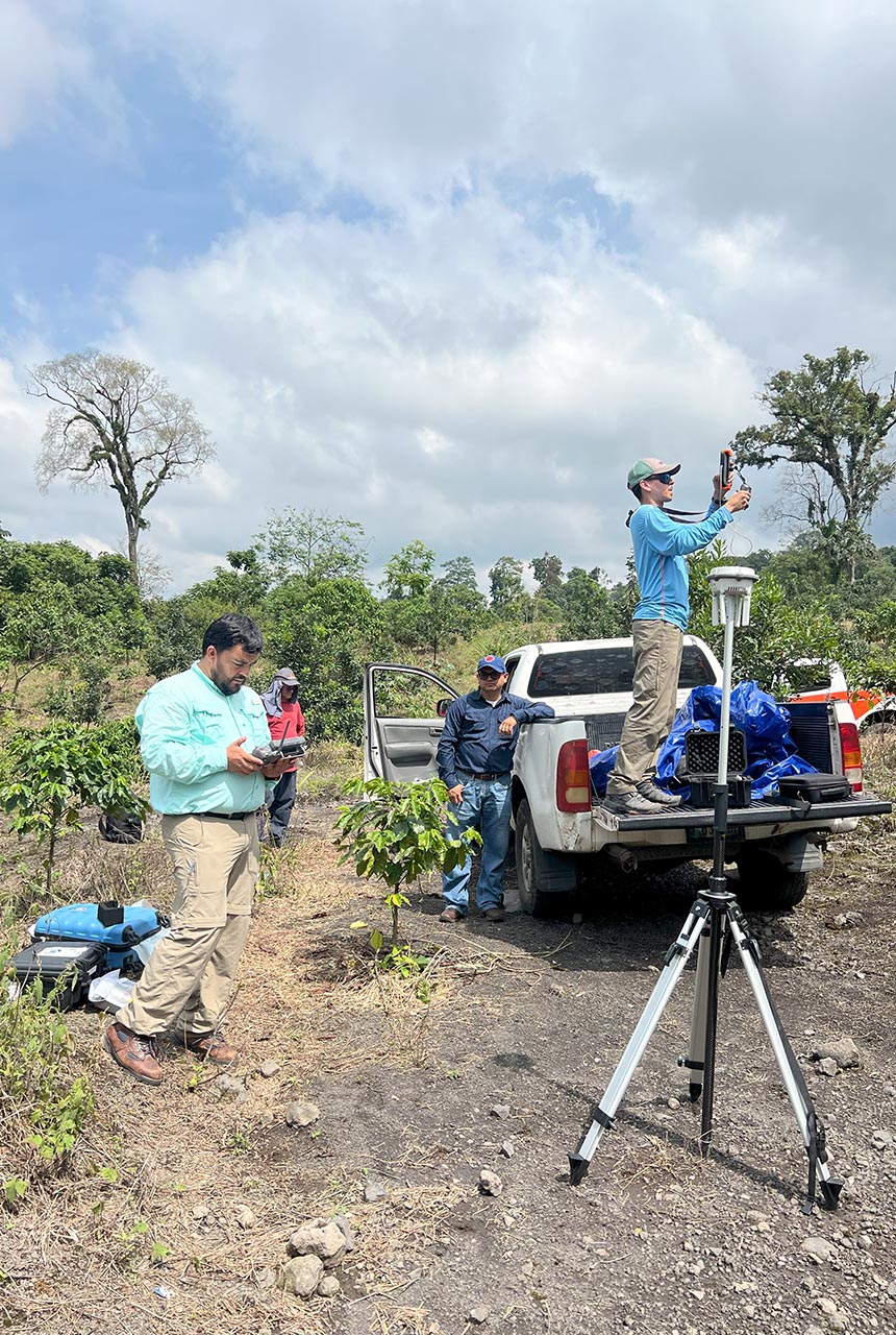
Drones were used to map and create models of the volcano’s flank and the, ravines that host pyroclastic density currents, as well as the deposits from the March 2025 flows. BGS © UKRI.
Next steps
Back in the UK and with our partners abroad, we are now analysing the samples and drone data. Geomagnetic measurements and remote sensing data will allow us to extend our observations back in time. Together, these results will help us understand how much material can safely accumulate on Fuego’s flanks before it becomes unstable.
Ultimately, our aim is to develop a monitoring framework for these deposits, so that future collapses and the potential runout of associated PDCs can be anticipated more effectively. Although our focus is Volcán de Fuego, the same processes occur at other active volcanoes around the world, from Etna in Italy to Fuji in Japan.
While in Guatemala…
Guatemala is a spectacular country with volcanoes always on the horizon. We spent our nights after work at the Fuego observatory, where we could watch the volcano — and it put a show up for us! Playing football on the local pitch with the volcano in the background was also a highlight of our evenings.
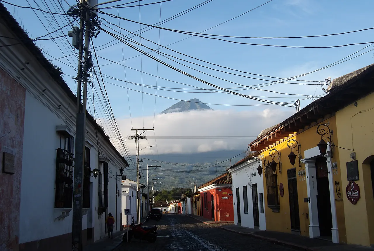
Three imposing volcanoes frame the horizon of Antigua Guatemala: Fuego, Acatenango, and Agua, which is captured in this photograph. BGS © UKRI.
It was a privilege to spend time with our Guatemalan colleagues and learn from their experiences of living alongside active volcanoes. Field days were demanding, often cut short by weather, but what more could a volcanologist want than to discuss volcanic processes as they unfold in front of you, with delicious food and the country’s famously strong coffee to end the day?
A collaborative project
The fieldwork was a collaboration between:
- BGS
- University of Edinburgh
- University of South Florida (USA)
- Institute for Scientific and Technological Research of San Luis Potosí (Mexico)
- National Institute for Seismology, Vulcanology, Meteorology and Hydrology (INSIVUMEH, Guatemala’s national monitoring institute)
- Coordinating Agency for Disaster Reduction (CONRED, the national civil protection agency)
The project also includes colleagues from the University of Liverpool and Michigan Technological University (USA).
The monitoring carried out by INSIVUMEH was essential for managing risks during our campaign, especially afternoon rainstorms that often trigger lahars (volcanic mudflows) in our study area. Their expertise and guidance, based on daily experience working on Fuego, allowed the team operate safely in the field.
About the author
Dr Symeon Makris
Volcanologist
Relative topics
Related news

Ukraine and the UK strengthen their commitment to geological cooperation
10/06/2026
A new Memorandum of Understanding reaffirms the UK’s support of Ukraine’s ambitions to develop its critical mineral resources, paving the way for collaboration through capacity-building programmes.

International science consortium to survey the health, economic value and social importance of Lake Victoria
22/05/2026
The project will replicate the 1927 survey to assess changes in the lake’s health, economic value and social importance.

BGS contributes to UN sand and sustainability report
19/05/2026
The new report highlights the impact of poor governance and unsustainable sand mining practices, calling on policymakers to take action.
BGS engineering geologist elected to CCOP
29/04/2026
Marcus Dobbs has been elected as vice-chair of the advisory group for the Coordinating Committee for Geoscience Programmes in East and Southeast Asia.

Strengthening capacity through partnership: a critical minerals perspective
28/04/2026
BGS has been working in partnership with the Geological Survey Department of Zambia (GSD) to build national capacity, improve data accessibility and support long-term, sustainable development.

New research could help provide a more reliable water supply for millions in rural Africa
24/03/2026
A new BGS-led study has revealed crucial insights into the longstanding challenges affecting the reliability and performance of rural water supply infrastructure in sub-Saharan Africa.

PhD adventures in Copenhagen, Denmark: revealing past recovery processes of tropical forest systems through ancient environmental DNA
12/03/2026
PhD student Chris Bengt visited the University of Copenhagen to carry out very delicate extraction of aeDNA from lake-sediment cores, in the hopes of unlocking the secrets of past volcanic eruptions.

New UK/Chile partnership prioritises sustainable practices around critical raw materials
09/02/2026
BGS and Chile’s Servicio Nacional de Geología y Minería have signed a bilateral scientific partnership to support research into critical raw materials and sustainable practices.

Extensive freshened water confirmed beneath the ocean floor off the coast of New England for the first time
09/02/2026
BGS is part of the international team that has discovered the first detailed evidence of long-suspected, hidden, freshwater aquifers.

Hole-y c*@p! How bat excrement is sculpting Borneo’s hidden caves
23/12/2025
BGS researchers have delved into Borneo’s underworld to learn more about how guano deposited by bats and cave-dwelling birds is shaping the subsurface.

BGS awarded funding to support Malaysia’s climate resilience plan
17/12/2025
The project, funded by the Foreign, Commonwealth & Development Office, will focus on minimising economic and social impacts from rainfall-induced landslides.
‘Three norths’ set to leave England and not return for hundreds of years
12/12/2025
The historic alignment of true, magnetic, and grid north is set to leave England, three years after they combined in the country for the first time since records began.