BGS have produced 13 summaries of the onshore regional geology for England, Wales and Northern Ireland. The extents of the regional summaries areas follow the British Regional Geology (Regional Guides) series. They provide informative overviews of the geology of each of the regions designed for a general audience. The summaries are stand-alone and contain a generalised geological map, cross sections (‘vertical slices’) through the geology and illustrations. Because of the variations in the geology and geological history in different regions the colour scheme used and the way the rock units are subdivided in individual accounts may vary.
The regional geological summaries for England, Wales and Northern Ireland form part of BGS’s wider work on better communicating the geology of the UK. Their development has been financially supported by Nuclear Waste Services and forms part of a wider BGS National programme, funded by a range of stakeholders, to make our science publicly available and accessible to all. The regional geological summaries for Scotland are under development.
Downloads
| Title / Download | Description |
|---|---|
| Bristol and Gloucester and adjoining areas | This region is one of the most geologically varied parts of the country, with almost every geological time period represented. |
| Central England | Central England has a varied scenery and landscape determined by the underlying geology. |
| East Anglia and adjoining areas | East Anglia’s relatively flat and rolling landscape provides a rich agricultural setting and contains an interesting geological story. |
| Eastern England | This region’s diverse landscape comprises low-lying plains, steep ridges and upland areas. |
| London and the Thames Valley | At the surface this region is formed of rocks laid down in seas that covered the area in the past. |
| Northern England | Within this region a striking diversity of rocks and geological structure are present resulting from a geological history that spans almost 500 million years. |
| Northern Ireland | The landscape of Northern Ireland is remarkably varied considering its relatively small area and is a reflection of the diverse geology from which it has been shaped. |
| South-west England | The near-surface geology of the region is well known due to the many quarries, mines, coastal cliffs and shallow boreholes. |
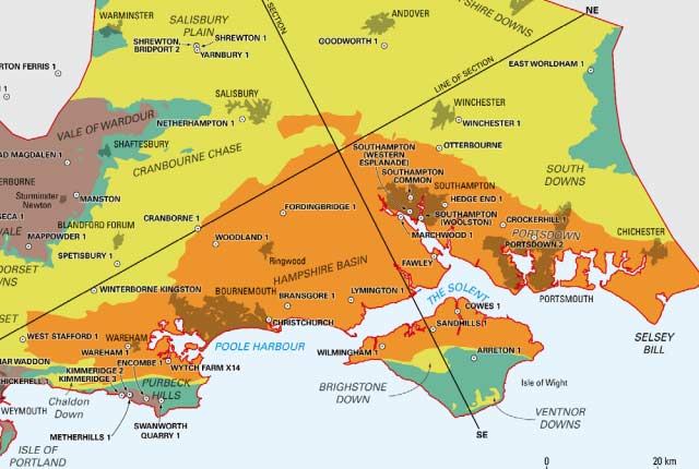
| The Hampshire Basin and adjoining areas | Geologically this region forms the western part of a deep basin filled with sediments laid down in ancient seas. |
| The Pennines and adjacent areas | Geology influences many aspects of the varied countryside and land-use of this region. |
| The Wealden District | This region is mainly formed of rocks laid down in seas that covered the area in the past. |
| The Welsh Borderland | The Welsh Borders region contains a broad range of rock types and ages, exposing some of the oldest rocks in Britain. |
| Wales | The geology near the surface is well known from abundant natural outcrops of rock, such as coastal cliffs and mountain crags, as well as quarries and mines. |
These Regional Geological Summaries reports are NOT the published outputs of the BGS National Geological Screening exercise. The National Geological Screening reports are written for a technical audience to inform Nuclear Waste Services in its discussions with communities interested in finding out about the potential for their area to host a GDF.
You may also be interested in
National Geological Screening
A series of studies compiling existing publicly available geological information about England, Wales and Northern Ireland.
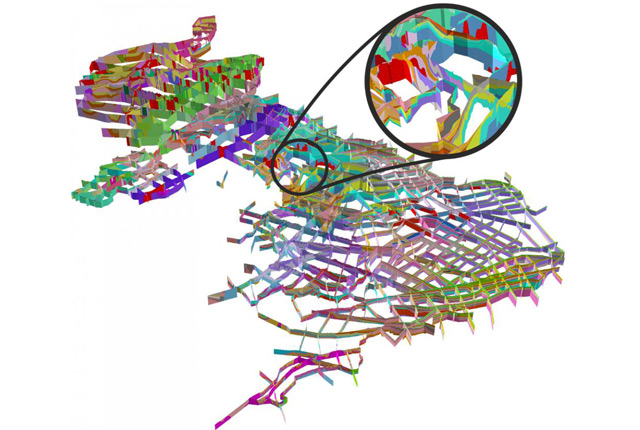
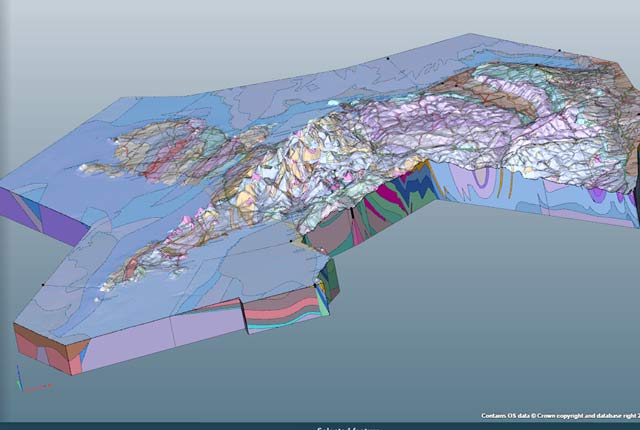
Regional geological visualisation models
Interactive 3D models are available for exploring the geology of regional areas of England, Wales and Northern Ireland.