Key information
Scale:
1:250 000Coverage:
Great BritainAvailability:
FreeFormat:
GIS grid data. (ESRI, MapInfo, others available by request)Price:
Free for commercial, research and public use under the Open Government Licence. Please acknowledge the material.
Get data
Download
Supporting documents
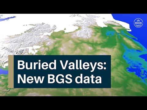
Buried valleys are ancient river or subglacial (beneath a glacier) drainage networks that are now abandoned and have become either partly or completely buried by more recent sediment. As such, buried valleys often exhibit little or no surface expression within the modern landscape.
The concealed occurrence of buried valleys can have significant and often unexpected implications for groundwater and hydrocarbon or geothermal resources. Buried valleys can also be significant stores of sand and gravel mineral resources, which can act as traps for contaminants as well as pathways into groundwater aquifers.
This dataset
The buried valley dataset contains our current knowledge of the onshore likely occurrences of buried valleys in Great Britain.
It is comprised of two datasets:
- locations where BGS historic survey activities and other published work has identified buried valleys onshore in Great Britain
- an expert-led, semi-automated method to identify areas of significant (>20 m) superficial thickening based on our current onshore borehole dataset


NEXTMap Britain elevation data from Intermap Technologies. BGS © UKRI.
This dataset is for users who are seeking information about the locations of buried valleys across Great Britain. These are important features for geologists, civil engineers, hydrogeologists and environmental scientists because they can have unexpected consequences for anyone interested in the position of bedrock or the thickness of superficial deposits. Equally, this dataset will be of interest to the research community of Great Britain as buried valleys provide detailed archives of palaeoenvironmental and landscape change.
Buried valleys data should only be used as an indicator where evidence has pointed to the presence of a buried valley. The absence of evidence does not substantiate the absence of buried valley features. If you have evidence of a buried valley that is not part of this dataset, we would be very interested to evaluate it and consider including it in future versions.
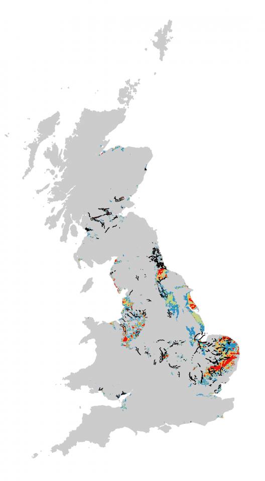
Buried valleys coverage map. BGS © UKRI – Contains OS data © Crown copyright 2020.
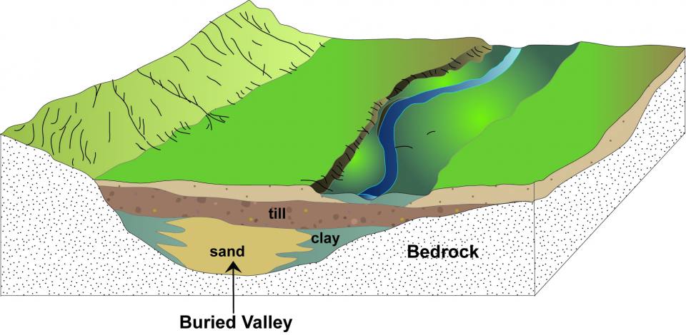
A stylised example of a buried valley. Note how it is offset from the modern river system. The sequence of sediment infilling the buried valley is purely illustrative and in reality the fill of a buried valley can vary greatly between valleys.
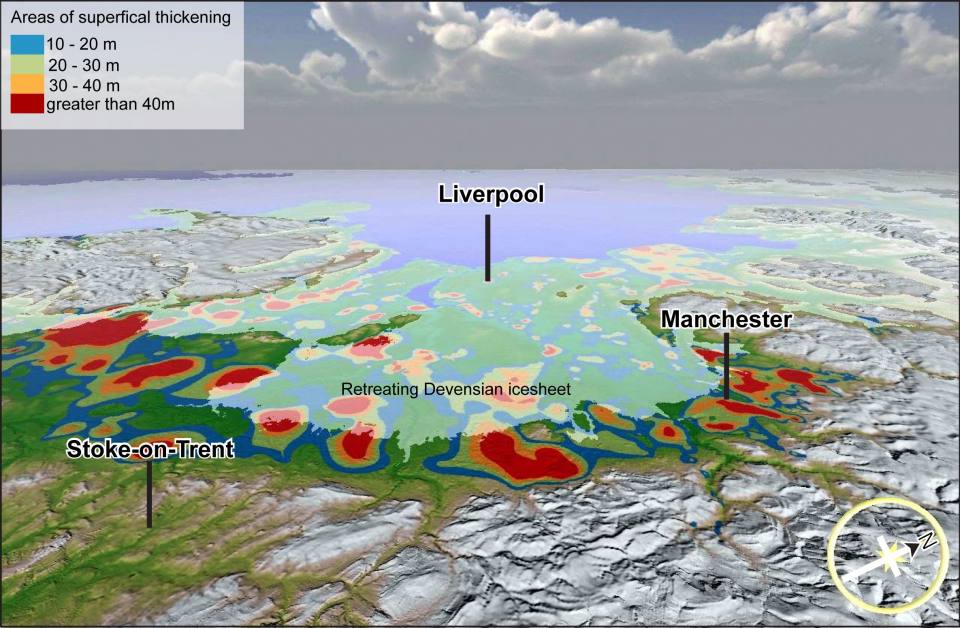
A 3D view of the buried valley dataset in the Cheshire basin with the retreating of the Devenisan icesheet overlain. NEXTMap Britain elevation data from Intermap Technologies.
