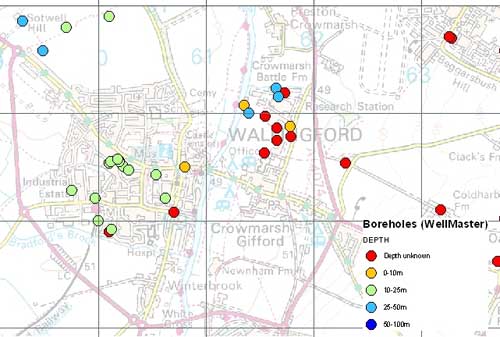

WellMaster hydrogeological database sample. BGS © NERC. Contains Ordnance Survey data © Crown Copyright and database rights 2011. BGS OS licence no. 1000221290/2011.
WellMaster hydrogeological database
- Great Britain
- Open / Premium
WellMaster is our digital version of the water well archive. Index level data is available for all water boreholes known to the BGS.
Key information
- Coverage:
- Great Britain
- Availability:
- Open / Premium
- Price:
£1.13 per record. Index data (including locations) available for free.
- Format:
- GIS point data with detailed data available as relational database tables or in spreadsheet format. (Microsoft Access, Microsoft Excel)
- Uses:
- Site-level use
- Themes:
- Geoscience information, Hydrogeology
More detailed hydrogeological data, including information on geology, well construction, water levels and yields and water quality, has also been digitised for the majority of water boreholes, if the information is available.
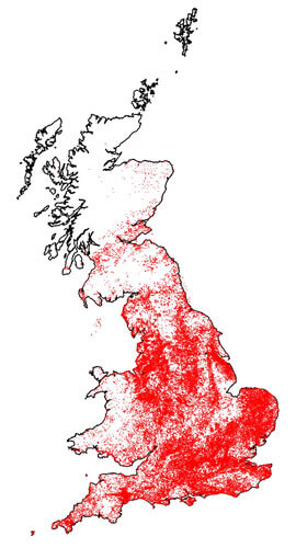
WellMaster hydrogeological database coverage.
You may also be interested in
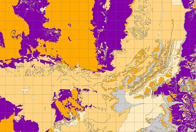
Aquifer designation data
The aquifer designation dataset reflects the importance of aquifers in England and Wales as a resource and their role in supporting surface water flows and wetland ecosystems.
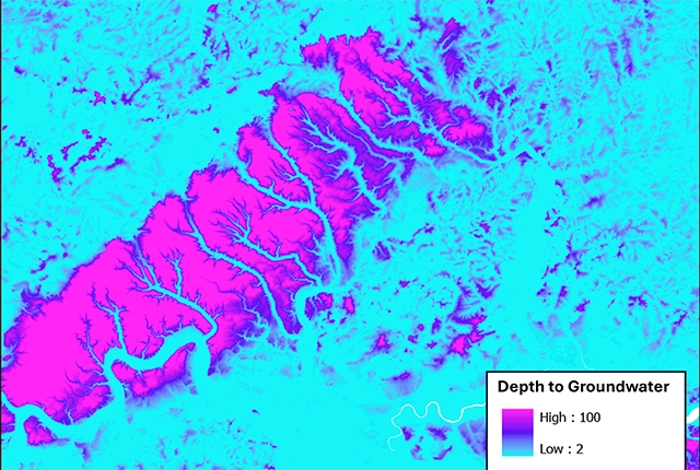
Depth to groundwater
The BGS depth to groundwater product is a national scale dataset of probable maximum depth to the phreatic water table.
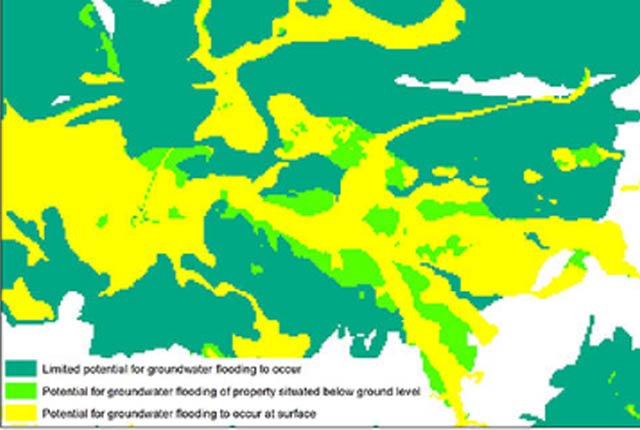
Groundwater flooding
In response to the need for more information on groundwater flooding, BGS has produced the first national dataset on the susceptibility across Britain.
Groundwater vulnerability data
Our groundwater vulnerability maps provide an assessment of the vulnerability of groundwater in overlying superficial rocks and those that comprise the underlying bedrock.
Hydrogeological maps of Scotland
The BGS has produced a suite of hydrogeological maps of Scotland. The suite includes layers with groundwater vulnerability and aquifer productivity data.
Infiltration SuDS map
The BGS Infiltration SuDS map dataset is suitable for those involved in the design of sustainable drainage systems and approving SuDS planning applications.