Earthquakes
Discovering Geology — Earth hazards
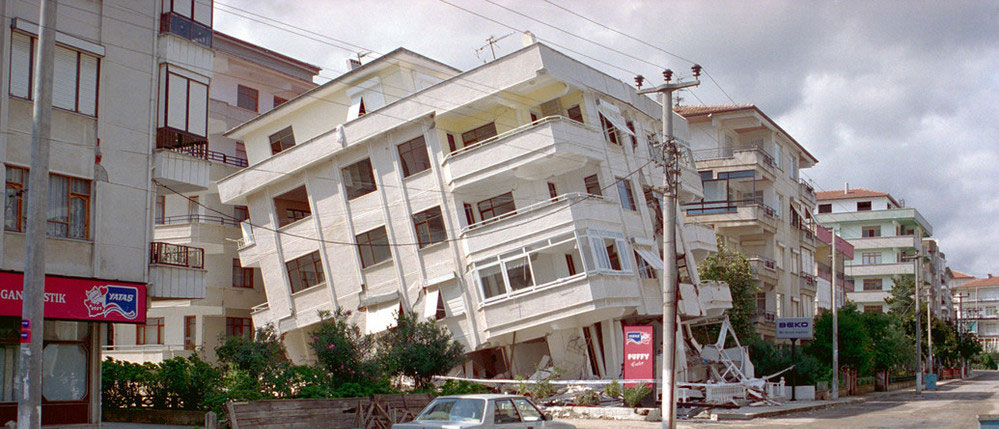
Earthquakes are among the most deadly natural hazards. There are around 100 earthquakes each year of a size that could cause serious damage. They strike without warning and many of the Earth’s earthquake zones coincide with areas of high population density. When large earthquakes occur in such areas the results can be catastrophic, with terrible loss of human lives and untold economic cost.
What is an earthquake?
An earthquake is the sudden release of strain energy in the Earth’s crust, resulting in waves of shaking that radiate outwards from the earthquake source. When stresses in the crust exceed the strength of the rock, it breaks along lines of weakness, either a pre-existing or new fault plane. The point where an earthquake starts is termed the focus or hypocentre and may be many kilometres deep within the earth. The point at the surface directly above the focus is called the earthquake epicentre.
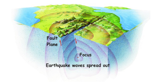

Vibrational energy is produced when rocks break; the energy spreads out in all directions like ripples on a pond. The shock waves radiate out from the point where the rocks first begin to break; this point is called the focus or hypocentre of the earthquake. The energy is dissipated as the shaking we call an earthquake. BGS ©UKRI.
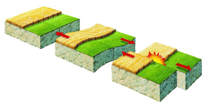
Movements within the Earth’s crust cause stress to build up at points of weakness, and rocks to deform. When the stress finally exceeds the strength of the rock, the rock fractures along a fault, often at a zone of existing weakness within the rock. BGS ©UKRI. All rights reserved.
Intense vibrations, or seismic waves, spread out from the initial point of rupture (the focus) like ripples on a pond. These waves are what makes the ground shake and can travel large distances in all directions. Near the focus, the waves can be very large, making them extremely destructive.
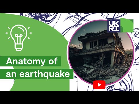

Anatomy of an earthquake. © NERC/UKRI. All rights reserved.
BGS earthquake monitoring
The BGS’s earthquake seismology team is the UK’s national earthquake monitoring agency. We operate a network of sensors across the UK to measure earthquakes in at home and around the world. We use the data we collect to investigate the nature and distribution of earthquake activity, and what makes them happen, to improve our understanding of earthquake hazards.
Recent earthquake data feeds
– Earthquakes in and around the UK (last 50 days)
– Induced seismicity in and around the UK (last 50 days)
– Significant world earthquakes (last 200 days)
– Online data feeds (GeoRSS & KML)
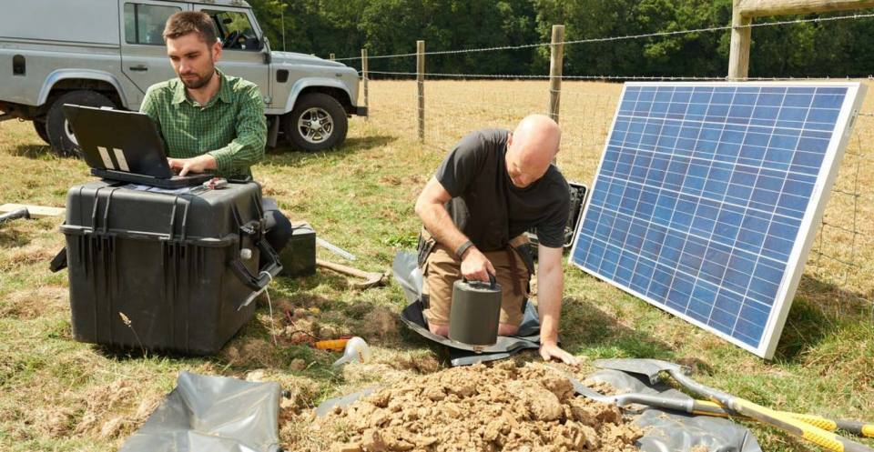
In 2018, BGS installed five seismometers in Surrey to track a sequence of earthquakes near Newdigate. BGS ©UKRI.
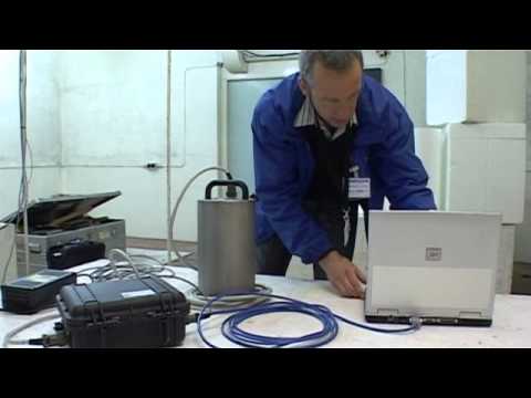
BGS seismology: a brief introduction. BGS © UKRI.
Find out more about earthquakes
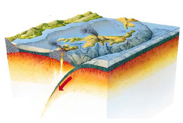
What causes earthquakes?
The causes of earthquakes and the different types of tectonic boundaries and faults on which they usually occur.
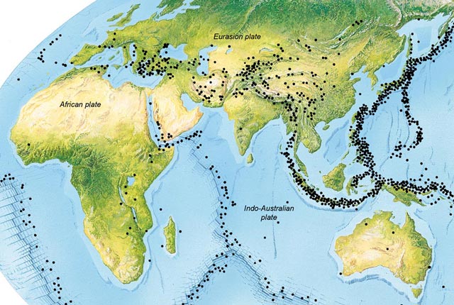
Where do earthquakes occur?
Where earthquakes occur around the world and in the UK.
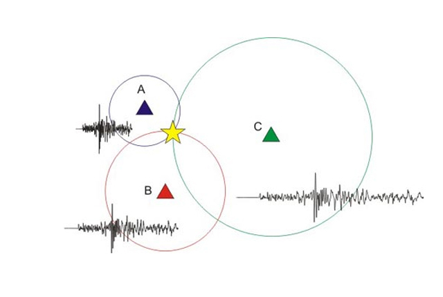
How are earthquakes detected?
Seismometers are used to record the seismic waves produced by earthquakes. Relative arrival times of these waves is used to determine earthquake location.
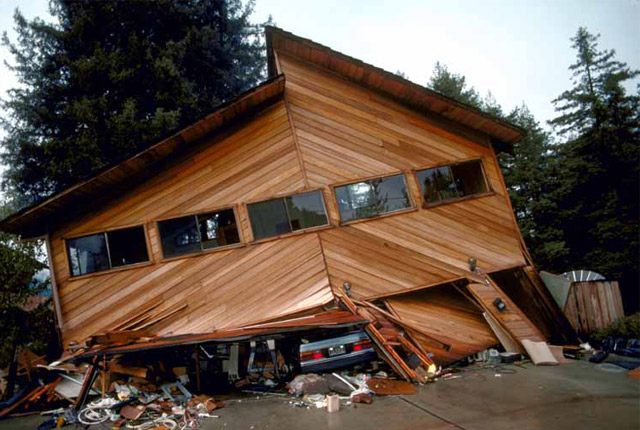
How do earthquakes affect people?
The extent of damage an earthquake causes depends not only on the magnitude of the earthquake, but also on local geology and on building techniques.
You may also be interested in
Discovering Geology
Discovering Geology introduces a range of geoscience topics to school-age students and learners of all ages.
Earth hazards
The Earth beneath our feet is constantly shifting and moving, and violently with catastrophic and immediate results. Find out more about earth hazards.