Citizen science
BGS Research
What is citizen science?
‘Citizen science’ is a term used for projects in which individual volunteers (or networks of volunteers), many of whom may have no specific scientific training, perform or manage research-related tasks such as observation, measurement or computation.
The use of citizen science networks often allows scientists to accomplish research objectives more readily than would otherwise be possible. In addition, these projects aim to promote public engagement with the research, as well as with science in general.
Our projects
Citizen science for multi-hazards and disaster risk reduction
We are using citizen science for people to develop a shared understanding of hazardous phenomena and for communities to contribute to hazard forecasting and early warning.
Enhancing multi-hazard resilience through citizen science in the Caribbean
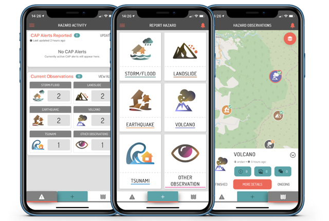
We are working with partners to develop a citizen science app for collecting and sharing observations of natural hazards and impacts in near real-time.
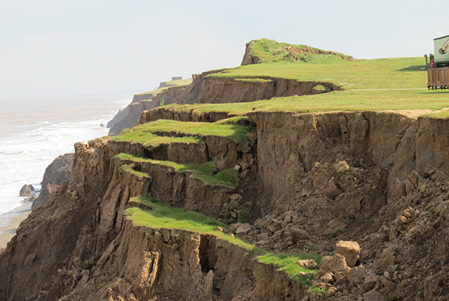
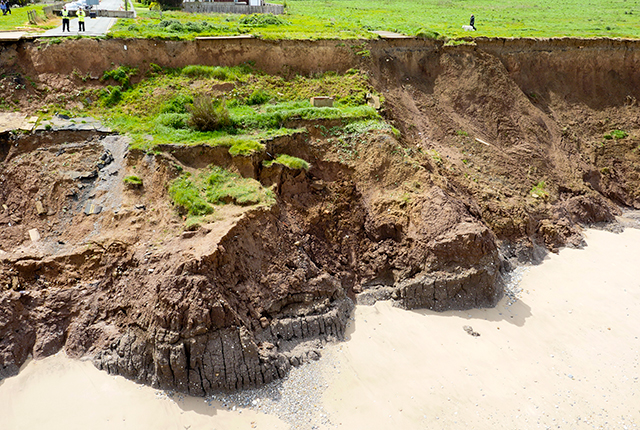
Report a landslide
Please tell us about any British landslides you may have seen on TV, heard about on the radio or read in newspapers, or seen yourself.
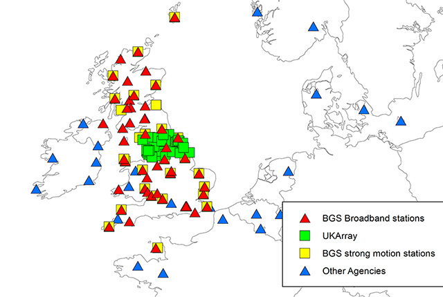
Have you felt an earthquake?
A short questionnaire to record what people experienced during an earthquake that helps us gather information that may give vital information about the level of shaking to emergency services.
Related news
Citizen science: become part of a real-time Global Landslide Detector
29/08/2022
BGS and partners are trialling a new social media tool that detects worldwide landslides in real time.
iGeology: enhancing the visibility of BGS map data and reports
24/03/2021
Downloaded over 400 000 times worldwide by building surveyors, walkers, teachers and geologists
Citizen science for multi-hazards and disaster risk reduction
We are using citizen science for people to develop a shared understanding of hazardous phenomena and for communities to contribute to hazard forecasting and early warning.
Citizen science
Allowing scientists to accomplish research objectives more readily than would otherwise be possible, using volunteers to perform research-related tasks.
Enhancing multi-hazard resilience through citizen science in the Caribbean
We are working with partners to develop a citizen science app for collecting and sharing observations of natural hazards and impacts in near real-time.
You may also be interested in

Collaborations
The BGS is involved in many initiatives, at UK, European and global scales, that aim to increase access to public environmental spatial data in interoperable formats.

BGS maps portal
High-resolution viewing of images of almost all the small- and medium-scale geological maps produced by the BGS since mapping started in 1832.