We provide user-focussed data and knowledge to support effective management of the geological variability, uncertainty and opportunities that lie within Great Britain’s shallow subsurface. These information resources are designed for use by decision makers, educators and applied users in the minerals, groundwater and civil engineering sectors.
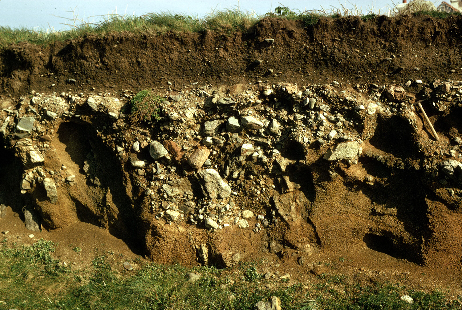

Superficial deposits can be very heterogeneous and challenging to predict. Here, a gravel- and boulder-rich raised beach deposit lies atop weathered gneiss bedrock in Guernsey, Channel Islands. This is overlain by a fine, wind-blown cover sand. BGS © UKRI.
What is the shallow subsurface?
The shallow subsurface is the most interacted-with part of the UK’s geology. The physical properties of deposits in the shallow subsurface affect ground conditions and applications for hydrogeology, engineering and mining. Understanding the variability of these deposits is therefore crucial to de-risking construction and ground investigation, extracting resources efficiently and managing drinking-water aquifers.
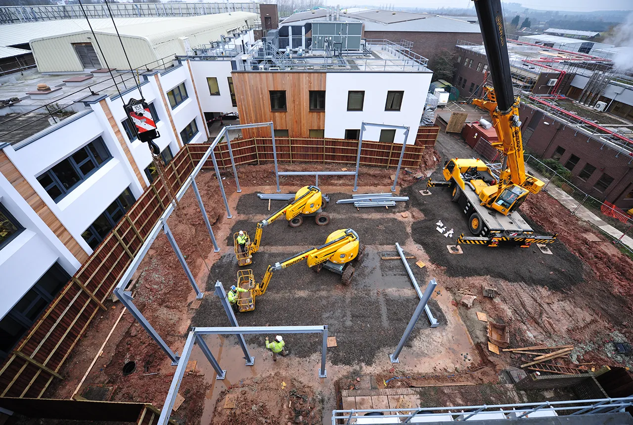
Quaternary deposits are often encountered during the construction of infrastructure and buildings. BGS © UKRI.
What are Quaternary domains?
To better communicate information about the shallow subsurface to applied users, we have developed ‘Quaternary Domains’. This is a regional-scale classification scheme that summarises the recent or Quaternary (past 2.6 million years) geology of Great Britain according to its geological, geomorphological, genetic and applied properties.
On BGS maps, unlithified sediments laid down during the Quaternary period are referred to as ‘superficial deposits’. They were historically termed ‘drift’.
Who does the Quaternary domains project aim to help and how?
This work provides an updated dataset and classification approach to Quaternary geology in the shallow subsurface, which can be understood and used by a range of user groups in language and terminology that is relevant to them.
BGS’s regional knowledge was crucial to developing this national to regional-scale dataset. We combined our expert knowledge of applied considerations and uses of the shallow subsurface with deliberately selected geospatial data analysis techniques alongside our broad experience of British Quaternary and bedrock mapping.
The dataset is intended for a variety of end users, including geologists, the general public, teachers, hydrogeologists, engineering geologists, minerals geologists, planners and decision makers. For example, the dataset shows the extent of different domains and describes the hydrogeological properties that might be associated with the superficial deposits in a region. This improved Quaternary knowledge may then go on to inform policies such as those related to government missions regarding housing, infrastructural development (of both local and national significance) and site investigation, amongst other uses.
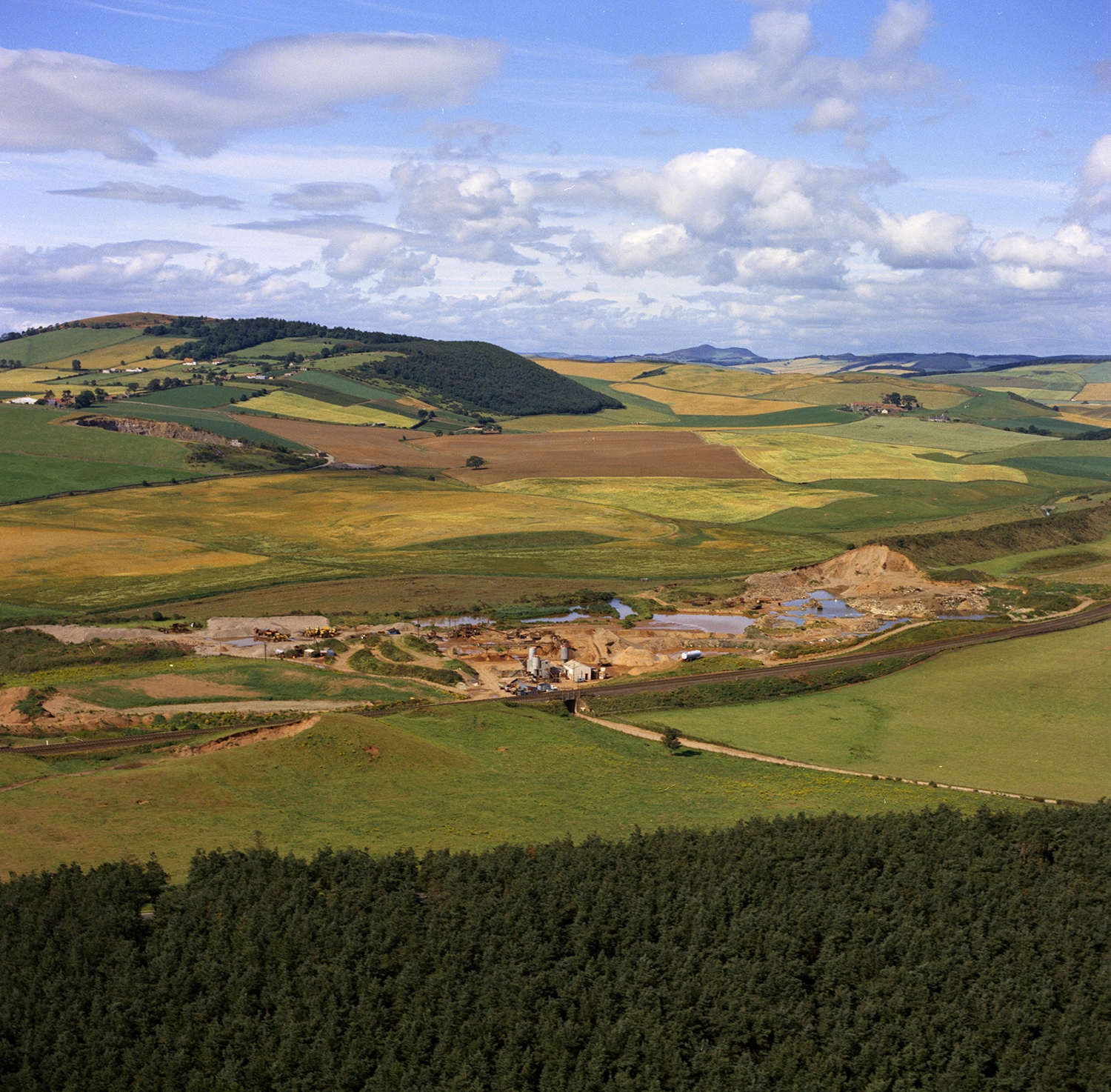
A glaciofluvial esker, which is the site of a sand and gravel quarry in Fife, Scotland. The quarry lies within the ‘Till dominant’ Quaternary domain, close to the boundary with the ‘Glacial drowned valley estuaries’ Quaternary domain. BGS © UKRI.
What will the outcomes be?
BGS has produced a Great Britain-wide dataset that offers regional-scale summaries of the Quaternary and its impact to different stakeholder communities, highlighting the geological risks and opportunities relevant to them.
- For engineers, this means that subsurface heterogeneity and the common geological risks likely to be encountered during ground investigation and construction are summarised for each domain, enabling a site to be contextualised at the desk study stage
- From a hydrogeological perspective, the dataset describes the likely impact of the anticipated superficial deposits and their relationships with the surface, each other, and the underlying bedrock on aquifer recharge and groundwater flow pathways
- Mineral resource applications include use of the dataset to identify the potential for overburden at a prospective site, the likely heterogeneity of potential resource deposits, and the possible source and maturity of resource sediment such as sand and gravel
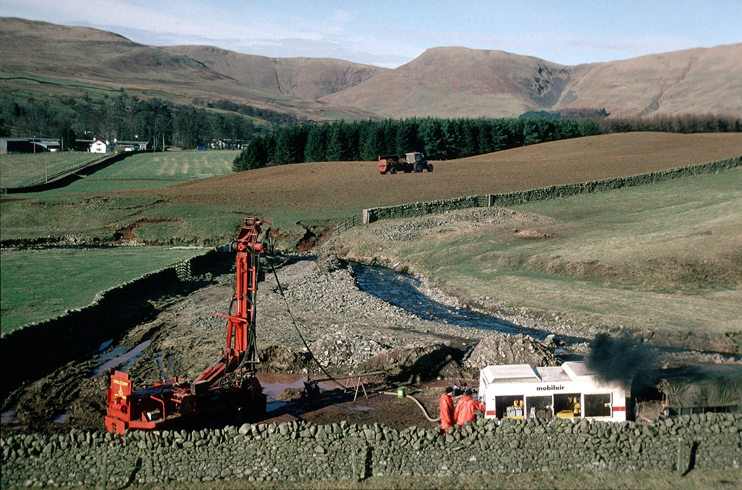
A borehole being drilled to assess groundwater aquifer potential in Dumfries and Galloway. Records state that 5 m of coarse superficial gravel was present atop Permian bedrock at this site. The drill site lies in the ‘Till dominant’ domain, whilst the ‘Mountain and valley’ domain is visible in the background of the image. BGS © UKRI.
More information
Lee, J R, and Roberson, S. 2025. Refining the known extent of major onshore Quaternary glaciation in the UK — types of evidence, nomenclature and uncertainty. Proceedings of the Geologists’ Association, Vol. 136(3), 101087. DOI: https://doi.org/10.1016/j.pgeola.2024.12.002
Lee, J R, Finlayson, A, Kearsey, T, Palamakumbura, R, Roberson, S, and Whitbread, K. 2024. UK Quaternary: mapping and modelling the Quaternary — meeting our stakeholder needs. British Geological Survey Open report OR/24/011. (Nottingham, UK: British Geological Survey.) Available: https://nora.nerc.ac.uk/id/eprint/537249/
Contact
If you would like more information, please contact Romesh Palamakumbura.