
Taking soil samples. BGS © UKRI.
London Earth
- Greater London and surrounding area
- Premium
London Earth is the systematic, high-density, geochemical soil dataset of the Greater London Area (GLA) aiming to give insight into the environmental impacts of urbanisation and industrialisation as well as to characterise the geochemical baseline of the UK’s most populous city. The study was carried out as part of the G-BASE project to map the chemical status of the surface environment of Great Britain.
Supporting documents:
Key information
- Coverage:
- Greater London and surrounding area
- Availability:
- Premium
- Price:
Available on request. Cu, Ca, Fe, Pb and Ni can be viewed online
- Format:
- Database tables
- Uses:
- Local-level to regional-level use
- Themes:
- Environmental change, Geochemistry
London Earth is the systematic, high-density, geochemical soil dataset of the Greater London Area (GLA) aiming to give insight into the environmental impacts of urbanisation and industrialisation as well as to characterise the geochemical baseline of the UK’s most populous city. The study was carried out as part of the G-BASE project to map the chemical status of the surface environment of Great Britain.
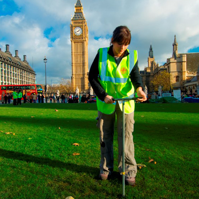
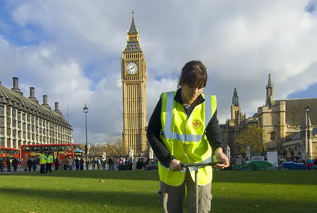
Collecting a G-BASE soil sample in central London. BGS © UKRI.
Soil sampling campaigns were carried out according to G-BASE procedures from 2005 to 2009. Approximately 6600 soil samples, typically taken from open ground such as parks, playing fields, gardens and roadside verges, were collected. Chemical analyses were completed in 2010 and analytical data for over 50 inorganic chemical substances is available under licence. In addition, 76 soil samples were analysed for persistent organic pollutants in east London.
The soil geochemical data have application to:
- assessing the geochemical baseline concentration of over 50 substances, including potential harmful elements such as lead (Pb), arsenic (As) or nickel (Ni) in soil of the urban and developed areas
- informing and supporting local councils, developers and the general public of environmental quality issues, to aid land contamination ecosystem and human health risk assessment and sustainable urban regeneration
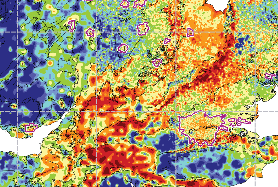
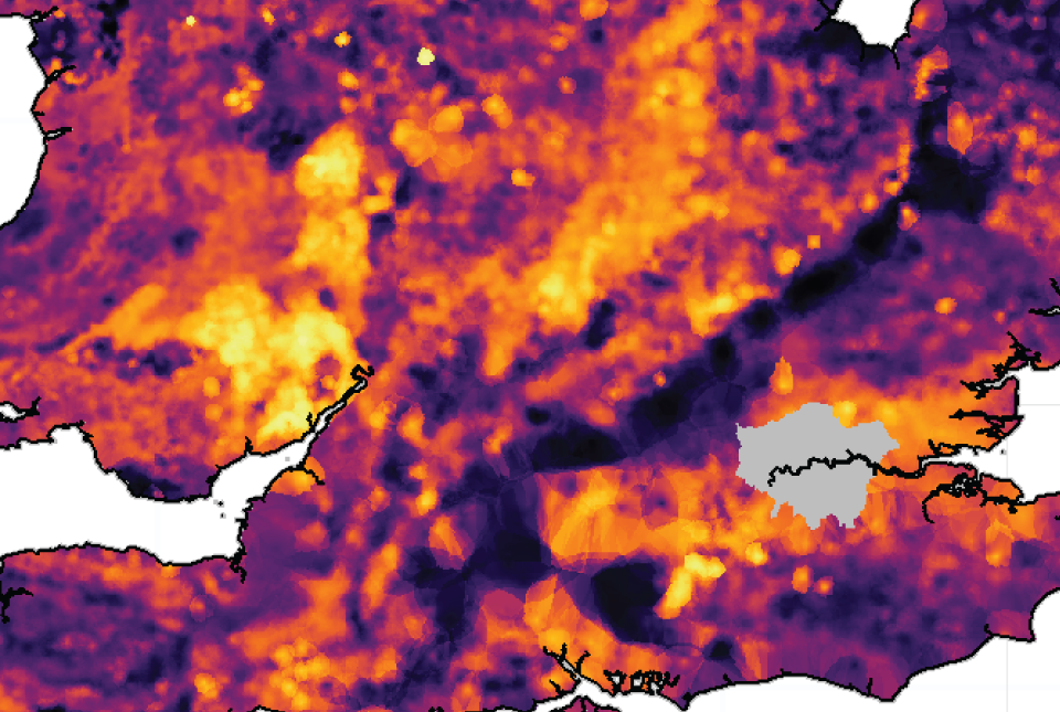
London Earth soil geochemistry
The BGS GeoIndex Onshore viewer displays interactive geochemical maps for five of these elements (copper, calcium, iron, lead and nickel).

London Earth soil geochemistry viewer. BGS © UKRI.
Data from the surveying campaign is available to licence.
Sample maps and guidance notes
A set of ten geochemical maps and short interpretations are available to download for a selection of environmentally sensitive elements (arsenic, cadmium, chromium, copper, calcium, iron, lead, nickel, selenium and zinc).
You can access and download pdfs of London Earth soil geochemical maps and interpretations.
More information
- London Earth FAQs
- Summary table of sample sites by local government district and urban centre
- The London Earth dataset has been included in a geochemical atlas documenting the baseline geochemistry of the wider London Region
Please note: There is now a national-scale dataset available providing urban and rural Topsoil Geochemistry for the UK.
Publications
Appleton, J D, and Cave, M R. 2018. Variation in soil chemistry related to different classes and eras of urbanisation in the London area. Applied Geochemistry, Vol. 90, 13–24.
Ferreira, A.; Johnson, C.C.; Appleton, J.D.; Flight, Dee; Lister, T.R.; Knights, K.V.; Ander, L.; Scheib, C.; Scheib, A.; Cave, M.; Wragg, J.; Fordyce, F.; Lawley, R. (2017) London region atlas of topsoil geochemistry. British Geological Survey, 91pp. (Earthwise) http://nora.nerc.ac.uk/id/eprint/516540
Appleton, J D, Johnson, C C, Ander, E L, and Flight, D M A. 2013. Geogenic signatures detectable in topsoils of urban and rural domains in the London region, UK, using parent material classified data. Applied Geochemistry, Vol. 39, 169–180.
Beriro, D, and Vane, C. 2014. Concentrations of PAH and PCB in London. Brownfield Briefing + Contaminated Land Bulletin, Vol. 165, 9–11.
Johnson, C C, Scheib, A, and Lister, T R. 2011. London Earth topsoil chemical results: user guide. British Geological Survey Open Report OR/11/035. (Nottingham, UK: British Geological Survey.) (Unpublished.)
Lark, R M, and Scheib, C. 2013. Land use and lead content in the soils of London. Geoderma, Vol. 209–210,. 65–74.
Ludden, J, Peach, D, and Flight, D. 2015. Geochemically based solutions for urban society: London, a case study. Elements, Vol. 11(4), 253–258.
Mao, L Bailey, E H,; Chester, J, Dean, J, Ander, E L, Chenery, S R, and Young, S D. 2014. Lability of Pb in soil: effects of soil properties and contaminant source. Environmental Chemistry, Vol. 11(6), 690–701.
Meng, Y, Cave, M, and Zhang, C. 2018. Spatial distribution patterns of phosphorus in top-soils of Greater London Authority area and their natural and anthropogenic factors. Applied Geochemistry, Vol. 88(B), 213–220.
Meng, Y, Cave, M, and Zhang, C. 2020. Identifying geogenic and anthropogenic controls on different spatial distribution patterns of aluminium, calcium and lead in urban topsoil of Greater London Authority area. Chemosphere, Vol. 238, 124541.
Meng, Y, Cave, M, and Zhang, C. 2019. Comparison of methods for addressing the point-to-area data transformation to make data suitable for environmental, health and socio-economic studies. Science of The Total Environment, Vol. 689, 797–807.
Vane, C H, Kim, A W, Beriro, D J, Cave, M R, Knights, K, Moss-Hayes, V, and Nathanail, P C. 2014. Polycyclic aromatic hydrocarbons (PAH) and polychlorinated biphenyls (PCB) in urban soils of Greater London, UK. Applied Geochemistry, Vol. 51, 303–314.
Yuan, Y, Cave, M, and Zhang, C. 2018. Using Local Moran’s I to identify contamination hotspots of rare earth elements in urban soils of London. Applied Geochemistry, Vol. 88(B), 167–178.
You may also be interested in

London Earth: frequently asked questions
London Earth is part of a national programme, G-BASE, to measure and map the chemical status of the surface environment of Great Britain.
Soil chemistry for environmental assessments
This dataset contains estimated ambient background concentrations of potentially harmful elements for rural and selected urban topsoils.
UK: topsoil geochemistry
The UK Compiled Topsoil Dataset (UKTS), is the most extensive topsoil geochemistry dataset for the UK.
UK: Stream sediment geochemistry
The UK stream sediment geochemistry maps present data compiled from the G-BASE and TellusNI geochemical projects.