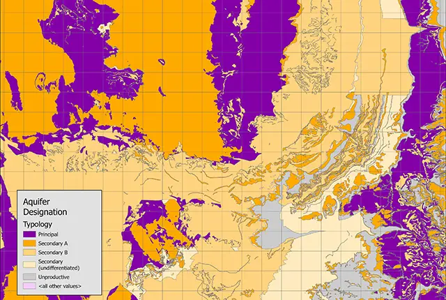

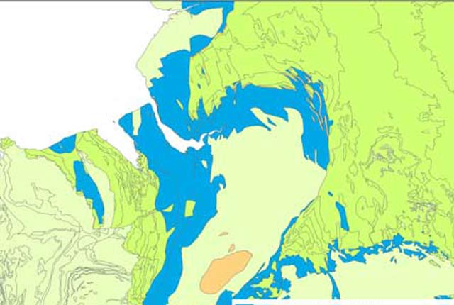
Aquifer designation sample. BGS © UKRI.
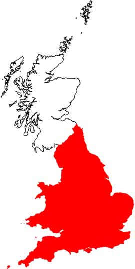
Aquifer designation data
- 1:50 000
- England and Wales
- Open / Premium
The aquifer designation dataset has been created by the Environment Agency (EA), Natural Resources Wales (NRW) and BGS, and identifies the different aquifers of England and Wales. The designations reflect the importance of aquifers not only in terms of groundwater as a resource (drinking water supply) but also their role in supporting surface water flows and wetland ecosystems.
Supporting documents:
Key information
- Scale:
- 1:50 000
- Coverage:
- England and Wales
- Availability:
- Open / Premium
- Price:
Free: Available to view via the Defra Magic Portal (England) and the BGS GeoIndex (Wales).
Licence: £0.34 per km2 for commericial download use. Subject to number of users, licence fee and data preparation fee. Non-commercial users should contact EA (for England) and NRW (for Wales) for access.
- Format:
- GIS polygon data (ESRI, MapInfo, others available by request)
- Uses:
- Local-level to Region-level use
- Themes:
- Environmental change, Hydrogeology
The aquifer designation dataset has been created by the Environment Agency (EA), Natural Resources Wales (NRW) and the BGS, and identifies the different aquifers of England and Wales.
Groundwater protection policy in England and Wales uses aquifer designations that are consistent with the Water Framework Directive.
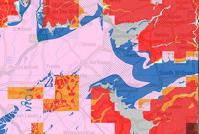
Aquifer designation coverage. BGS © UKRI – Contains OS data © Crown copyright 2020.
These designations reflect the importance of aquifers not only in terms of groundwater as a resource (drinking water supply) but also their role in supporting surface water flows and wetland ecosystems.
The maps are split into two different types of aquifer designations:
- superficial: permeable, unconsolidated (loose) deposits, e.g. sands and gravels
- bedrock: solid, permeable formations, e.g. sandstone, chalk and limestone
The maps display the following aquifer designations:
- principal aquifers
- secondary aquifers:
- secondary A
- secondary B
- secondary undifferentiated
- unproductive strata
You many also be interested in
Groundwater vulnerability data
Our groundwater vulnerability maps provide an assessment of the vulnerability of groundwater in overlying superficial rocks and those that comprise the underlying bedrock.
Hydrogeological maps of Scotland
The BGS has produced a suite of hydrogeological maps of Scotland. The suite includes layers with groundwater vulnerability and aquifer productivity data.
Hydrogeology 625K digital hydrogeological map of the UK
The hydrogeological map indicates aquifer potential in generalised term.

Permeability
Permeability data is often used in studies of groundwater. Our permeability information is based on BGS Geology 50K data.