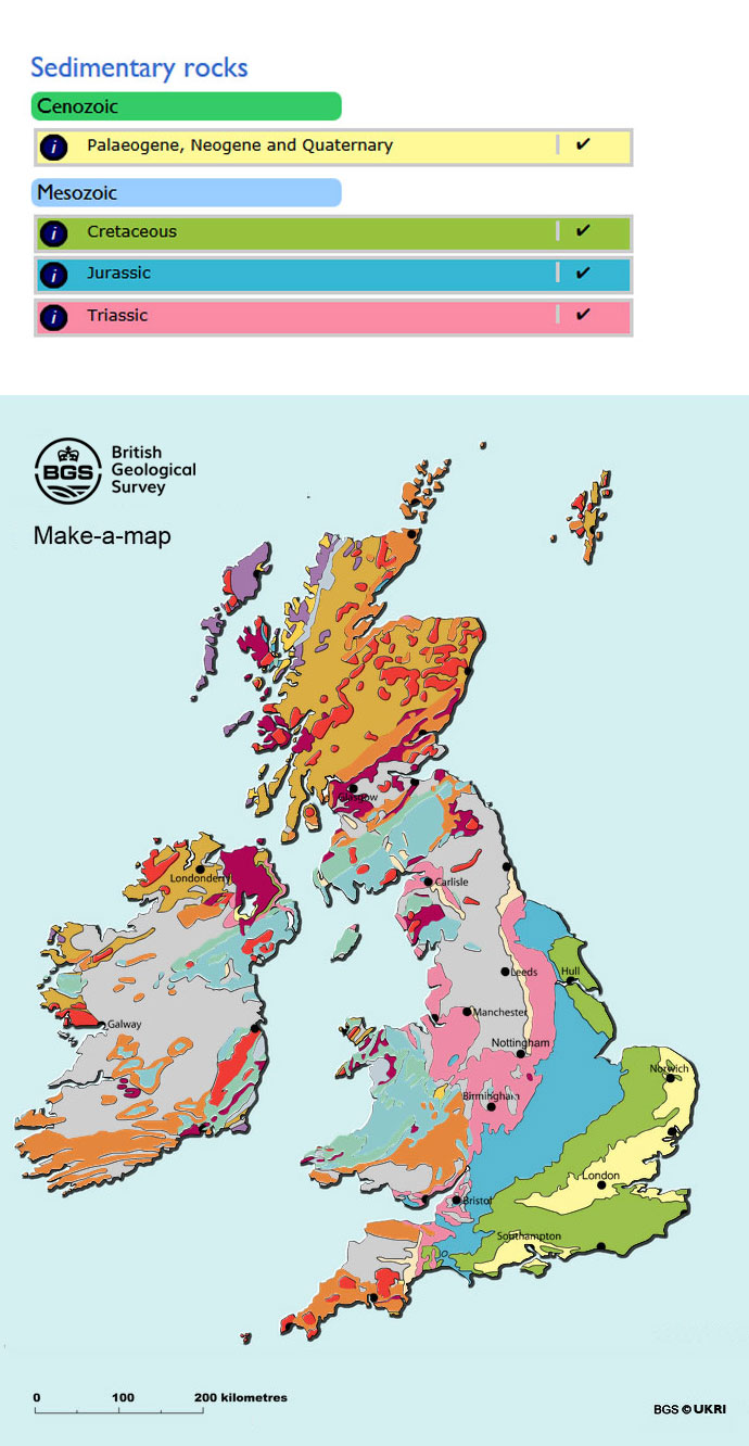
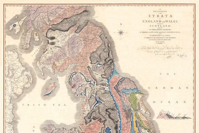
Make-a-map is an interactive geological map of the UK and Ireland. It is intended for amateur geologists, students and teachers looking for an overview of the geology of these islands.

Make-a-map is an interactive geological map of the UK and Ireland. BGS © UKRI.
Rock types
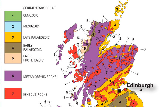
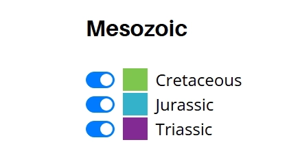
The rocks in Make-a-map are divided into sedimentary, metamorphic and igneous rock units. The sedimentary and metamorphic rock units are then subdivided by their ages. In most cases this corresponds to a geological period.
You can customise Make-a-map to show just those rock units that are of interest to you. You can also show or conceal the place names, coastline and other features. BGS © UKRI.
The rocks in Make-a-map are divided into sedimentary, metamorphic and igneous rock units. BGS © UKRI.
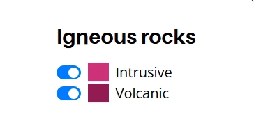
See the BGS Geological Timechart for more information on the subdivisions of geological time. The igneous rocks are subdivided into intrusive and extrusive types.
Please note that Make-a-map has been simplified and generalised to allow the whole of the UK and Ireland to be displayed at once.
Want to buy or view a geological map?
Make-a-map is based on a simplified geological map available, over-the-counter, as a postcard from our shops; poster maps showing the geology of Britain are also available.
You can view most of the BGS 1:50 000-scale geology maps online using our Geology of Britain viewer.
You may also be interested in
Discovering Geology
Discovering Geology introduces a range of geoscience topics to school-age students and learners of all ages.
Maps and resources
Download and print free educational resources.