The British Geological Survey is calling on drillers, consultants, councils, housebuilders and developers to take part in a data drive for the Newcastle and Gateshead area, helping to improve the understanding of the region’s subsurface for the creation of an updated geological map and model.
The initiative, led by the National Geoscience Data Centre (NGDC), aims to gather ground investigation (GI) data from across the region, particularly borehole logs and site investigation records, that have not been shared with the National Borehole Index.
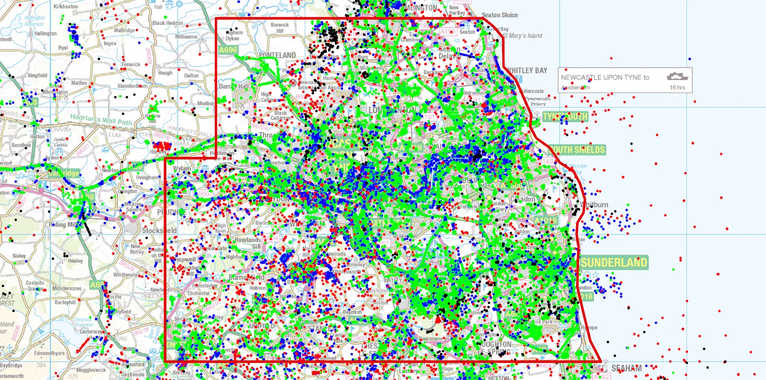

National Geoscience borehole map. BGS © UKRI.
Why it matters
Every year, an estimated 100,000 boreholes are drilled across the UK, yet less than 5% of this data makes its way into the NGDC. This leaves a significant gap in the collective understanding of the nation’s ground conditions. The NGDC is home to the national register of borehole data and includes over 1.4 million borehole records. The data is accessed by over 3,000 users per month for a range of purposes, including desktop assessments to understand ground conditions and the requirement for further drilling.
By contributing data, participants will be helping to:
- Improve geological mapping and 3D modelling for our current urban project in the Newcastle-Gateshead region.
- Enable better-informed decisions, reducing delays and risks associated with ground conditions, and enabling more targeted drilling.
- Support open data principles and national guidance, including The Construction Playbook, which promotes sharing subsurface data through standard contract clauses.
How to get involved
BGS is seeking engagement and contributions of legacy or recent GI data from organisations, including:
- Local councils and planning authorities
- Developers, house builders and contractors
- Engineering and environmental consultancies holding legacy data
Digital data can be deposited via the NGDC Data Deposit Portal. We are keen to understand from users the formats data is held. Information regarding data in different formats can be sent to: NGDC.
Any GI data donated, will be made available and added to the 1.4 million borehole records already held by BGS.
Wider project objectives
As well as increasing the volume of data, BGS will be working with our community of stakeholders to understand more about:
- Volumes and formats of existing data.
- Barriers preventing data deposit.
- The potential impact of greater data sharing on project outcomes.
You may also be interested in
The Common Ground project
The Common Ground project aims to enhance the value of ground investigation data for the UK construction and environmental sectors.

Depositing data
Guidelines for depositing data with NGDC
AGS data format
The AGS data transfer format is a standard file format for the transfer of geotechnical and geoenvironmental data in the site investigation industry.