We delivered enhanced, site-specific geological understanding to support the cost-effective development of a multi-billion-pound infrastructure project close to the UK’s largest population centre.
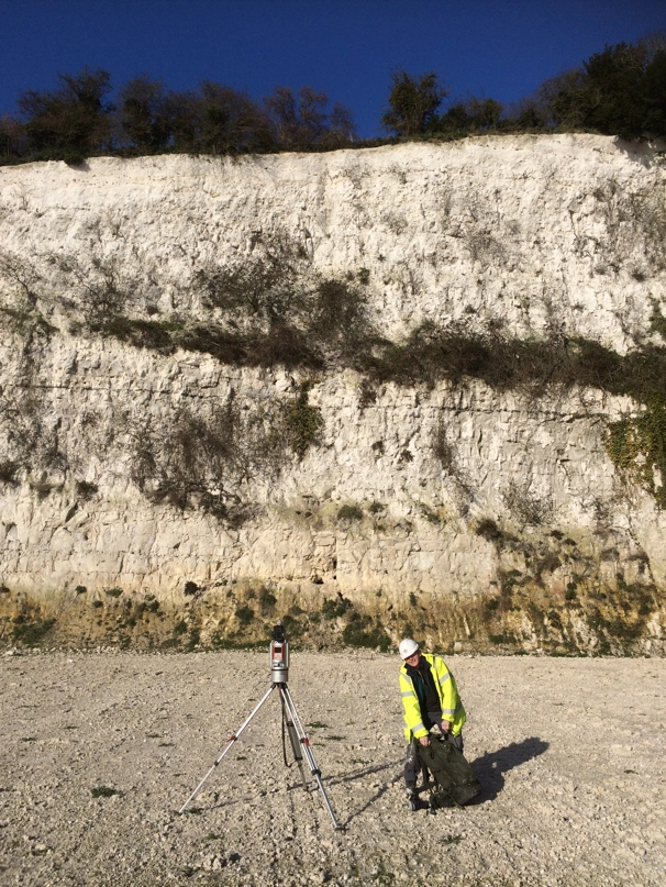

A LiDAR scan being taken of an outcrop of the Cretaceous-aged Chalk Group, enabling remote 3D visualisation and interrogation of the section. BGS © UKRI.
What was the Lower Thames Crossing project?
The Lower Thames Crossing project, worth up to £9 billion, was commissioned by National Highways and included the development of 23 km of motorway connecting the M2/A2, A13 and M25, including two 4 km-long tunnels (each will be 16.4 m diameter) in the area of the Thames estuary. The rock ages are Holocene, Quaternary, Palaeogene and Cretaceous.
Working alongside geotechnical partner organisations such as AECOM, BGS provided expert 3D subsurface interpretations through:
- existing datasets
- data collected by specialist BGS staff via LiDAR scanning and photogrammetry
- geological logging
- shallow geophysical surveying
- virtual outcrop model analysis
- geological modelling

A BGS geologist studying a flint band within an outcrop of the Creatceous-aged Chalk Group as part of fieldwork during the Lower Thames Crossing project. BGS © UKRI.
Who did the project aim to help and how?
The variable geology and wide spatial extent of the Lower Thames Crossing scheme posed multiple geotechnical challenges, such as variability in the thickness of superficial deposits and the prevalence of flint bands at several horizons within the Chalk Group, which have the potential to damage drilling equipment.
The data and knowledge provided by BGS complemented the intrusive ground investigation, increasing confidence in predicting the likely ground conditions for the tunnel and transport infrastructure to ensure the tunnel would be built in the most geologically suitable area. It also meant that ground investigation resources could be focused in areas with the most pressing geotechnical challenges, therefore maximising cost benefit.
The longevity of infrastructure of this nature relies on a robust understanding of the site and its geotechnical challenges at the construction stage, which in turn enable informed design decisions to be made in order to protect the asset throughout its design life.
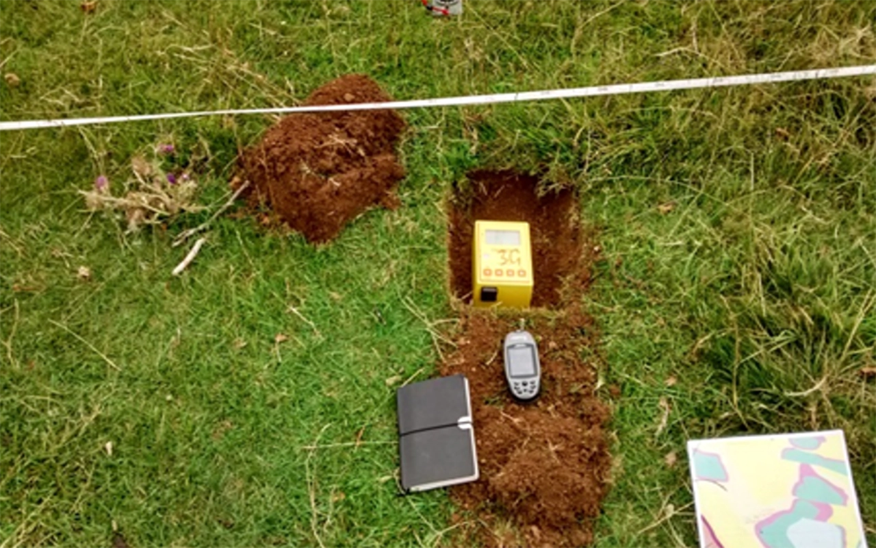
A passive seismic survey being conducted in the field. The data gathered using this non-intrusive ground-investigation technique was used to augment information gathered by more invasive methods such as borehole drilling, which was conducted elsewhere in the project area. BGS © UKRI
What will the outcomes be?
Cost-effective collection of a large amount of project-specific ground information was provided in a very short timeframe and with minimal impact on landowners. Increased confidence in the existing ground model (refinement, confirmation or alteration of data) and the project-specific information for considerations associated with tunnelling-related equipment (such as the tunnel-boring machine and slurry treatment plant) were also provided as part of this project. These augmented the intrusive ground investigation, increasing the confidence of predicting the likely ground conditions for the tunnel and transport infrastructure.
Contact
If you would like more information, please contact Ricky Terrington, the Lower Thames Crossing project leader.
Footnotes
1. £9 billion
Lower Thames Crossing Funding Statement, Infrastructure Planning (Applications: Prescribed Forms and Procedure) Regulations 2009 Volume 4, National Highways, published October 2022.