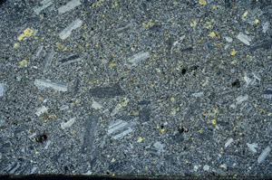
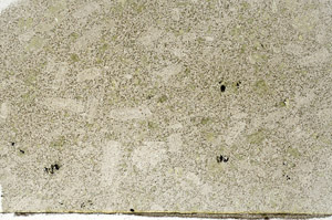
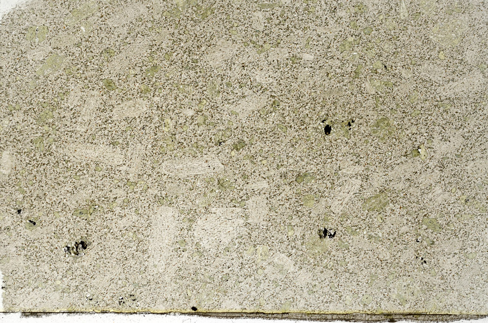
BGS mineralogy and petrology collection record
| Sample number | S76474; COLLNOBX658; |
|---|---|
| Sample Donor | Henderson,W.G. |
| Rock name | Not entered |
| Stratigraphy | Not entered |
| Comments | Lower Carboniferous basalt dyke |
| Locality details | On SE bank of long stream flowing into Glen Fruin north of Stuckiedow Burn, 1535m WSW of Auchenvennel |
| 50k map sheet | Loch Lomond (38) |
| Map reference | NS 2742 8835 |
| Year collected | Not entered |
| Bore name | Not applicable |
| Confidentiality | No restrictions |
Petrological thin sections
Links to high resolution images
Transition from XPL to PPL light
S76474