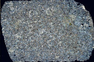
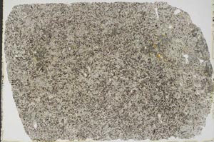
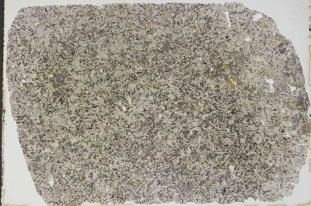
BGS mineralogy and petrology collection record
| Sample number | S50861; COLLNOBO6832; |
|---|---|
| Sample Donor | Read,W.A.; Specimen from bores (Scotland); |
| Rock name | Not entered |
| Stratigraphy | Not entered |
| Comments | Lava or intrusive |
| Locality details | Lambhill bore no. 9 (1965) near Solsgirth, c. 600 yds NNW of Howfold Farm; depth 191 ft 6 in |
| 50k map sheet | Stirling (39) |
| Map reference | NT 00168 95699 |
| Year collected | Not entered |
| Bore name | Not applicable |
| Confidentiality | No restrictions |
Petrological thin sections
Links to high resolution images
Transition from XPL to PPL light
S50861