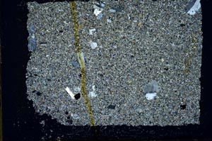
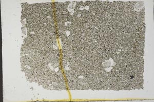
BGS mineralogy and petrology collection record
| Sample number | S33175 |
|---|---|
| Sample Donor | Macgregor,A.G. |
| Rock name | Not entered |
| Stratigraphy | Not entered |
| Comments | Dolerite dyke, 10 feet in from E edge |
| Locality details | Near county boundary fully 1 mile SSW of Stroanshalloch |
| 50k map sheet | Maxwelltown (9) |
| Map reference | NX 709 903 |
| Year collected | Not entered |
| Bore name | Not applicable |
| Confidentiality | No restrictions |
Petrological thin sections
Links to high resolution images
Transition from XPL to PPL light
S33175