BGS mineralogy and petrology collection record
| Sample number | E39860 |
|---|---|
| Sample Donor | Worsam,B.C. |
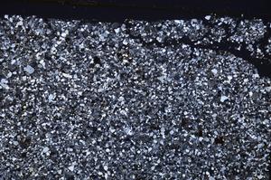
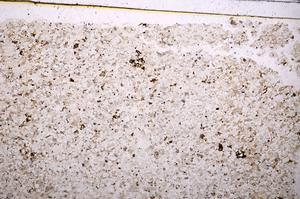
| Rock name | Sandstone (Undifferentiated). 'Original entry: Sandstone' |
| Stratigraphy | Not entered |
| Comments | 6" Map (and quarter sheet), 31N.W.S. Sandstone from middle of a 15' bed exposed in quarry. Middle Coal Measures. |
| Locality details | Old quarry, 200 yards N.W. of Hanginghill Farm & 1450 yards east 35 degrees south of Union Lodge. |
| 50k map sheet | Loughborough (141) |
| Map reference | SK 3122 1655 |
| Year collected | Not entered |
| Bore name | Not applicable |
| Confidentiality | No restrictions |
Petrological thin sections
Links to high resolution images
Transition from XPL to PPL light
E39860