
The well measures water levels in the Chalk Group aquifer of the South Downs, on the eastern margin of the Cuckmere valley, in south-east England.
BGS Enquiries can help you to access data from the National Groundwater Level Archive (NGLA) for this well
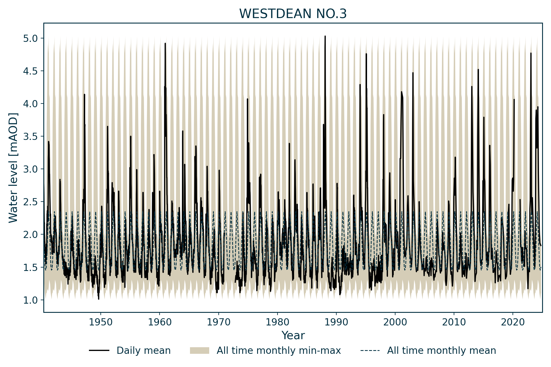
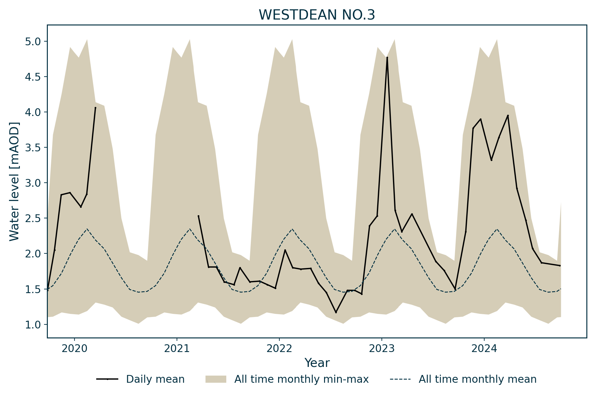
Hydrograph
Information about the well
Hydrogeological setting
| Westdean No.3 | |
|---|---|
| Wellmaster ID | TV59/7C |
| NGR | 5529 0992 |
| Datum | 13.48 m AOD |
| Monitoring details | |
| Type | Groundwater level |
| Aquifer | Chalk |
| Confinement | Unconfined |
| Depth | 24.99 m |
| Record | |
| Monitored by | EA Southern |
| Records commence | 1940 |
| Records end | Active |
Thin head deposits (chalky, sandy and silty clay, locally pebbly) overlie the Seaford Chalk Formation at the site. The well is located in a dry valley on the eastern side of the Cuckmere valley. The well is at the lower end of its catchment and water levels are only slightly above mean sea level.
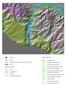

Geological map of the area around Westdean No.3. BGS © UKRI.
Well or borehole construction
The borehole was drilled to 24.99 m in 1896 and water levels have been measured since 1904. It was plumbed as being 21.1 m deep (21.5 m below top of lining tubes) in 1972. Neither the drilled diameter of the borehole nor the length of the casing are known.
Hydrograph response
The chalk aquifer is unconfined and the hydrograph has an annual sinusoidal appearance. The hydrograph exhibits a relatively flashy response, probably because of the relatively small size of the associated chalk blocks. Levels regress consistently to around 1.5 m above sea level, normally peaking between 2.5 and 3.5 m above sea level, but with occasional peaks above 4 m, which may be considered indicative of localised groundwater flooding in the catchment.
Data issues
No data is available for 1971, due to a bees’ nest in the recorder, or 1972.
Acknowledgements
Groundwater level data are provided to the NGLA by the Environment Agency (EA), Natural Resources Wales – Cyfoeth Naturiol Cymru (NRW), the Scottish Environment Protection Agency (SEPA) and, for Northern Ireland, the Department for Infrastructure – Rivers and the Northern Ireland Environment Agency.
Further information about these monitoring networks can be found on these pages:
Contact
Please contact BGS Enquiries for further information.