
Groundwater flooding
Periods of abnormally high rainfall can result in groundwater flooding of basements and the emergence of groundwater at the ground surface, causing damage to property and infrastructure. BGS has one of the largest groups of scientists researching groundwater flooding. This includes aspects such as improving our understanding of groundwater flooding mechanisms, modelling groundwater flooding and mapping susceptible areas.
Groundwater flooding can cause significant social and economic disruption and is a threat in many areas of north-west Europe, including the UK. Flooding legislation initially introduced in Europe and was transposed into UK law recognises the importance of groundwater flooding by incorporating a requirement to assess the risk and undertake measures to reduce it where significant.
What is groundwater flooding?
Groundwater flooding is defined as the emergence of groundwater at the ground surface away from perennial river channels, or the rising of groundwater into artificial ground under conditions where the ‘normal’ ranges of groundwater level and groundwater flow are exceeded.
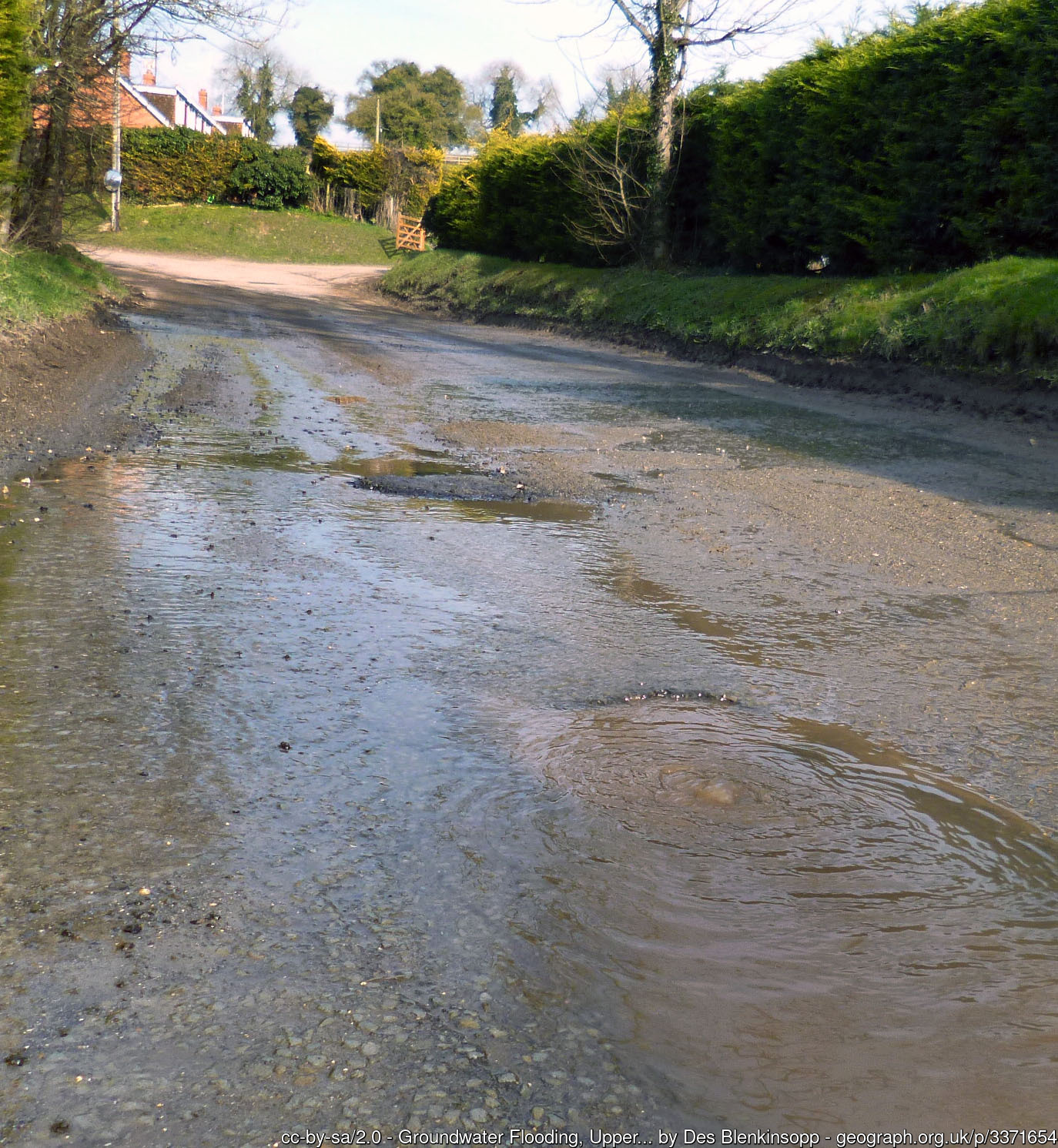

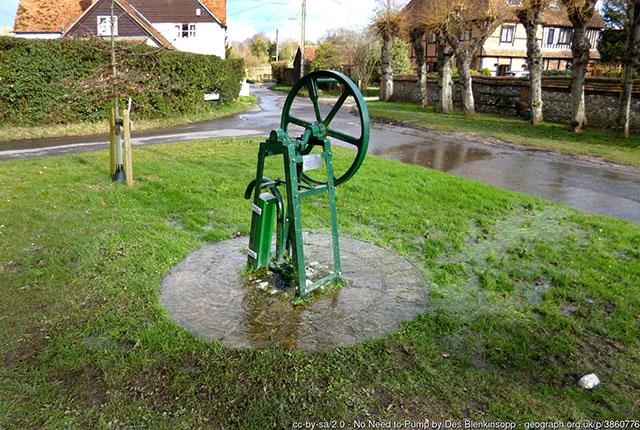
Groundwater flooding in Upper Lambourn, Berkshire, England, in 2013. The groundwater level has risen above the level of the road, so water is forcing its way through the road surface as a spring. © Des Blenkinsopp and licensed for reuse under this Creative Commons Licence.
Exceptionally large flows from perennial springs or large flows from intermittent or dormant springs also come under the definition of groundwater flooding. They can cause both localised flooding in the vicinity of the springs and where surface water drainage channels may not be adequate.
Where does groundwater flooding occur?
Groundwater flooding can occur in a range of geological settings. There are three main settings that have been identified in the UK where significant groundwater flooding can occur:
- unconfined major aquifers such as the Chalk
- shallow, unconsolidated, sedimentary aquifers
- groundwater rebound in urban centres
The first two of these settings encompass the majority of sites affected by groundwater flooding in the UK. BGS carries out its groundwater research in these settings to improve our understanding of the flooding mechanisms involved. This research has been the basis for the production of our susceptibility to groundwater flooding maps, which cover England, Wales and Scotland.
Characteristics of groundwater flooding
The characteristic feature of groundwater flooding events is its relatively long duration compared with fluvial (river) flooding.
The impact of groundwater flooding can occur before water levels reach the ground surface, for example when there is inundation of building basements and buried services, such as road tunnels or other assets, below ground level.
Groundwater levels that rise above ground level also have the potential to reach low-lying areas otherwise protected from fluvial flooding.
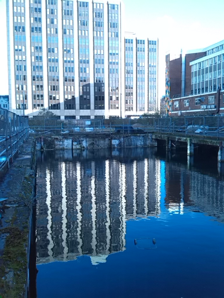
Flooded basement of a demolished building in Cardiff, Wales. The basement has flooded to a level close to or the same as the groundwater level beneath the city. BGS © UKRI.
More information
Feature image
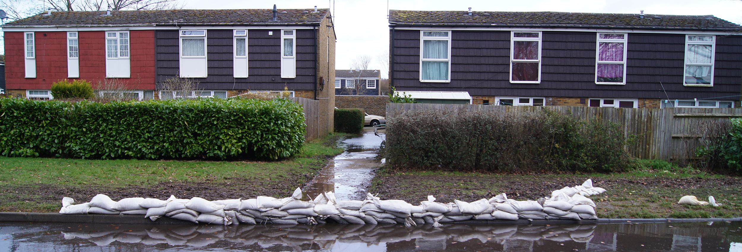
Groundwater flooding in Basingstoke, Hampshire, England, in 2014. Basingstoke is located on the Chalk aquifer of southern England. © Mr Ignavy and licensed for reuse under this Creative Commons Licence.
Our research
How many properties are at risk from groundwater flooding?
How we estimated where and how many homes may be at risk from groundwater floods.
Controls on regional-scale groundwater flooding
Researching widespread, regional groundwater floods.

Case study: groundwater flooding in Oxford
Investigating the causes of groundwater flooding in the River Thames floodplain.