
This is a new observation borehole, complementing records from a well that was dug into the Cretaceous-aged Chalk Group aquifer over 130 years ago in the garden of the Well House Inn pub, on the North Downs in south-east England.
BGS Enquiries can help you to access data from the National Groundwater Level Archive (NGLA) for this well
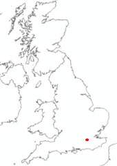

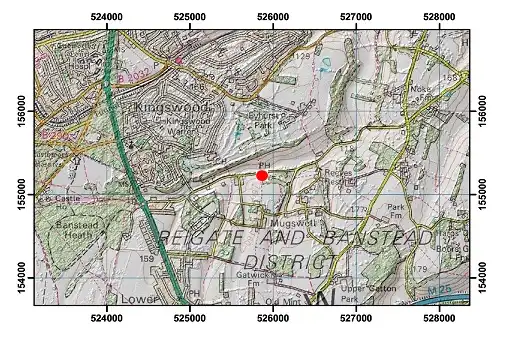
Location of Chipstead GWL (Well House Inn). BGS © UKRI.
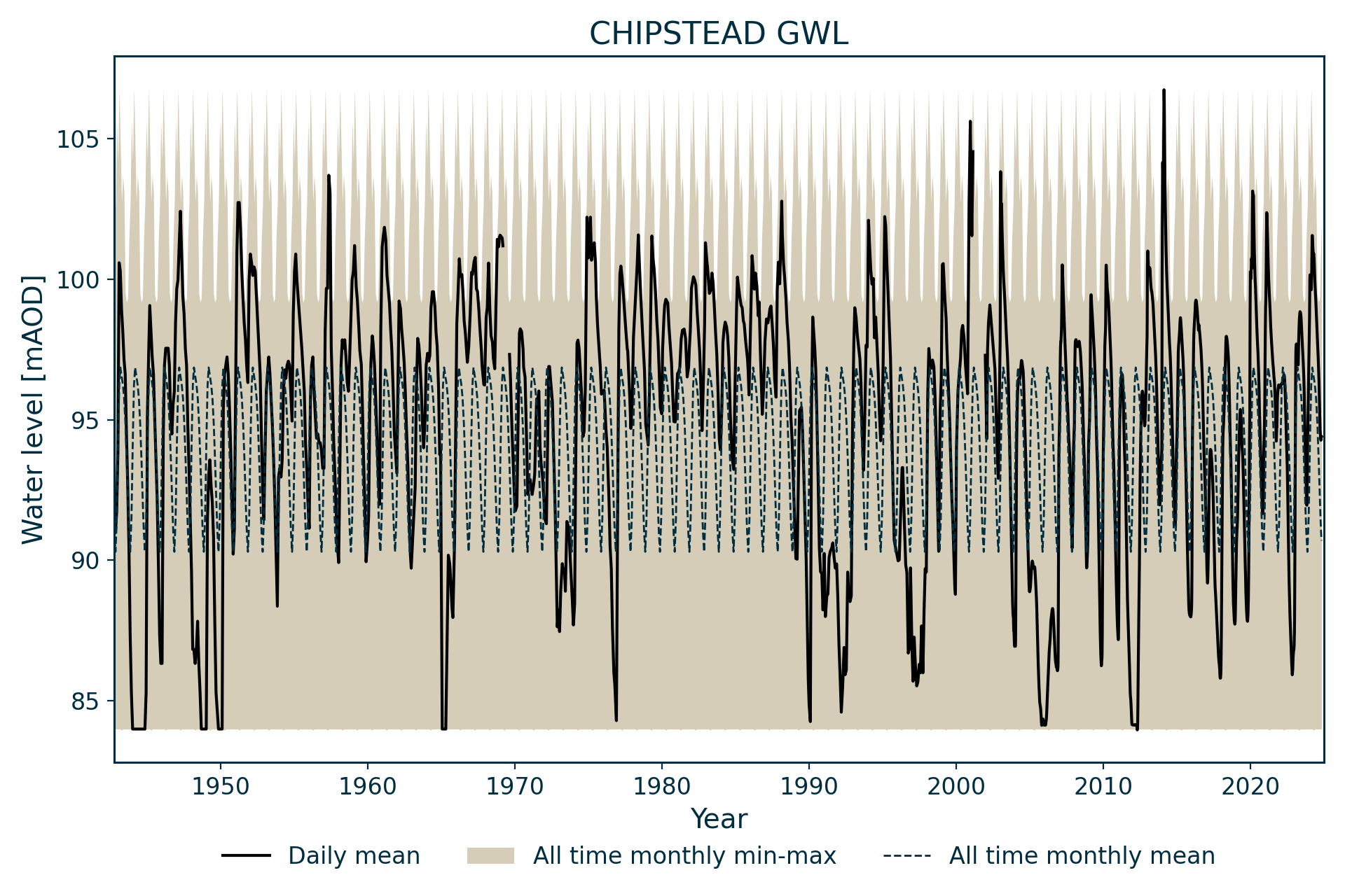
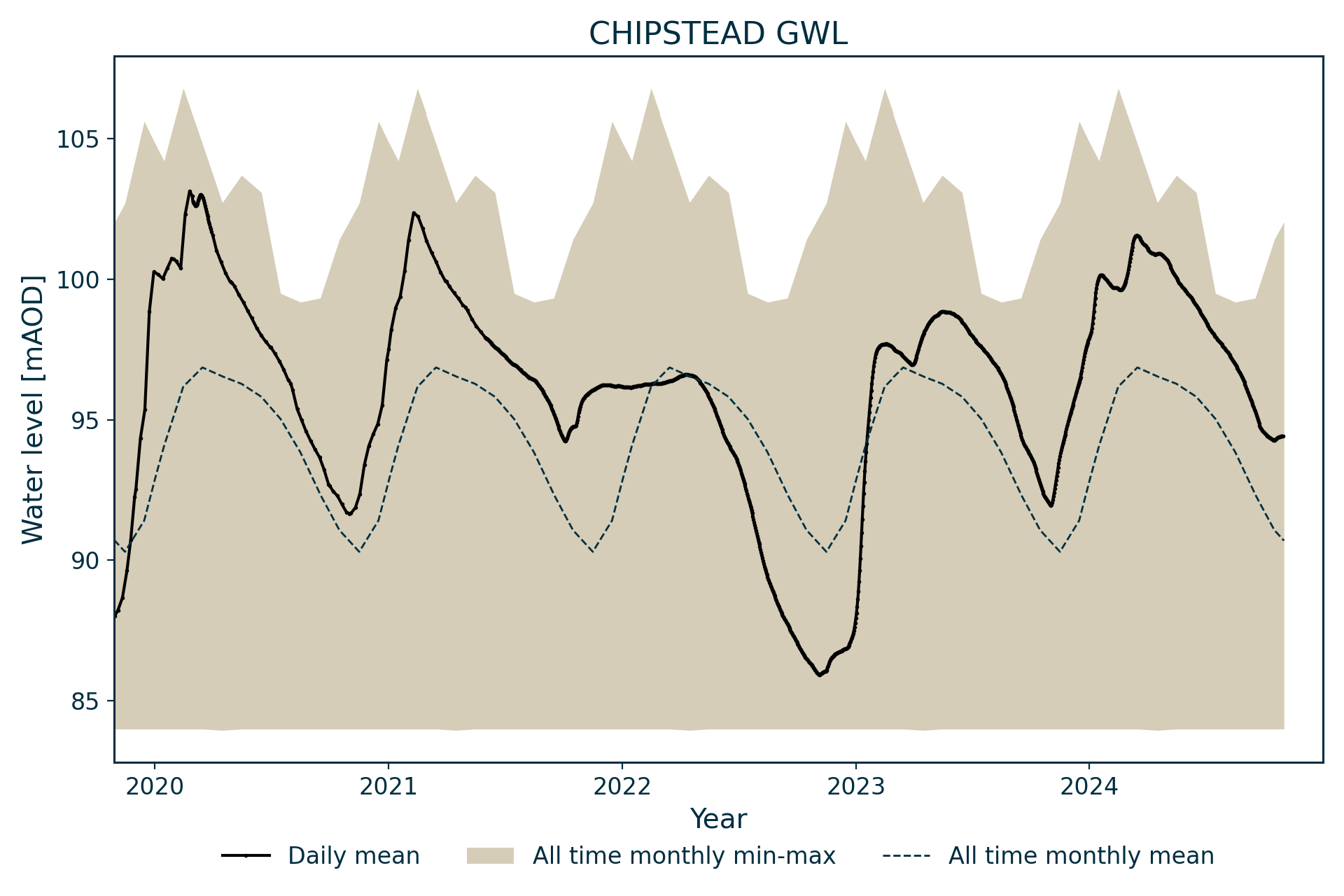
Hydrograph
Information about the well
Hydrogeological setting
| Chipstead GWL (Well House Inn) | |
|---|---|
| Wellmaster ID | TQ25/86 |
| NGR | 5258 1552 |
| Datum | 132.27 m AOD |
| Monitoring details | |
| Type | Groundwater level |
| Aquifer | Chalk |
| Confinement | Unconfined |
| Depth | 140 m |
| Record | |
| Monitored by | EA Thames |
| Records commence | 1999 (extended back to 1942) |
| Records end | Active |
This well measures water level in the Chalk Group of the North Downs. It penetrates:
- Newhaven Chalk Formation
- Seaford Chalk Formation
- Lewes Nodular Chalk Formation
- New Pit Chalk Formation
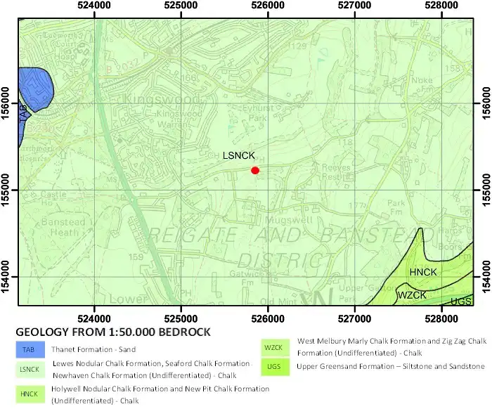
Geological map of the area around the Well House Inn. BGS © UKRI.
Well or borehole construction
This is a 140 m-deep drilled observation borehole. It complements the Well House Inn site (TQ25/13), a dug well, which is 50.6 m deep and was constructed before 1877 in the garden of the Well House Inn pub. Monitoring has been carried out in the well since 1942. The record presented here shows observation borehole data with data pre-1999 inferred from the older well.
Hydrograph response
The water level in the well normally exhibits a 10 m annual fluctuation. A relatively stable maximum develops in many years at around 30 m below ground level, hinting at some degree of structual control, possibly a zone of enhanced porosity. The annual sinuosity is superimposed on a longer period response to significant drought episodes, which is typical of relatively poorly drained chalk blocks.
Data issues
The data is an amalgam of monthly data from TQ25/13 (Well House Inn) until 1999, weekly data for TQ25/86 (Chipstead GWL) from 1999 to 2002, and subsequently daily data. The site is equipped with Environment Agency telemetry. The two sites show an excellent correlation except during the driest conditions, when it is thought that TQ25/13 levels are slightly higher than they should be. This has been corrected in the amalgamated record, but levels fall below the depth of the new sensor during droughts.
Topographical map with hillshade of the area around the Well House Inn. BGS © UKRI.
Acknowledgements
Groundwater level data are provided to the NGLA by the Environment Agency (EA), Natural Resources Wales – Cyfoeth Naturiol Cymru (NRW), the Scottish Environment Protection Agency (SEPA) and, for Northern Ireland, the Department for Infrastructure – Rivers and the Northern Ireland Environment Agency.
Further information about these monitoring networks can be found on these pages:
Contact
Please contact BGS Enquiries for further information.