
The borehole monitors groundwater level in the Permo–Triassic-aged Dawlish Sandstone Formation near Exeter in south-west England.
BGS Enquiries can help you to access data from the National Groundwater Level Archive (NGLA) for this well.
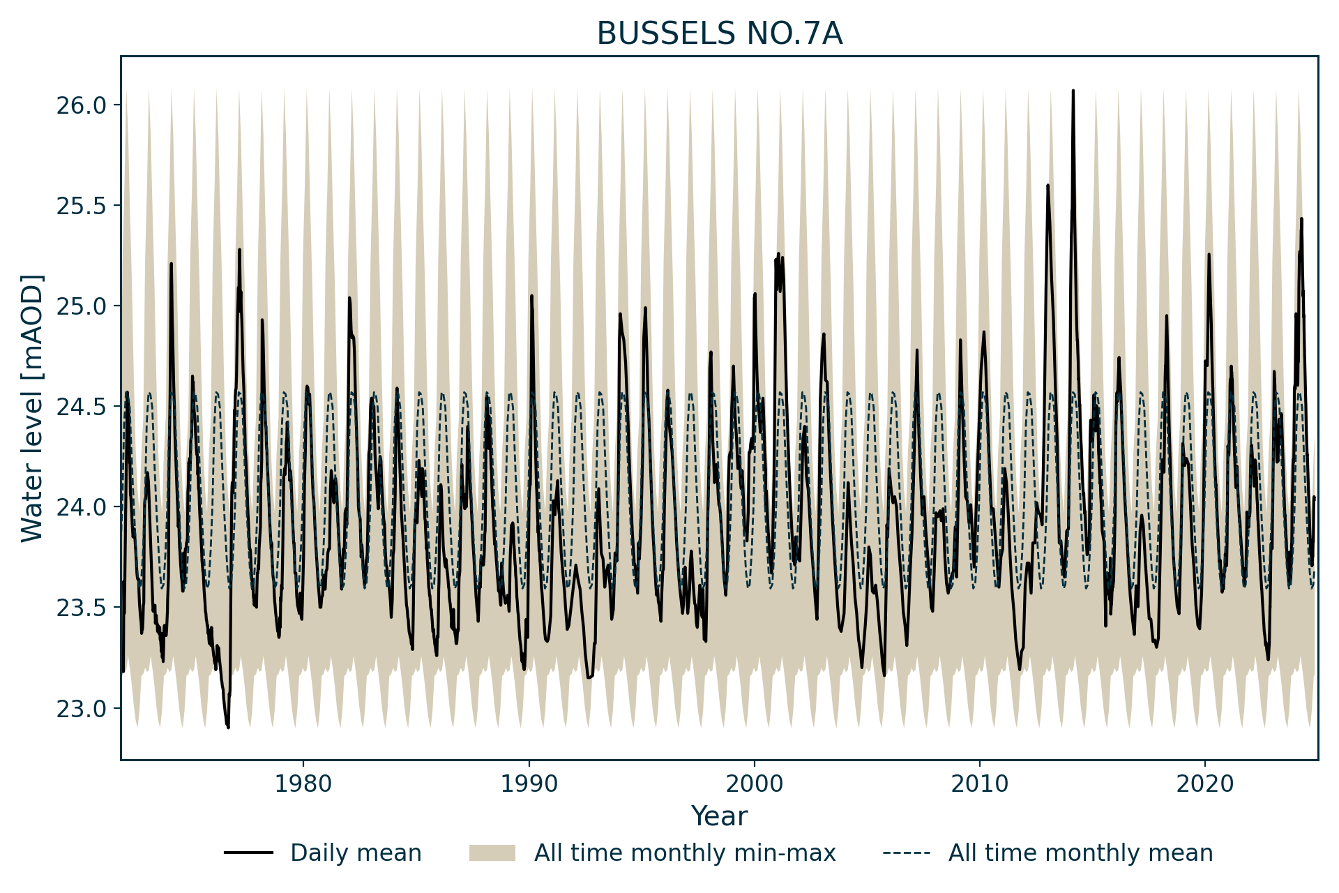
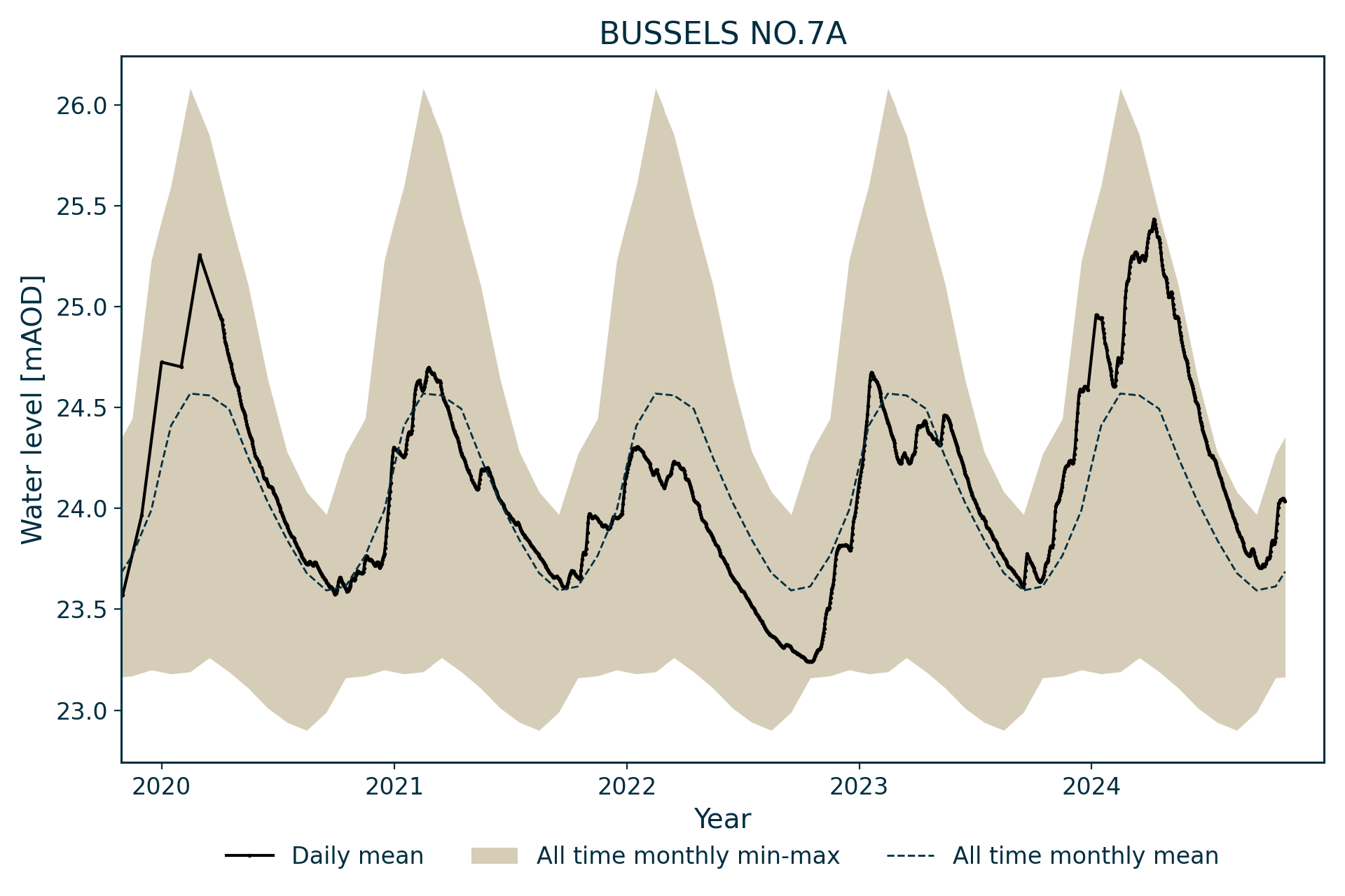
Hydrograph
Information about the well
Hydrogeological setting
| Bussels No 7A | |
|---|---|
| Wellmaster ID | SX99/37B |
| NGR | 2952 0987 |
| Datum | 26.97 m AOD |
| Monitoring details | |
| Type | Groundwater level |
| Aquifer | Permo–Triassic sandstone |
| Confinement | Unconfined |
| Depth | 91.44 m |
| Record | |
| Monitored by | EA South West |
| Records commence | 1971 |
| Records end | Active |
The borehole monitors groundwater level in the Permo–Triassic sandstones of south-west England. It is drilled into the Dawlish Sandstone Formation of the Exeter Group, overlain by a thin layer of river terrace deposits.
Water levels in the borehole stand within the cased section and just below the terrace deposits, but the aquifer appears to be unconfined.
Well or borehole construction
The borehole was drilled as an observation well.
It was drilled at a diameter of 311 mm from surface to 18.44 m with 203 mm diameter casing inserted. The remainder of the borehole was drilled at 146 mm diameter then opened up to 194 mm diameter.
Hydrograph response
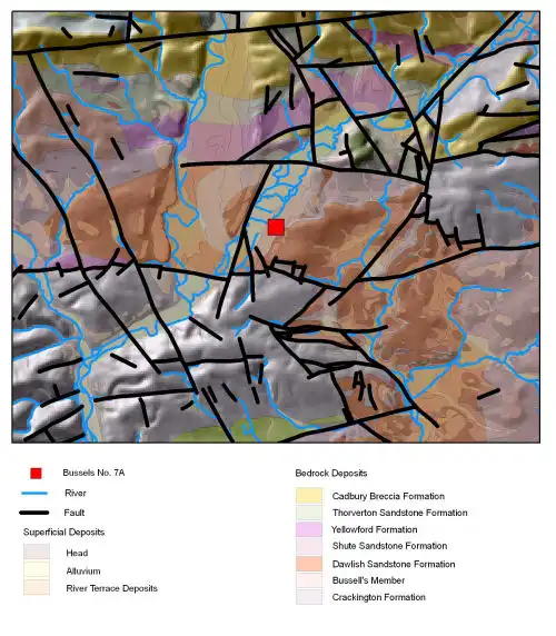

Map of Bussells No 7A showing geology. BGS © UKRI.
The hydrograph has an annual sinusoidal appearance, with a subdued reaction to individual rainfall events in both summer and winter, suggesting some rapid recharge occurs. This is borne out by reports of rapid recovery in response to heavy rainfall observed during the bore’s post-construction pump test.
Annual fluctuations are normally between 1 and 2 m.
There is some evidence of a superimposed, long period response, with gentle rises and falls over several years that may be influenced by rainfall variation over similar periods.
Data issues
Datum changed from 26.97 m AOD on 20 January2000.
References
Bloomfield, J P, Gaus, I, and Wade, S D. 2003. A method for investigating the potential impacts of climate-change scenarios on annual minimum groundwater levels. Water and Environment Journal, Vol. 17 (2), 86–91.
Acknowledgements
Groundwater level data are provided to the NGLA by the Environment Agency (EA), Natural Resources Wales – Cyfoeth Naturiol Cymru (NRW), the Scottish Environment Protection Agency (SEPA) and, for Northern Ireland, the Department for Infrastructure – Rivers and the Northern Ireland Environment Agency.
Further information about these monitoring networks can be found on these pages:
Contact
Please contact BGS Enquiries for further information.