
National overview maps
Two national overview maps are available. One shows the extent or area over England and Wales where rock units that are designated as principal aquifers by the Environment Agency are present at the surface and below ground. The second map shows the extent of the six major (potentially gas-bearing) shale units present at the surface and below ground.
Because aquifers, shales and clays are found throughout the rock sequence of the UK, maps at this scale can’t represent the complex spatial and depth relationships between shallow aquifers and deeper underlying shale and clay units. To see visualisations of these relationships use the separation maps.
The maps
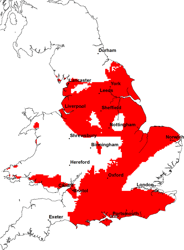
Principal aquifers are defined by the Environment Agency as ‘units of rock that, because of their relatively high permeability and storage properties, provide strategically important water supplies and/or flow to rivers’.
There are eleven such geological units and a map of their combined subsurface extent is shown here. However, only the upper part of the principal aquifers is typically used for water supply or will provide flow to rivers.
Information about each of the principal aquifers of England and Wales is available by viewing the aquifer maps.

Map of principal aquifers in England and Wales. BGS © UKRI.
The national shale and clay map shows the combined subsurface extent of the six major shale and clay units in England and Wales. It shows that shales and clays are a relatively common type of rock in England and Wales.
Although the map shows the extent of the rock type, it doesn’t show which parts of these units may contain shale gas or which parts may contain recoverable shale gas resources, as this information isn’t currently available.
Information about individual shales and clay units in the UK is available by viewing the shale and clay maps.
 Map of shale and clay units in England and Wales. BGS © UKRI.