
Use this page to choose one of the 25 maps showing the vertical separation between aquifer/shale or aquifer/clay pairs. Each map has a link to find further information about each of the aquifer and shale/clay unit pairs.
Go to an aquifer:
- Crag
- Chalk
- Lower Greensand
- Spilsby Sandstone
- Corallian limestone
- Oolites
- Triassic sandstone
- Magnesian limestone
- Permian sandstone
About the separation maps
More information on how the separation maps have been calculated and how they should be used and interpreted can be found in the methods section or download the data used to prepare the maps.
Crag
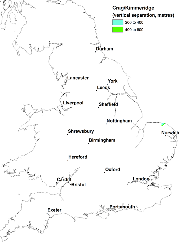

Crag Group vs. Kimmeridge Clay Formation and Ampthill Clay Formation. BGS © UKRI.

Crag Group vs. Kellaways Formation, Oxford Clay Formation and Osgodby Formation. BGS © UKRI.
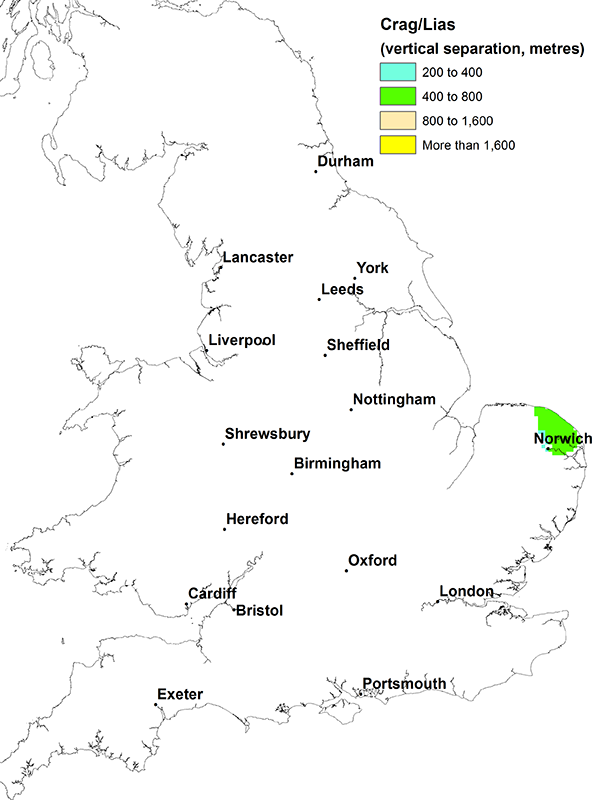
Crag Group vs. Lias Group. BGS © UKRI.
Chalk
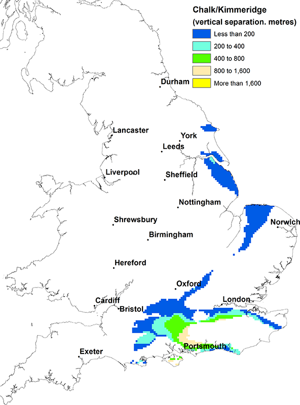
Chalk vs. Kimmeridge Clay Formation and Ampthill Clay Formation. BGS © UKRI.

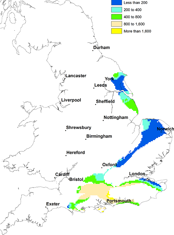
Chalk vs Kellaways Formation, Oxford Clay Formation and Osgodby Formation. BGS © UKRI.
Chalk vs Lias Group. BGS © UKRI.
Lower Greensand
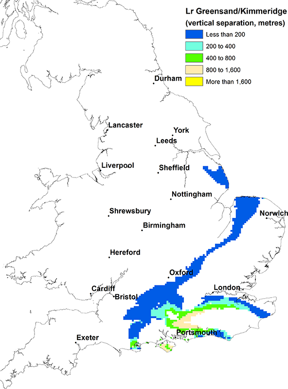
Lower Greensand vs Kimmeridge Clay Formation and Ampthill Clay Formation. BGS © UKRI.
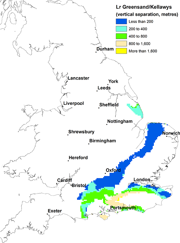
Lower Greensand vs Kellaways Formation, Oxford Clay Formation and Osgodby Formation. BGS © UKRI.
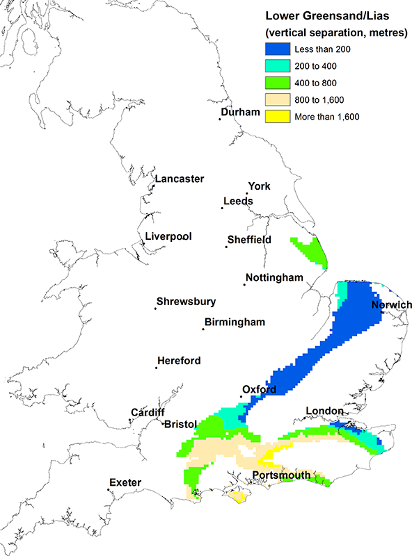
Lower Greensand vs Lias Group. BGS © UKRI.
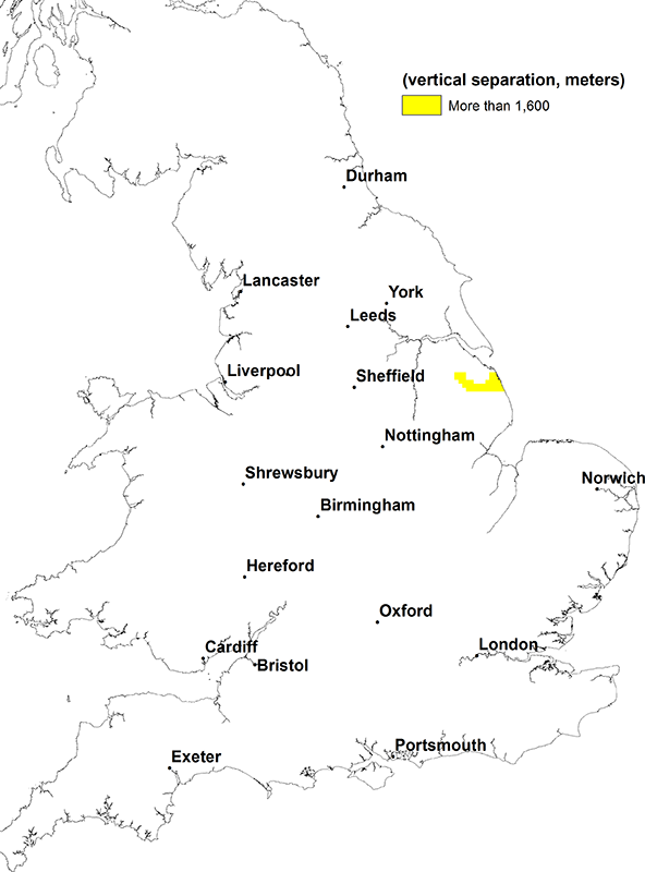
Lower Greensand vs Bowland Shale Formation and Craven Group. BGS © UKRI.
Spilsby Sandstone
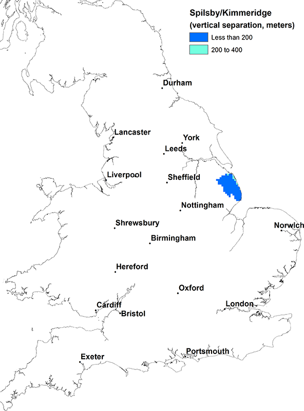
Spilsby Sandstone vs Kimmeridge Clay Formation and Ampthill Clay Formation. BGS © UKRI.
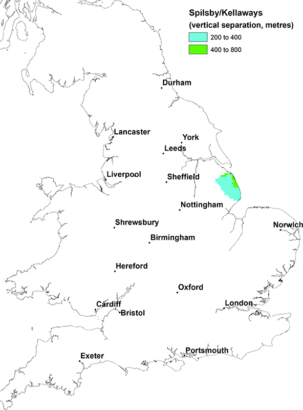
Spilsby Sandstone vs Kellaways Formation, Oxford Clay Formation and Osgodby Formation. BGS © UKRI.
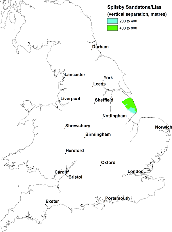
Spilsby Sandstone vs Lias Group. BGS © UKRI.

Spilsby Sandstone vs Bowland Shale Formation and Craven Group. BGS © UKRI.
Corallian limestone
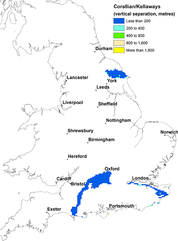
Corallian limestone vs Kellaways Formation, Oxford Clay Formation and Osgodby Formation. BGS © UKRI.
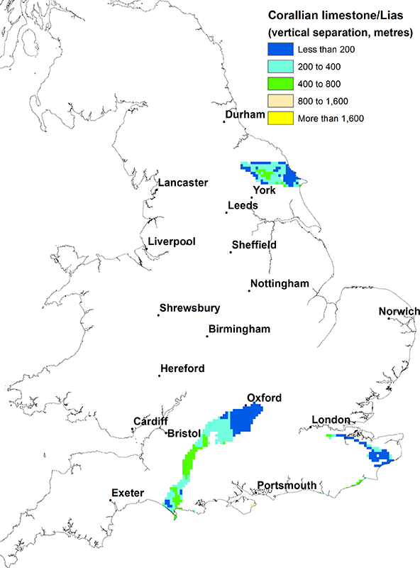
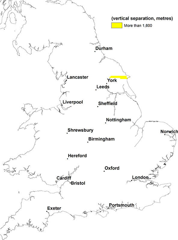
Corallian limestone vs Lias Group. BGS © UKRI.
Corallian limestone vs Bowland Shale Formation and Craven Group. BGS © UKRI.
Oolites
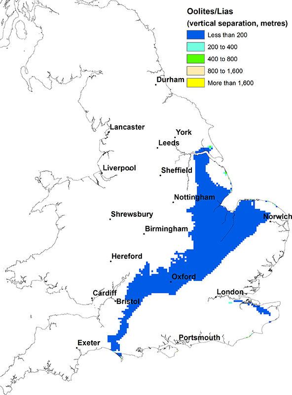
Oolites (Great Oolite and Inferior Oolite) vs Lias Group. BGS © UKRI.
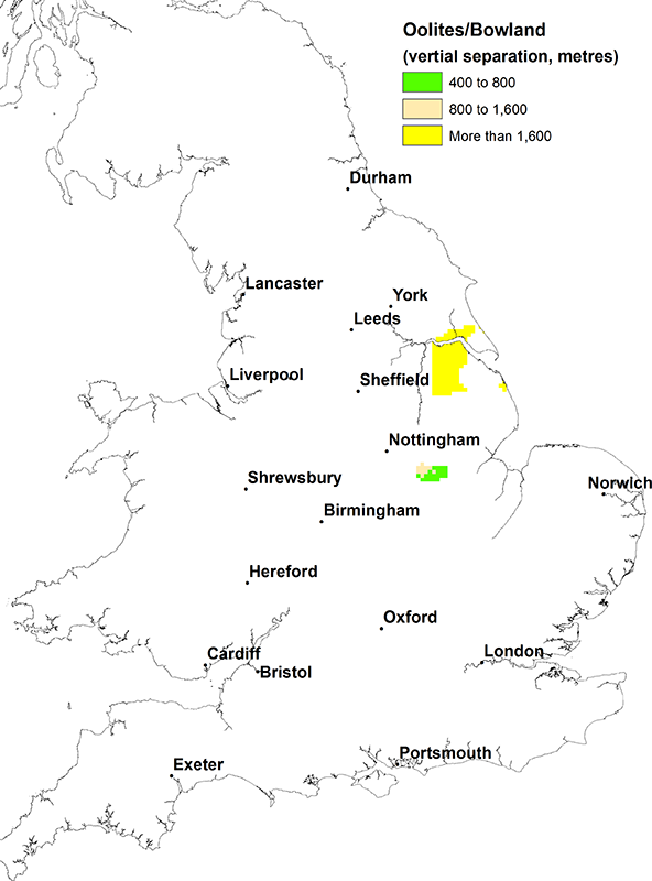
Oolites (Great Oolite and Inferior Oolite) vs Bowland Shale Formation and Craven Group. BGS © UKRI.
Triassic sandstone
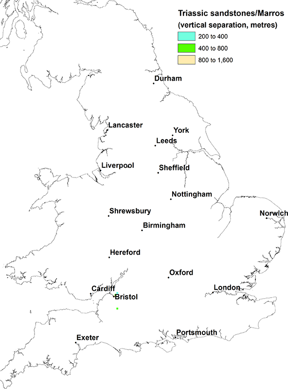
Triassic sandstone vs Marros Group. BGS © UKRI.
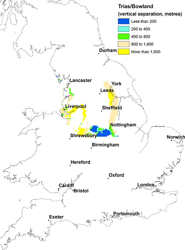
Triassic sandstone vs Bowland Shale Formation and Craven Group. BGS © UKRI.
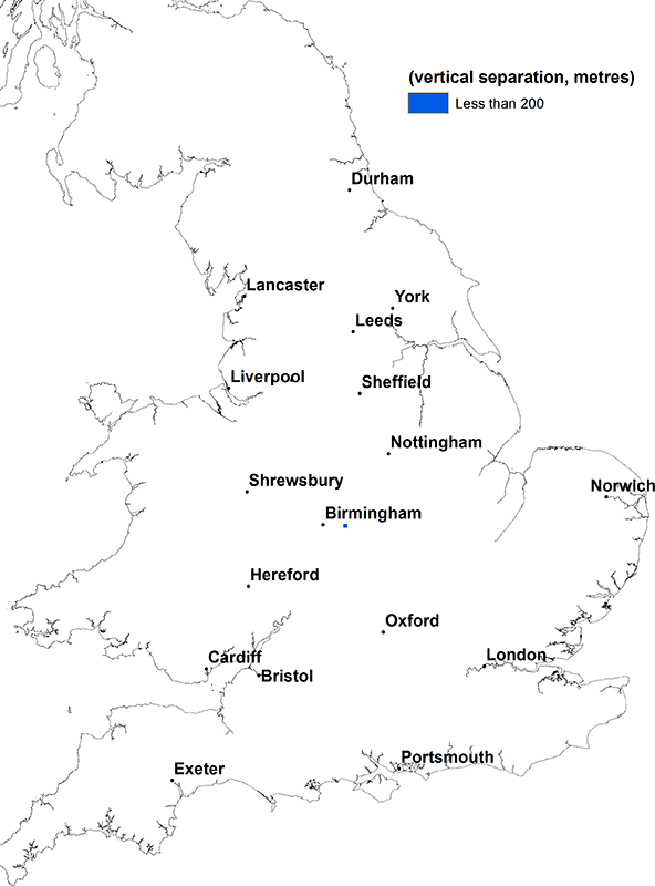
Triassic sandstone vs Upper Cambrian shales. BGS © UKRI.
Magnesian limestone
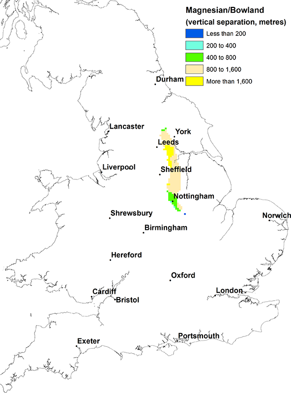
Magnesian limestone vs Bowland Shale Formation and Craven Group. BGS © UKRI.
Permian sandstone
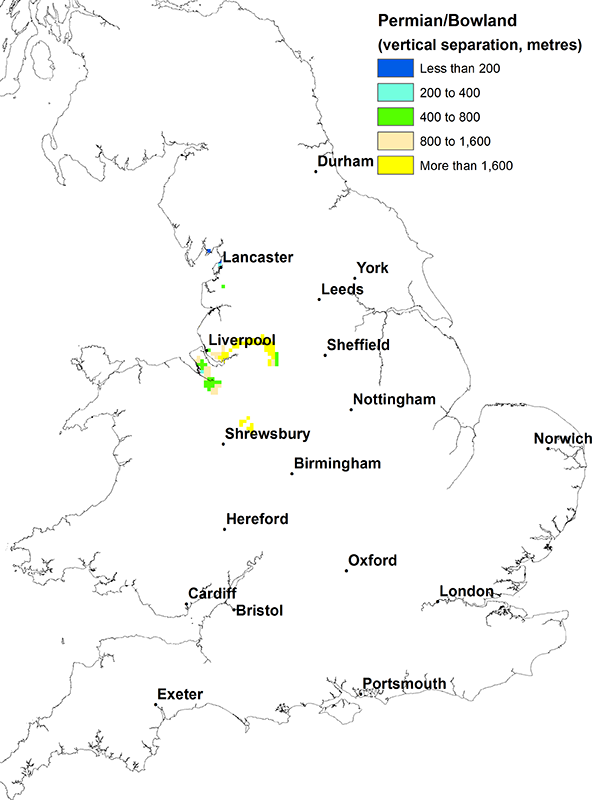
Permian sandstone vs Bowland Shale Formation and Craven Group. BGS © UKRI.