
If shale gas resources were to be developed in the UK, the implications for groundwater would need to be considered as part of any risk assessment. This assessment can help us to understand and quantify the spatial relationships between the potential shale gas source rocks (including both shales and some clay units) and overlying aquifers.
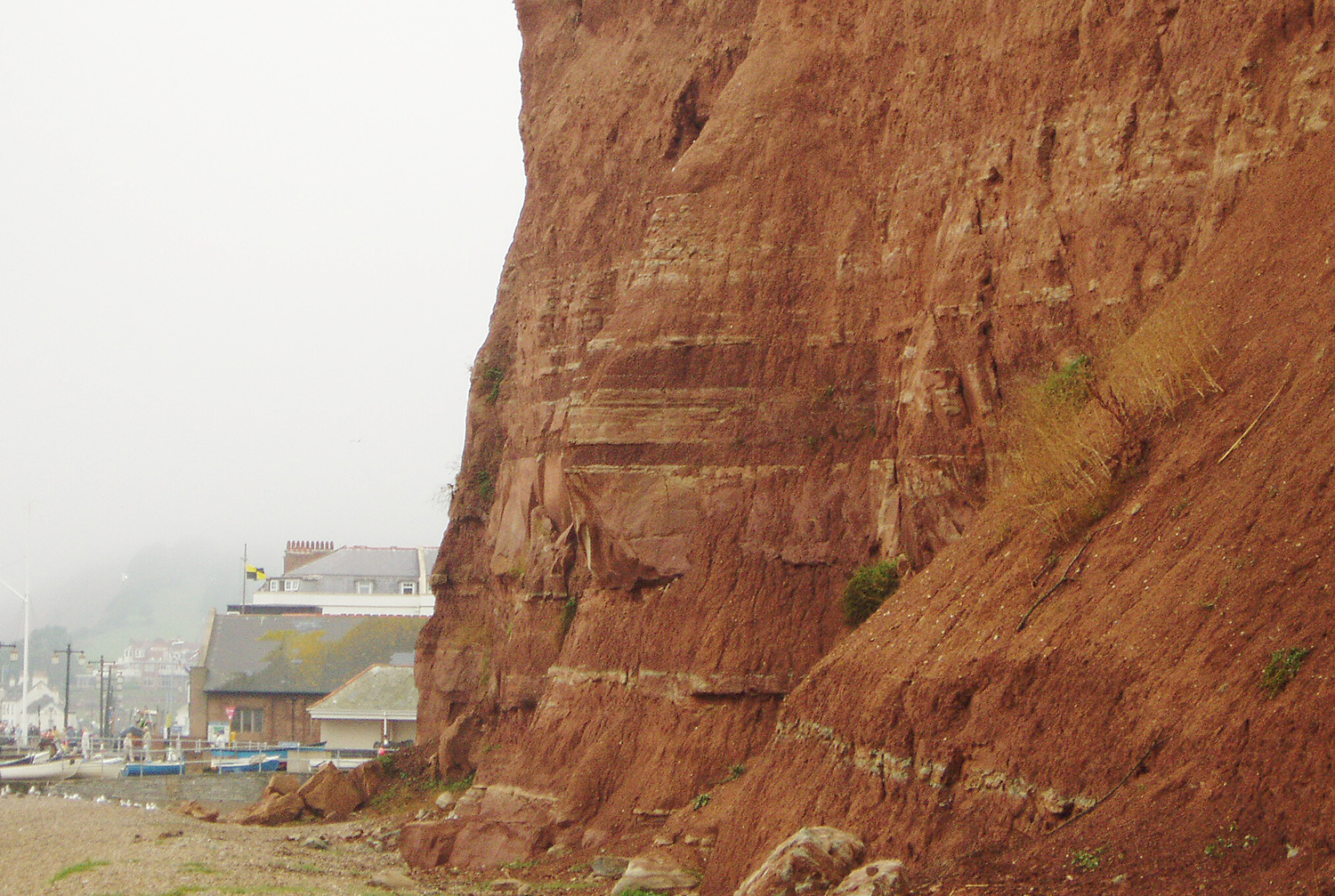

View of cliffs east of Sidmouth, south Devon, showing the gradational upward passage by interdigitation from the Triassic Sherwood Sandstone Group (a major aquifer across the UK) in the lower half of the cliff to the overlying Triassic Mercia Mudstone Group. BGS © UKRI.
BGS aims to provide an overview, at the national scale, of the spatial relationships between principal aquifers and some of the major shale and clay units in England and Wales.
Aquifer, shale and clay maps
There are eleven principal aquifers in England and Wales and the distribution of each of these at the surface and below ground is shown in a series of aquifer maps. The maps include information on the depth to the base of the geological units that form each of the principal aquifers, as well as interpretive information about the principal aquifers.
BGS has produced maps of the six major shale or clay units in England and Wales. The distribution of each of these is shown on separate shale maps and include information on the depth to the top of the shale or clay unit. There is also associated interpretive information about each of the units.
This series of 25 aquifer/shale separation maps show where the principal aquifers overlie a shale or clay unit. Each map shows a relative estimate of the vertical separation between the base of a given aquifer and the top surface of a given shale or clay unit below that aquifer. Basic interpretive information about the separation maps is also available.
There are two national overview maps. One shows the extent or area over England and Wales where rock units that are designated as principal aquifers by the Environment Agency are present at the surface and below ground. The second map shows the extent of the six major (potentially gas-bearing) shale units present at the surface and below ground.
Data
- Download the data used to prepare the maps
- Information describing the methods used to produce the maps
The moratorium on hydraulic fracturing in the UK
Shale gas extraction is not presently allowed to proceed in the UK.
In January 2015, the Scottish Government put a moratorium on unconventional oil and gas development in Scotland in place, following the publication of a independent expert scientific panel report.
In October 2018, licensing powers in Wales were transferred to the Welsh Assembly, which took the decision not to support applications for hydraulic fracturing in Wales or fracking consents.
In November 2019, the UK Government announced a moratorium on hydraulic fracturing in shale in England.