
Groundwater flooding is a complex phenomenon. Historically, most attention has been given to groundwater flooding on chalk, with up to 138 000 properties in England located in areas at risk of groundwater flooding. It is harder to estimate the risk of flooding from groundwater than with other aquifers, but up to 152 000 further properties could be affected. In total, an estimated 122 000 to 290 000 properties in England lie in areas at risk of groundwater flooding. These numbers do not include properties also at risk of flooding from rivers or the sea.
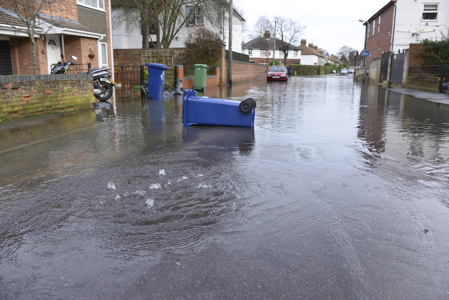

A flooded residential street in Oxford, January 2014. BGS © UKRI.
While this is significantly fewer than the number that are at risk from other sources of flooding, groundwater flooding is still locally significant in many areas. It can be difficult to predict exactly where it may occur and the management of groundwater flooding brings a number of unique problems.
BGS and the Environment Agency (EA) worked together to produce these revised estimates of the number of properties that are in areas with a groundwater flood hazard. We aimed to provide better estimates in a similar way to those prepared for flooding from rivers, the sea and surface water.
Background
Responsibilities
Under the Flood and Water Management Act, groundwater flood risk management is the responsibility of lead local flood authorities (LLFAs). The EA has a strategic overview for all sources of flooding whilst BGS is responsible for advising the UK Government on all aspects of geoscience.
Groundwater flood mapping
It is still much harder to understand and model risk from groundwater flooding than from other sources of flooding. Groundwater follows underground flowpaths: the exact locations where water may emerge and the volume of water that emerges will depend on variations in geology. This may be further influenced by human activity such as underground foundations and excavations for infrastructure. Consequently, most of the maps in existence are based on an understanding of hydrogeology and show areas where it is possible that floodwater might emerge; they do not necessarily show areas that might be flooded by groundwater.
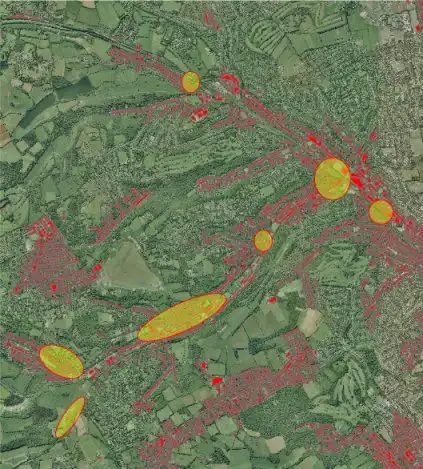
The method considered properties in areas susceptible to groundwater flooding (in red) and information about those affected by 2014 floods (yellow ovals). Aerial photography © UKP/Getmapping Licence No. UKP2006/01 and contains Ordnance Survey data © Crown copyright and database right 2015. BGS © UKRI.
We know that groundwater will not emerge uniformly and that some places will not experience groundwater emergence. Groundwater will not flood the whole of these areas of possible emergence and, because it will always follow the easiest path, it can flow downhill to areas away from these emergence zones. Whether or not properties flood internally will depend on their construction, any mitigation measures in place (for example, basement sump pumping) and groundwater levels. This means it is not appropriate simply to add up the number of properties in emergence zones and class them all as at risk of flooding.
Assessing the risk of flooding from groundwater
Despite the limitations of existing maps, we have been able to improve the estimate of the number of properties in areas at risk using information from the flooding during 2014. Our analysis provides an indication of the scale of risk from groundwater flooding but, due to the limited observational data on previous flood events and geological complexity, a number of assumptions and generalisations have had to be made.
The scale of flood risk from groundwater
Some 4.7 million properties lie in areas where the hydrogeology suggests that groundwater emergence may be possible; however, many of these properties will not at risk of flooding from groundwater.
The groundwater flooding that affected many places in 2000 and 2001 and in 2014 occurred largely on Chalk aquifers. We believe that 46 000 to 138 000 properties lie in chalk and limestone areas at risk of flooding. Up to 152 000 further properties may be in other areas at risk of groundwater flooding, although the degree of confidence in this estimate is much lower than for the chalk aquifers.
This does not include properties that may also be at risk of flooding from rivers or sea.
We estimate that groundwater flooding could affect between 122 000 and 290 000 properties overall.
In comparison, 2.4 million properties are at risk of flooding from rivers and sea (747 000 of which are at high or medium risk) and 3 million properties lie in areas at risk of flooding from surface water (772 000 of which are at high or medium risk).
Why groundwater flooding is different
Although groundwater poses a smaller scale of risk than other sources of flooding, in some areas it is significant.
High groundwater levels do contribute to river, surface water and sewer flooding. Groundwater contributes base flows to rivers and saturates ground, restricting the amount of rain that can soak away, and infiltrates into sewers. We have not included this contribution to flooding from other sources in our assessment of groundwater flood risk.
Groundwater flooding tends to remain around for weeks or even months at a time, so causing greater damage to properties. Properties that don’t directly flood can be affected by restricted access. Areas where basements are common are often worst impacted, particularly where there has been a trend to convert basements into living areas.
Flooded septic tanks and sewers may mean:
- toilets can’t be flushed
- increased pollution via combined sewer overflows
- more sewage reaching treatment works, with associated treatment costs
- high costs associated with pumping and tankering in order to maintain a functioning sewage network
Groundwater flooding tends to affect a wider range of infrastructure, particularly infrastructure below the natural ground level. Structures such as tunnels and road and railway cuttings are often affected, with widespread impacts.
Improving the estimates
The figures reported here are estimates: details of the assumptions made are outlined in the final report. The estimates could be improved with more detailed modelling and mapping, which in turn would need to be supported by better, more consistent and complete collection and collation of records of observed groundwater flooding.
Further reading
McKenzie, A A, and Ward, R S. 2015. Estimating numbers of properties susceptible to groundwater flooding in England. British Geological Survey Open Report OR/15/016. (Nottingham, UK: British Geological Survey.)