
BGS and collaborating organisations have undertaken a series of studies within the floodplain of the River Thames in the area around Oxford. The area has now been established as a field observatory, where baseline data is collected to benefit a number of research studies and innovative sampling methods, tracer applications and monitoring techniques are developed and tested. Cross-fertilisation between studies will lead to a better understanding of the water environment.
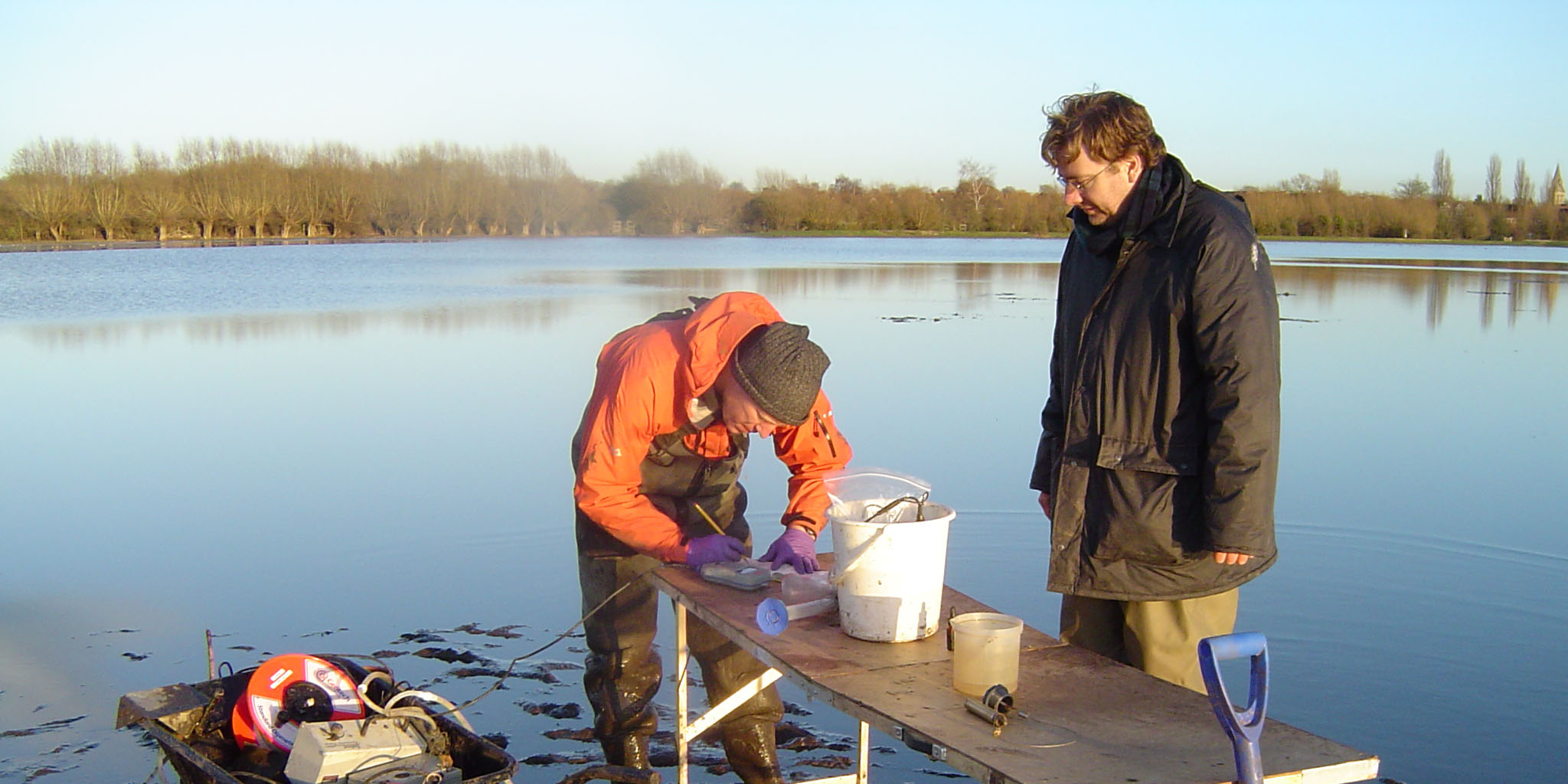

Groundwater sampling from boreholes beneath standing water on the River Thames floodplain near Oxford. BGS © UKRI.
Oxford and the Thames floodplain
Oxford is located in the upper reaches of the River Thames catchment. The Thames flows to the west of the historic centre of the city, which stands on high ground above the current floodplain. However, within the city, more than 3000 properties, major transportation routes and other infrastructure are located on the river’s floodplain. The floodplain also includes farming land and ecologically sensitive sites.
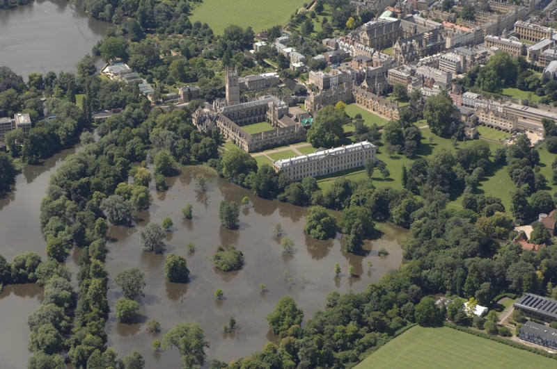
An aerial view of Oxford University colleges during the July 2007 flood event. BGS © UKRI.
The floodplain is underlain by shallow, highly permeable alluvial sediments. The water in the rivers and streams that flow across the plain are well connected to the groundwater within these sediments. Groundwater levels are generally no deeper than 2 m below ground level.
Environmental issues
Oxford is a city with many environmental pressures. In 2007 and 2014, flooding caused damage to many properties and work is ongoing to understand the flood risks and to mitigate them. These mitigation measures have the potential to affect natural flooding cycles and the ecosystems that depend on them.
Ecosystems are also potentially vulnerable to environmental change associated with longer term climate trends. Additionally, in the peri-urban areas around Oxford, current and legacy human pollution provides a threat to the quality of water in aquifers, rivers and streams.
Projects addressing environmental issues
Although the field studies are located in the Oxford area, the results of these projects are of value across the UK and beyond.
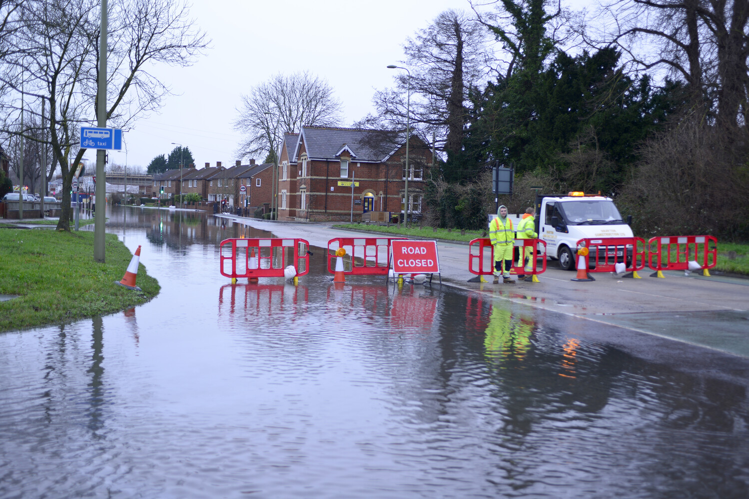
Flooded residential street in Oxford, 2014. BGS © UKRI.
Groundwater and flooding in Oxford
Collaborative work between BGS and the Environment Agency, which began in 2005, investigated the mechanism for the extensive groundwater flooding that occurs within Oxford during high-return flood events.
Modelling flood simulation
BGS and HR Wallingford linked existing groundwater models and river models that cover the Oxford floodplain, to allow improved simulation of flood events. The models were coupled using the OpenMI model interfacing system.
Floodplain Underground Sensors
FUSE was a NERC-funded project within the ‘Networks of sensors’ programme, which aimed to set up a high-density wireless sensor network to quantify floodplain hydro-ecological interactions. The study site is a Special Area of Conservation on the Thames floodplain upstream of Oxford.
Floodplains and their role in contaminant attenuation
BGS is investigating how the biogeochemical processes operating in floodplain environments affect the concentrations of urban-sourced groundwater contaminants reaching surface water courses. The Oxford floodplain is the case study area for the project.
Fundamental aspects of particle interaction
In collaboration with NERC’s Particle Characterisation Facility at the University of Birmingham, BGS developed a robust method for sampling and characterising nanoparticles in anaerobic groundwater. The field sampling methodology has been developed on boreholes within the Oxford floodplain.
Organic micropollutants in a peri-urban floodplain aquifer
BGS undertook a pilot study within an area that included a former landfill site in the Oxford floodplain. The study developed a sampling methodology needed to investigate the occurrence and distribution of emerging organic contaminants in groundwater.