
Some preliminary results of ground motion monitoring are shown in Figure 1. The causes of the observed changes are being investigated, but those around Manchester are likely to be related to the former Lancashire coalfield. Further processing needs to be carried out to improve the ground motion results, especially across rural areas.
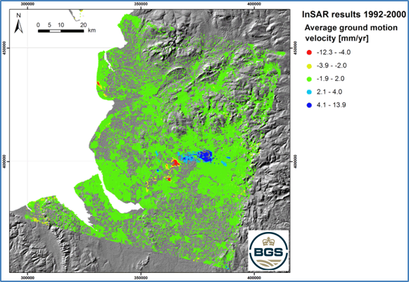

Figure 1 InSAR results. Red signifies subsidence; blue signifies uplift. ERS-1/2 SAR data provided for research purposes to F Cigna via the Category-1 project id. 13543: ‘Enhancing landslide research and monitoring capability in GB using C-band satellite SAR imagery and change detection, InSAR and Persistent Scatterers techniques’. InSAR results are overlapped onto shaded relief of the SRTM V4 DEM produced by NASA.