
In central and southern Scotland, 31 sites have been sampled for methane (CH4) from a number of different sedimentary aquifers, mostly from the Carboniferous Clackmannan Group and Scottish Coal Measures Group in central Scotland. Here, groundwater was historically an important resource for industry, but today it is not widely used. There is local groundwater abstraction for agriculture and domestic use in southern Scotland.
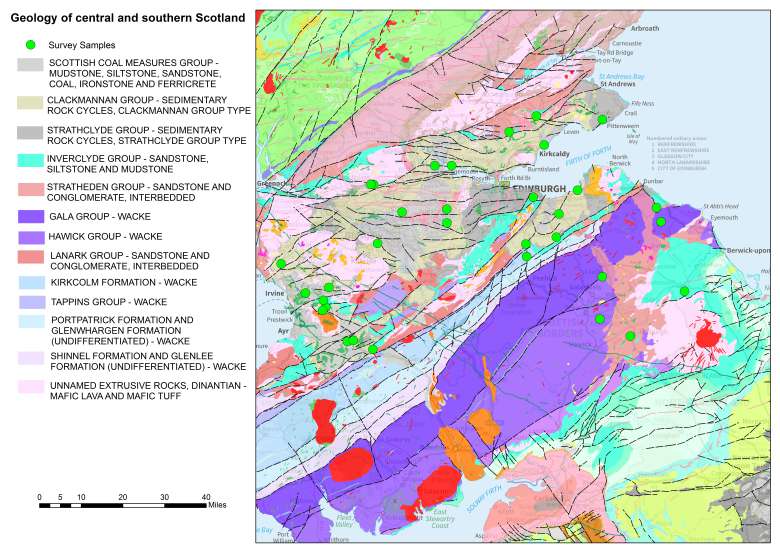

Geology of central and southern Scotland. Contains Ordnance Survey data © Crown copyright and database rights 2014. BGS © UKRI.
Clackmannan and Coal Measures groups
These two units form multilayered and vertically segmented aquifers. Fine-grained, well-cemented sandstone layers act as discrete aquifer units in which groundwater flow is predominantly through fractures. They are separated by lower permeability siltstones, mudstones or coals. Groundwater may be present at various depths under unconfined or confined conditions and different groundwater heads are seen in different aquifer layers. The thickness of the Carboniferous sedimentary aquifers varies from less than 500 m in southern Scotland to 3000 m in central Scotland.
Shale units
In this area, the formation that is most likely to have potential for shale gas or oil is the West Lothian Oil-Shale Formation, which lies stratigraphically immediately below the Clackmannan Group in the eastern part of central Scotland.
Results
These summary results are from single sampling visits to each site as part of the Baseline Scotland project. The data is summarised for the central and southern Scotland regions as a whole and for individual aquifers, where enough data is available.

Methane samples and concentrations in central and southern Scotland. Contains Ordnance Survey data © Crown copyright and database rights 2014. BGS © UKRI.

Methane concentrations chart for central and southern Scotland. BGS © UKRI.
| Area | Concentration | (mg/l) | No. samples | |
|---|---|---|---|---|
| Minimum | Median | Maximum | ||
| Central and southern Scotland | <0.0001 | 0.0036 | 1.68 | 31 |
| Clackmannan and Coal Measures sroups | <0.0005 | 0.00835 | 1.68 | 18 |
CH4 samples and concentrations in central and southern Scotland. Note: values less than the analytical detection limit have been converted to half the detection limit for the purposes of this statistical summary and graph, but the relevant detection limit is quoted in the table.
Baseline groundwater quality data
A summary of the baseline quality of groundwater in this area is below. This data was collected as part of a collaborative project between BGS and the Scottish Environment Protection Agency (SEPA) to investigate the baseline quality of groundwater in major Scottish aquifers.
Groundwater from the Clackmannan and Coal Measures Groups in this area is typically reducing and contains a high proportion of old water, recharged more than 35 to 60 years ago. Mining activity in this area has had a major impact on groundwater quality.
More detail on groundwater quality for central Scotland and southern Scotland is available.
| Analysis | Concentration | (mg/l) | No. samples | |
|---|---|---|---|---|
| Minimum | Median | Maximum | ||
| Ca | 7.26 | 54.5 | 290 | 21 |
| Mg | 3.11 | 17.5 | 96.2 | 21 |
| Na | 6.2 | 15.5 | 461 | 21 |
| K | 0.64 | 3.08 | 26.8 | 21 |
| Cl | 5.14 | 20.7 | 1230 | 21 |
| SO4 | 3.82 | 48.5 | 244 | 21 |
| HCO3 | 7 | 265 | 734 | 21 |
Baseline groundwater quality data for central and southern Scotland.