
The Yew Tree Farm borehole is used to monitor groundwater levels in the Permo–Triassic sandstones of Lancashire.
BGS Enquiries can help you to access data from the National Groundwater Level Archive (NGLA) for this well.
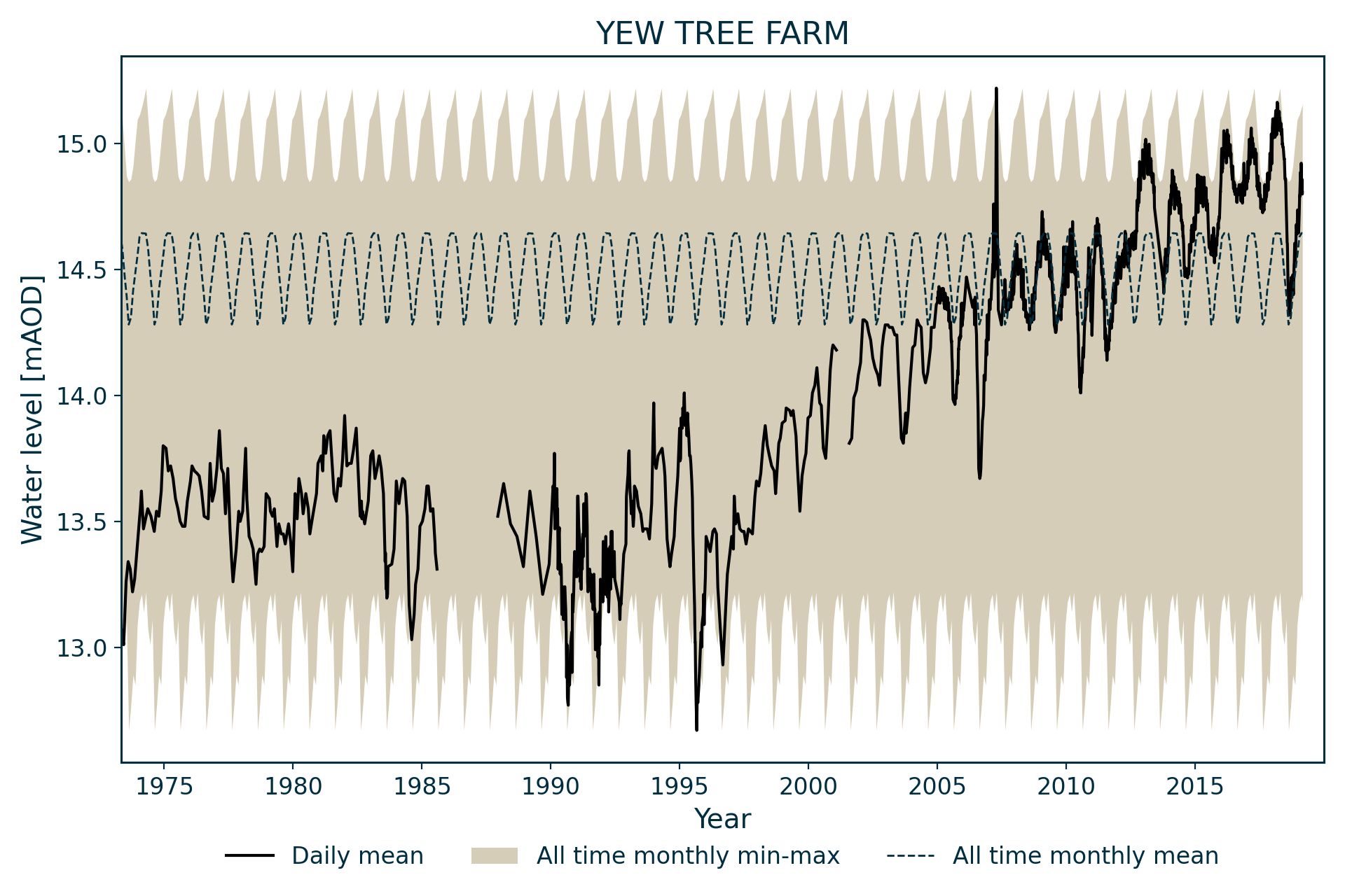
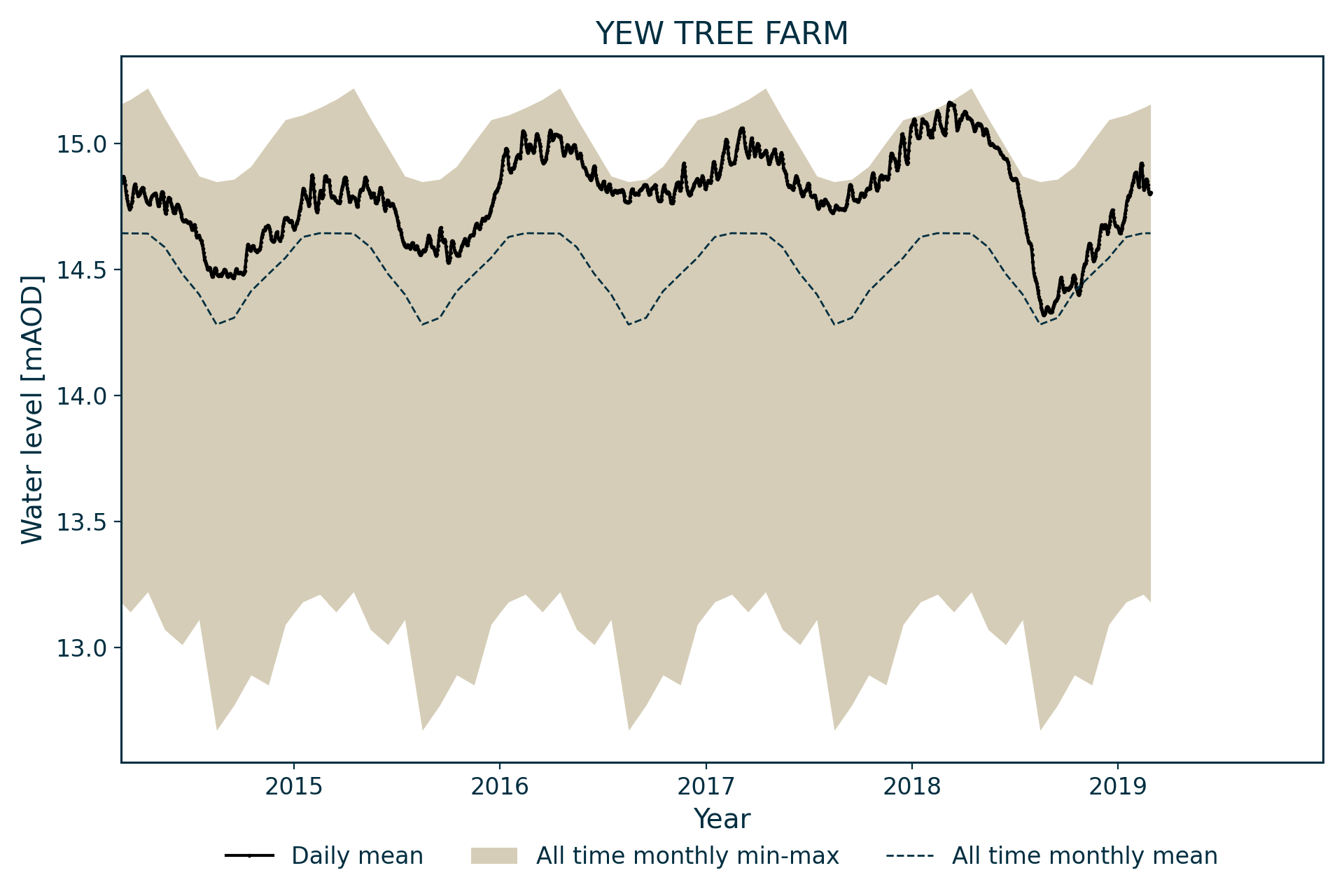
Hydrograph
Information about the well
Hydrogeological setting
| Yew Tree Farm | |
|---|---|
| Wellmaster ID | SD41/32 |
| NGR | 3440 4116 |
| Datum | 23.69 m AOD |
| Monitoring details | |
| Type | Groundwater level |
| Aquifer | Permo–Triassic sandstone |
| Confinement | Confined |
| Depth | 58 m |
| Record | |
| Monitored by | EA North West |
| Records commence | 1973 |
| Records end | Active |
The borehole measures groundwater levels in the Permo–Triassic sandstones of Lancashire. The borehole penetrates the Helsby Sandstone Formation, overlain by 18 m of till deposits. The till acts as a confining layer and observed levels tend to stand within the till.
Well or borehole construction
203 mm diameter borehole reducing to 150 mm diameter at depth.
Hydrograph response
The hydrograph has an annual sinusoidal pattern, with short-term responses to annual recharge events. These have been superimposed since the early 1990s on a rising trend. Prior to the 1990s, levels were stable.
Annual fluctuations are generally less than 0.5 m, although occasional variations of 1 m have been observed.
Reference
Finch, J, Marsh, T, and McKenzie, A A. 2007. A preliminary risk assessment of the potential for groundwater flooding during the winter of 2007/8 — an update. (Wallingford, UK: NERC/Centre for Ecology and Hydrology-British Geological Survey.)
Acknowledgements
Groundwater level data are provided to the NGLA by the Environment Agency (EA), Natural Resources Wales – Cyfoeth Naturiol Cymru (NRW), the Scottish Environment Protection Agency (SEPA) and, for Northern Ireland, the Department for Infrastructure – Rivers and the Northern Ireland Environment Agency.
Further information about these monitoring networks can be found on these pages:
Contact
Please contact BGS Enquiries for further information.