
The Wetwang borehole was drilled into the chalk aquifer at Wetwang, Yorkshire, in north-east England.
Our enquiries service can help you to access groundwater level data for this well.
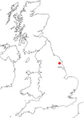

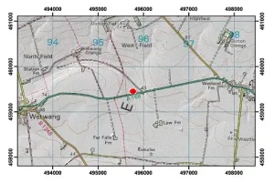
Location of Wetwang. BGS © UKRI.
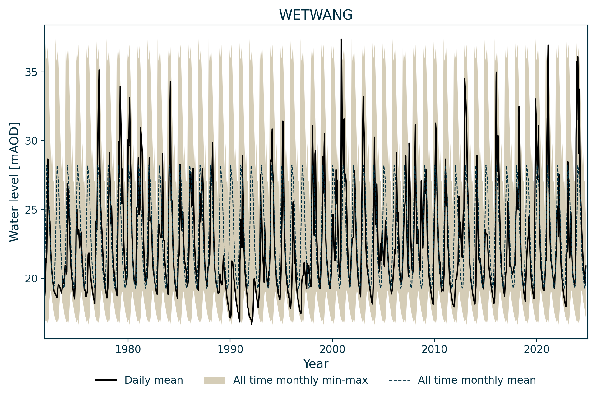
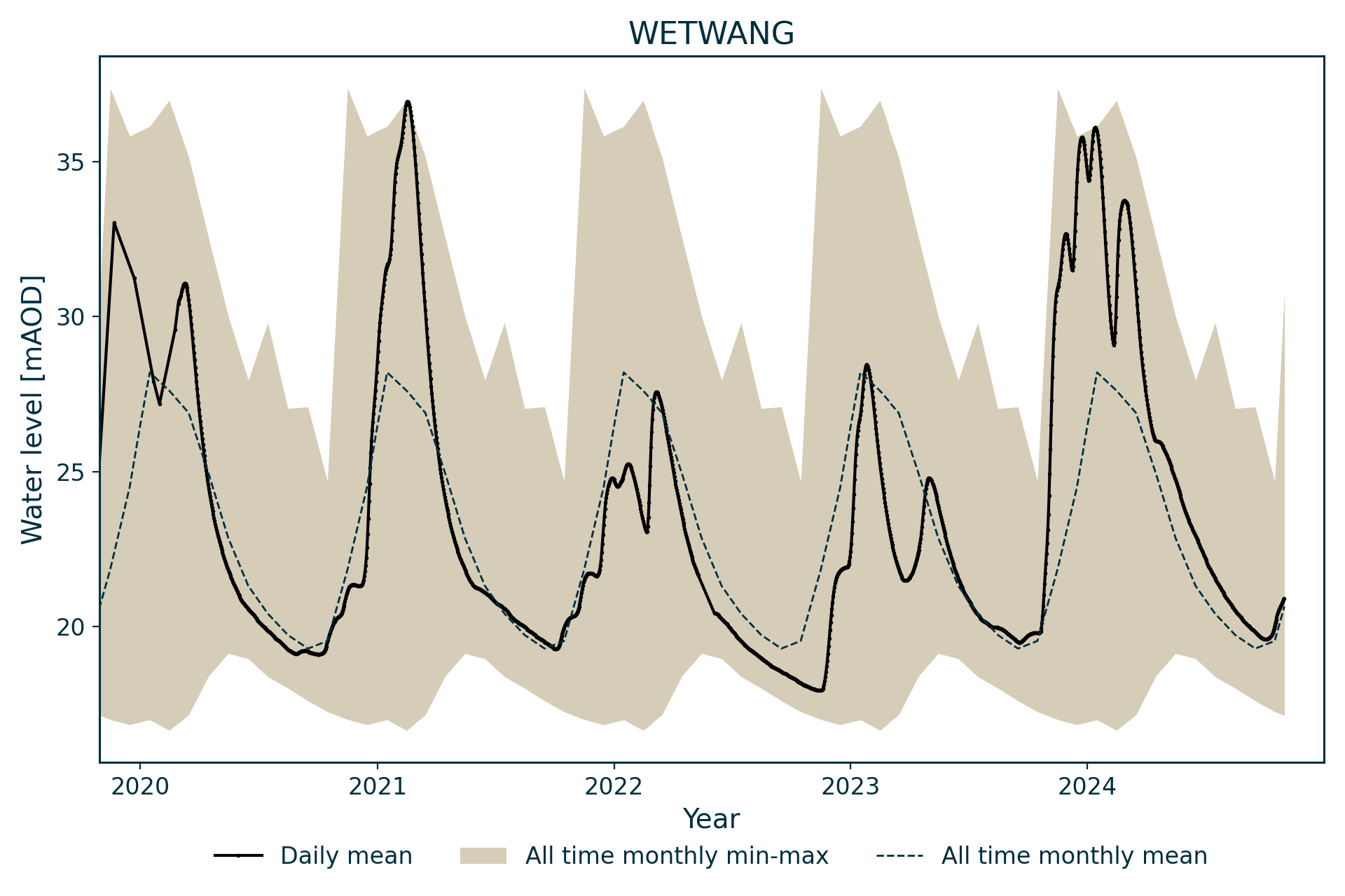
Hydrograph
The groundwater level for Wetwang starts in 1971.
Information about the well
Hydrogeological setting
This borehole measures water level in the Yorkshire Chalk.
| Wetwang | |
|---|---|
| Wellmaster ID | SE95/6 |
| NGR | 4957 4593 |
| Datum | 42.28 m AOD |
| Monitoring details | |
| Type | Groundwater Level |
| Aquifer | Chalk |
| Confinement | Unconfined |
| Depth | 45.72 m |
| Record | |
| Monitored by | E A North East |
| Records commence | 1971 |
| Records end | Active |
It is drilled into the Flamborough Chalk Formation of the Chalk Group and is overlain by 4.1 m of head deposits. The borehole log identifies ‘Upper Chalk’ and ‘Middle Chalk’, without putting a depth on the boundary between them.
The aquifer is unconfined.
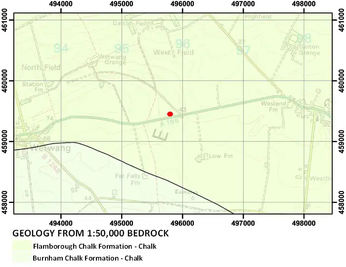
Geological map of the area around Wetwang. BGS © UKRI.
Well or borehole construction
The well consists of a 152 mm-diameter borehole, reducing to 101 mm, which is 37.49 m deep. The borehole was originally drilled to 45.72 m but caved in. It is lined to 7.6 m.
Hydrograph response
The hydrograph has an annual sinusoidal pattern, with some response to winter rainfall episodes.
The water levels in this well usually fluctuate by about 10 m over the course of a year, but these fluctuations have exceeded 15 m at times. The borehole recesses to a base level of just below 20 m AOD in most years. This is well above the borehole bottom, suggesting the presence of a geological control on water level.
Topography
Topographical map with hillshade of the area around the Wetwang borehole. BGS © UKRI.
Acknowledgements
Groundwater level data are provided to the NGLA by the Environment Agency (EA), Natural Resources Wales – Cyfoeth Naturiol Cymru (NRW), the Scottish Environment Protection Agency (SEPA) and, for Northern Ireland, the Department for Infrastructure – Rivers and the Northern Ireland Environment Agency.
Further information about these monitoring networks can be found on these pages:
Contact
Please contact BGS Enquiries for further information.