
Although once called the ‘Roman Well’, there is no real evidence that the West Woodyates Manor well is that old, but it has been used to measure groundwater levels in the Chalk Group aquifer since 1942. It is located between Blandford Forum and Salisbury in southern England.
BGS Enquiries can help you to access data from the National Groundwater Level Archive (NGLA) for this well.
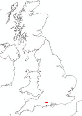

Location of West Woodyates Manor. BGS © UKRI.
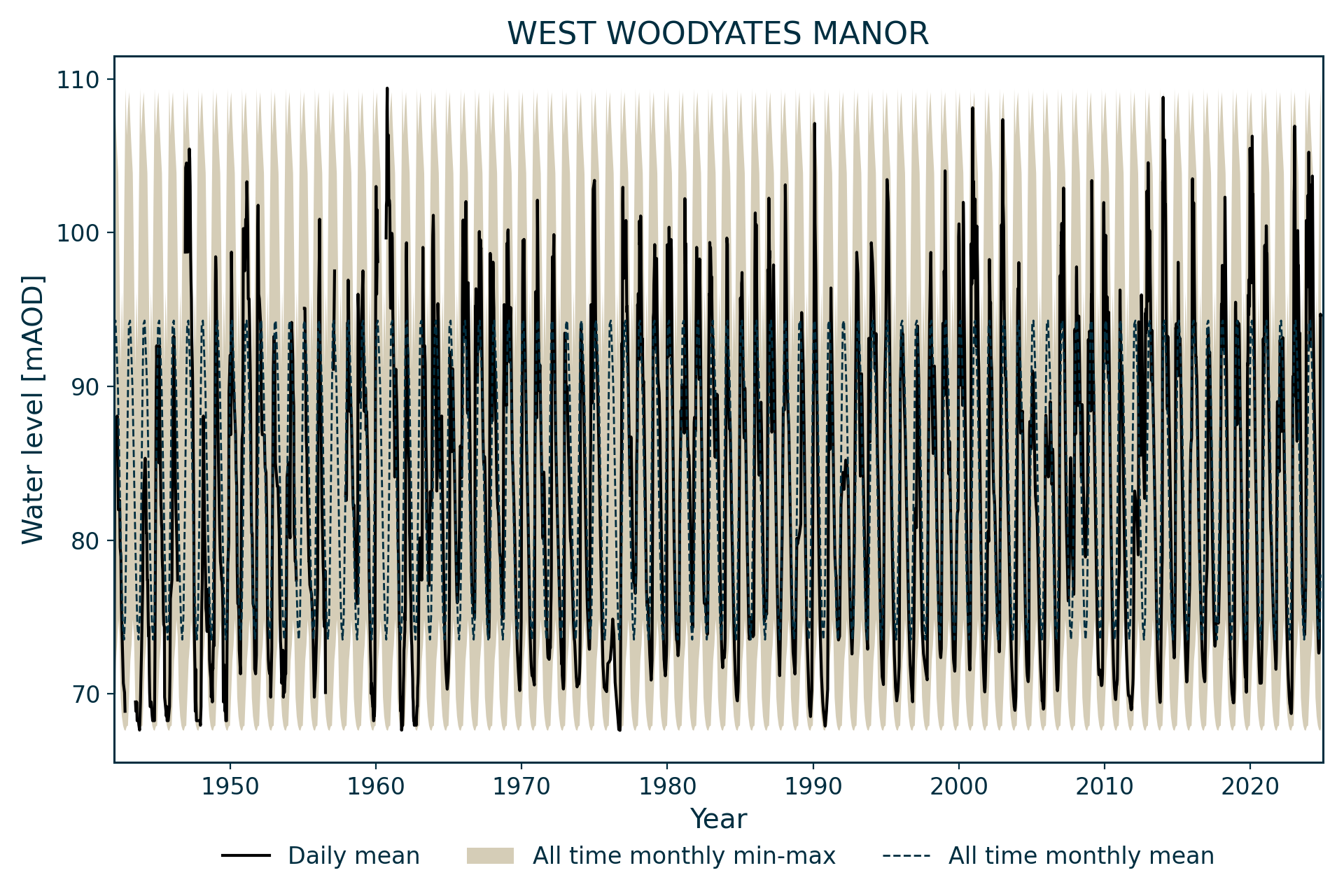
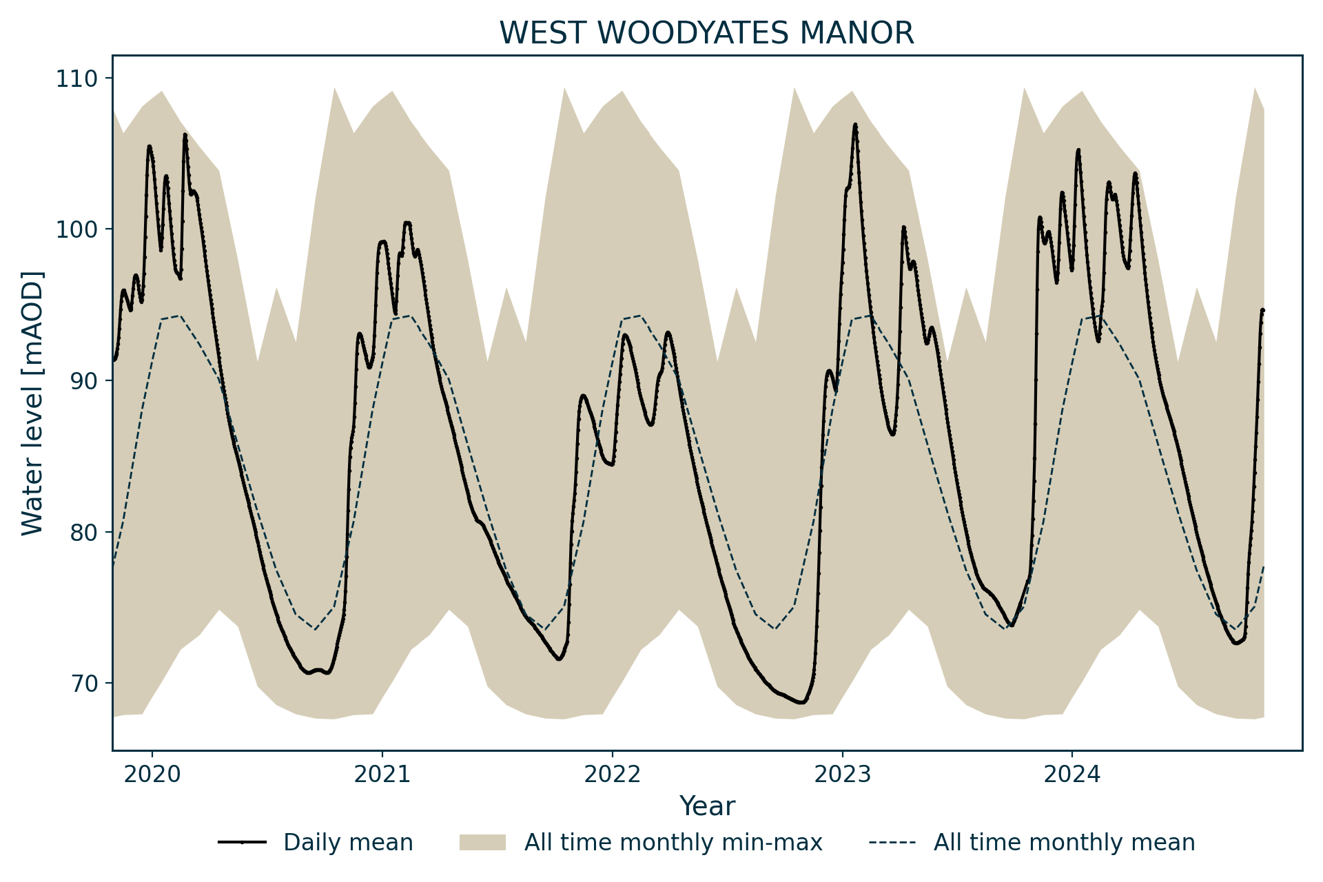
Hydrograph
Information about the well
Hydrogeological setting
This well measures water levels in the Wessex Chalk Group aquifer between Blandford Forum and Salisbury. It is dug into the Seaford Chalk Formation and is close to the head of a bourne (seasonal) chalk stream.
| West Woodyates Manor | |
|---|---|
| Wellmaster ID | SU01/5B |
| NGR | 4016 1194 |
| Datum | 110.88 m AOD |
| Monitoring details | |
| Type | Groundwater level |
| Aquifer | Chalk |
| Confinement | Unconfined |
| Depth | 45.1 m |
| Record | |
| Monitored by | EA South West |
| Records commence | 1942 |
| Records end | Active |
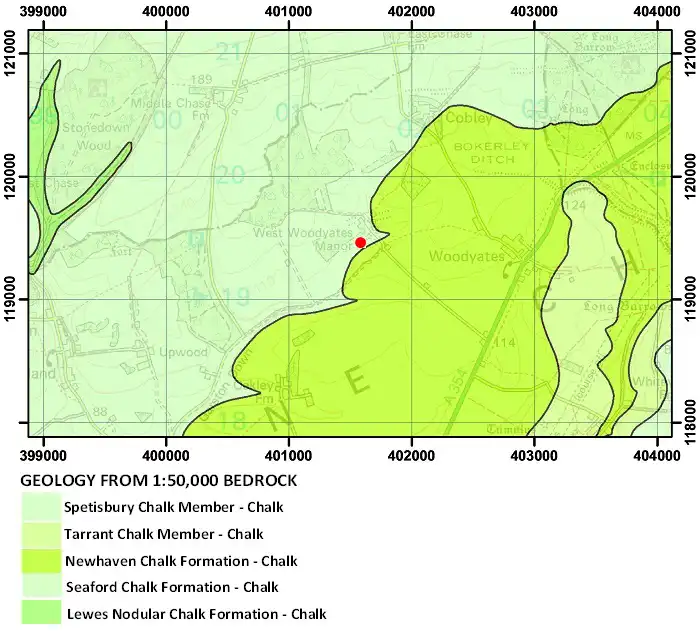
Geological map of the area around West Woodyates Manor. BGS © UKRI.
Well or borehole construction
The well consists of a 45.1 m-deep, oval shaft, with a diameter of 3 × 1.37 m. It is recorded in some records as the ‘Roman Well’ but there is no evidence in the record of whether this is anything other than a name.
Hydrograph response
The well has a relatively rapid and flashy response for a chalk well, with typical annual fluctuations of 25 m and evidence of rapid recharge at high levels. A file note suggests that the well responds to changes in wind direction, possibly due to barometric effects or the Venturi effect.
At the highest levels, groundwater flooding has been recorded in the cellars of the adjacent manor house.
Data issues
Levels were noted in 1930, 1936, 1937 and 1938 prior to the commencement of regular monitoring in 1942.
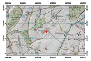
Topographical map with hillshade of the area around West Woodyates Manor. BGS © UKRI.
Acknowledgements
Groundwater level data are provided to the NGLA by the Environment Agency (EA), Natural Resources Wales – Cyfoeth Naturiol Cymru (NRW), the Scottish Environment Protection Agency (SEPA) and, for Northern Ireland, the Department for Infrastructure – Rivers and the Northern Ireland Environment Agency.
Further information about these monitoring networks can be found on these pages:
Contact
Please contact BGS Enquiries for further information.