
This borehole measures water levels in the Permian-aged ‘Magnesian Limestone’ (now called the Ford Formation) to the north-west of Darlington in north-east England.
BGS Enquiries can help you to access data from the National Groundwater Level Archive (NGLA) for this well.
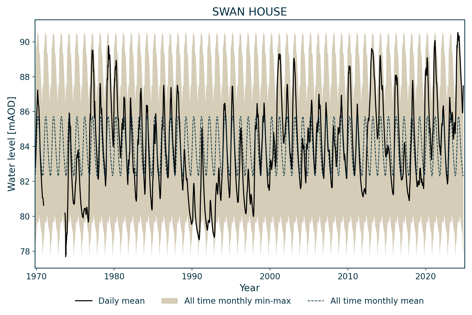
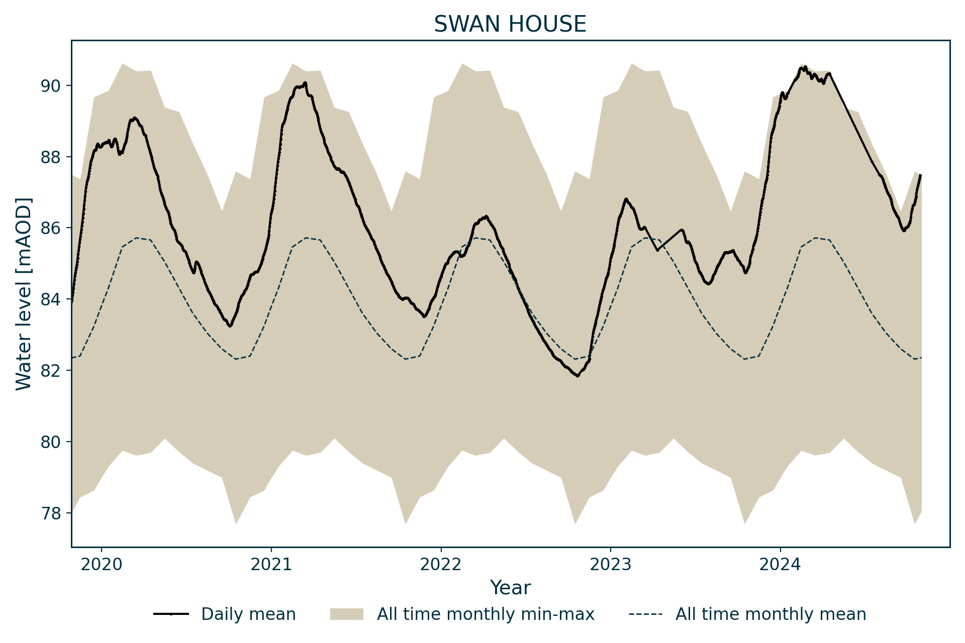
Hydrograph
Information about the well
Hydrogeological setting
| Swan House | |
|---|---|
| Wellmaster ID | NZ21/29 |
| NGR | 42521 5199 |
| Datum | 94.9 m AOD |
| Monitoring details | |
| Type | Groundwater level |
| Aquifer | Magnesian limestone |
| Confinement | Confined |
| Depth | 60 m |
| Record | |
| Monitored by | EA North East |
| Records commence | 1969 |
| Records end | Active |
The borehole fully penetrates the Ford Formation, which is overlain by 26 m of till deposits. The borehole was completed at the top of the Pennine Coal Measures Group
Well or borehole construction
The borehole was purpose drilled as an trial or observation borehole. It consists of a 610 mm-diameter borehole, lined to 34.44 m, then a 457 mm-diameter slotted casing, adjacent to the limestone, with a gravel pack in the 610 mm hole.
Hydrograph response
Water levels are confined. The hydrograph has an annual sinusoidal pattern, fluctuating around 5 m annually. This pattern appears to be superimposed on longer term fluctuations (possibly related to industrial abstractions) that saw water levels at a high in the late 1970s, after which levels declined to the early 1990s, with a subsequent recovery to 2000, after which levels appear stable. There appears to be a clear response to major recharge events, with distinct peaks in wetter years.
Data issues
This well replaced Rushyford (NZ22/22) as an index well in July 2001. Data is intermittent prior to September 1973.
Acknowledgements
Groundwater level data are provided to the NGLA by the Environment Agency (EA), Natural Resources Wales – Cyfoeth Naturiol Cymru (NRW), the Scottish Environment Protection Agency (SEPA) and, for Northern Ireland, the Department for Infrastructure – Rivers and the Northern Ireland Environment Agency.
Further information about these monitoring networks can be found on these pages:
Contact
Please contact BGS Enquiries for further information.