
This well is used to measure water levels in the Permian-aged Appleby Group sandstone aquifer, north-west of Dumfries in south-west Scotland.
BGS Enquiries can help you to access data from the National Groundwater Level Archive (NGLA) for this well.
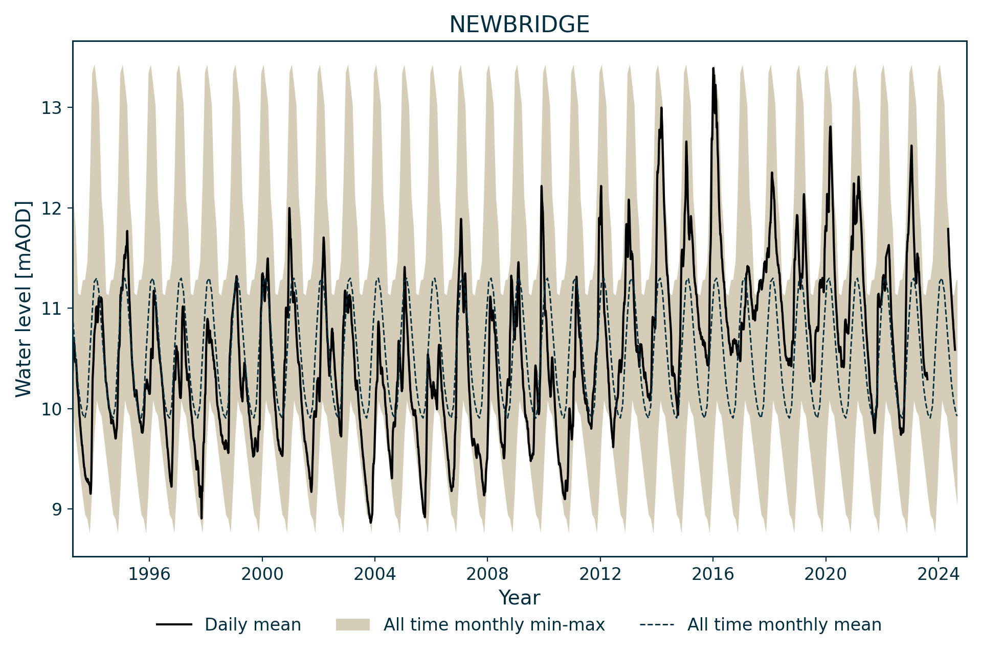
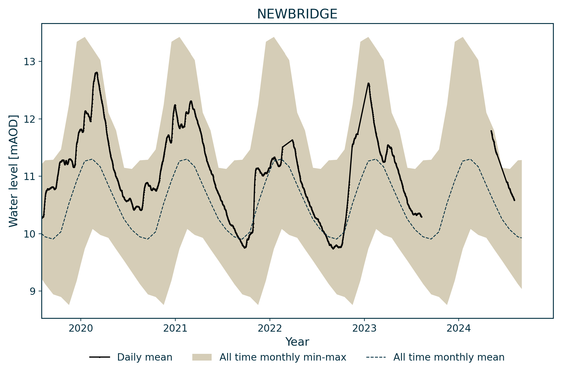
Hydrograph
Information about the well
Hydrogeological setting
| Newbridge | |
|---|---|
| Wellmaster ID | NX97/39 |
| NGR | 2951 5788 |
| Datum | 15.7 m AOD |
| Monitoring details | |
| Type | Groundwater level |
| Aquifer | Permo–Triassic sandstone |
| Confinement | Unconfined |
| Depth | 28 m |
| Record | |
| Monitored by | SEPA |
| Records commence | 1993 |
| Records end | Active |
The well is located in the Quaternary-aged Kilblane Sand and Gravel Formation, which is underlain by the Permian-aged Locharbriggs Sandstone Formation near its boundary with the Doweel Breccia Formation — both are part of the Appleby Group. The Locharbriggs Sandstone Formation is likely to be in hydraulic continuity with the overlying superficial deposits.
Well or borehole construction
The original borehole was 26.6 m deep and there is some uncertainty over the bottom diameter. The borehole was later deepened to 28 m and it has been assumed that this is the only part that is 70 mm in diameter; it is possible that the diameter decreases at the base of the casing.
Hydrograph response
The hydrograph exhibits an annual sinusoidal, but somewhat spiky, response with the water level remaining in the cased out superficial deposits section of the borehole. The minimum water level appears to possibly be controlled by the river level, as the borehole is about 210 m south of Cluden Water.
References
MacDonald, A M, Ball, D F, and Darling, W G. 2000. The Permian aquifer of Dumfries: groundwater chemistry and age. British Geological Survey Technical Report WD/00/024. (Wallingford, UK: British Geological Survey.) (Unpublished.)
Acknowledgements
Groundwater level data are provided to the NGLA by the Environment Agency (EA), Natural Resources Wales – Cyfoeth Naturiol Cymru (NRW), the Scottish Environment Protection Agency (SEPA) and, for Northern Ireland, the Department for Infrastructure – Rivers and the Northern Ireland Environment Agency.
Further information about these monitoring networks can be found on these pages:
Contact
Please contact BGS Enquiries for further information.